Belska Kočna - Mrzla gora
Starting point: Belska Kočna (968 m)
| Lat/Lon: | 46,4023°N 14,5664°E |
| |
Time of walking: 5 h 40 min
Difficulty: very difficult marked way
Altitude difference: 1235 m
Altitude difference po putu: 1550 m
Map: Kamniške in Savinjske Alpe 1:50.000
Recommended equipment (summer): helmet
Recommended equipment (winter): helmet, ice axe, crampons
Views: 10.525
 | 1 person likes this post |
Access to the starting point:
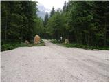
First, we drive to Jezersko, then continue our drive towards Austria. From Jezersko, the road climbs in a few serpentines to the Jezerski vrh border crossing, and from there it starts to descend steeply in many serpentines. Lower down, at Bela / Bad Velach, you reach a marked crossroads, where you turn right in the direction of Belska Kočna / Velacher Kotschna. The road crosses the Bela stream and a few metres further on leads to the next crossroads. Here, continue straight ahead on the right-hand road and continue driving along the aforementioned stream. Follow this road to a parking area next to a ramp which prevents further traffic.
Access is also possible via the Pavlič saddle. In this case, turn left at Bela. Continue as described above.
Path description:
From the parking lot, continue along the road, which leads to a crossroads after a 3-minute walk. Continue straight ahead, following the road in the direction of Logarska dolina (right Goli vrh). Follow the gently sloping road for about 20 minutes to a place where a marked trail branches off up to the left. Continue along the initially wide path, which leads us through the forest at a moderate gradient to a torrential stream, where the path turns right, crosses the stream and then leads us to a protected part of the path. With the help of a rope ladder, you climb up a slightly exposed ridge, which is short and easy on land. The path continues to climb through scrub with beautiful views of the surrounding peaks. The peak that catches our eye the most is the Vellacher Turm, which we are getting closer and closer to. Next, the path leads us past a pleasant little well, behind which we soon reach an old hunting lodge surrounded by lush vegetation. The path then climbs for some time through scrub and sparse wodland, beyond which we enter the embrace of larch trees. The world ahead is becoming more and more alpine, and the larch trees are being replaced by scree, which, due to their axial position, is under snow for quite a long time. Over the scree we are led along a rather steep and increasingly scenic path, which after a while leads us to Savinjsko sedlo, where there is a marked crossroads.
From Savinjsko sedlo we descend towards Okrešlju. After a few minutes of descent, we reach a small emergency bivouac, where we sign the entry book (bivouac under Mrzlim vrh). We continue descending and soon reach a crossroads where a climbing route branches off to the right up the scree to Koroška Rinka, and we continue downwards. Soon the path to Mrzla Gora branches off to the left at 1700m. The path initially climbs through a rare dwarf pines and then leads to a steel cable over a rock slab. Here you should put on your helmets, as the path ahead is very crumbly and exposed to falling rocks. From the steel cable the path leads to a ravine which we cross. We now reach the climbing part of the route. The route is well protected at the beginning, but the fixed safety gear soon runs out. There is an unguarded climb up a pyramid-shaped slope. As this part of the path is very steep, watch out for falling rocks. Before you reach the top of the pyramid you have the feeling that there is a summit. But when you get to the "top" you see that this is not the case. There is a very exposed crossing of a narrow shelf without fixed safety gear. At the end of this shelf, the route turns left up a moderately steep wall straight up (without fixed safety gear). The route then follows a ridge which is quite exposed in places. The path then turns slightly to the right and leads to the summit in 30 minutes on quite steep terrain. Starting point - Savinjsko sedlo 3:10, Savinjsko sedlo - Mrzla gora 2:30

Pictures:
 1
1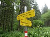 2
2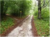 3
3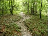 4
4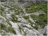 5
5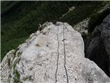 6
6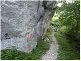 7
7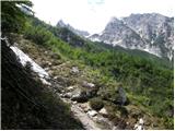 8
8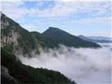 9
9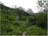 10
10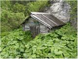 11
11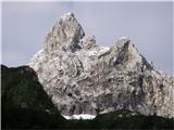 12
12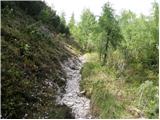 13
13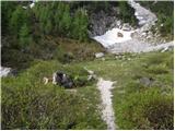 14
14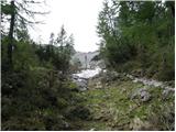 15
15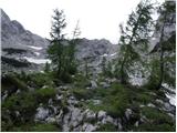 16
16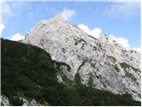 17
17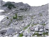 18
18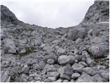 19
19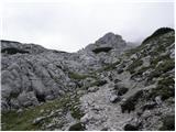 20
20 21
21 22
22 23
23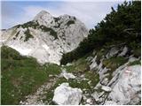 24
24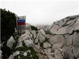 25
25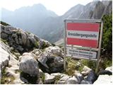 26
26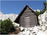 27
27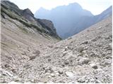 28
28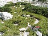 29
29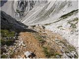 30
30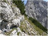 31
31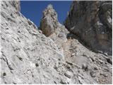 32
32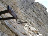 33
33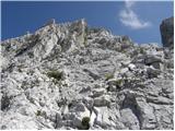 34
34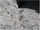 35
35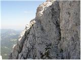 36
36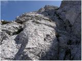 37
37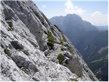 38
38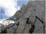 39
39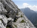 40
40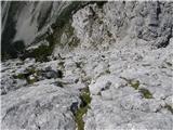 41
41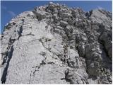 42
42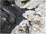 43
43 44
44 45
45
Discussion about the trail Belska Kočna - Mrzla gora
|
| Djuro18. 06. 2012 |
Enkrat sem šel po tej poti do Belskega turna (Storžek) in v spomini imam, da se nekje na poti (še nižje, verjetno še pred lovsko kočo) odcepi ena pot nekam v steno. Takrat sem sklepal, da je to avstrijska pot na Mrzlo goro. Mogoče kdo ve kaj o tem?
|
|
|
|
| garmont21. 08. 2014 |
Pri tem opisu ( slikah ) poti mi je nerazumljiv še vzpon na Storžek, saj ga pot enostavno obide. Gre vendar za vzpon na Mrzlo goro !
|
|
|
|
| Tadej21. 08. 2014 |
Pri slikah so bile med opisom pomotoma naložene slike Storžka. Te sem sedaj odstranil. Sicer pa hvala za obvestilo, za napako pa se opravičujem.
Lp, Tadej
|
|
|
|
| micamaca21. 08. 2014 |
@Garmont, poglej še enkrat  nikjer - ne v besedilu ne po slikah - ni razbrati, da pot na Mrzlo goro vodi prek Storžka. Je pa res na sliki 21 prikazan označen odcep za Storžek (desno, Klettersteig).
|
|
|
|
| garmont21. 08. 2014 |
Micamaca,poglej komentar Tadeja,ki je zmedo uredil.
|
|
|