Babni Vrt - Bašeljski vrh (via Sveti Lovrenc)
Starting point: Babni Vrt (602 m)
| Lat/Lon: | 46,323°N 14,3827°E |
| |
Name of path: via Sveti Lovrenc
Time of walking: 4 h 15 min
Difficulty: easy unmarked way, partly demanding marked way
Altitude difference: 1142 m
Altitude difference po putu: 1170 m
Map: Karavanke - osrednji del 1:50.000
Recommended equipment (summer):
Recommended equipment (winter): ice axe, crampons
Views: 2.933
 | 4 people like this post |
Access to the starting point:
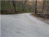
a) From the motorway Ljubljana - Jesenice take the exit Brnik, and when you reach the road Mengeš - Kranj, turn left towards Kranj. Follow the main road towards Kranj to the first roundabout, from where you take the first exit to the right towards Šenčur. Continue on the main road through Šenčur, and when you reach the road Kranj - Zgornje Jezersko, turn right towards Jezersko. When you reach Preddvor, leave the main road and turn left towards the centre of the town, and from there follow the signs for Bašelj. A little after Bašelj, the road descends to the Milka stream and crosses it via a bridge. Here, the road branches off to the right, which leads to Babni Vrt, and we drive above the settlement, where the asphalt road to the last homestead turns left, and we continue to the right. We continue past the quarry and after it we reach a small crossroads, at which we park in a suitable place.
b) From the motorway Jesenice - Ljubljana, take the exit Kranj West, then continue to Golnik. When you arrive at Tenetiše, leave the main road towards Golnik and turn right towards Trstenika. Approximately 1 km after Trstenik, you will reach a small crossroads, where the road first turns left towards Povlje, and a few 100 m further on towards Babni Vrt. Continue towards Babni Vrt, and from the crossroads above the settlement turn right onto a macadam road, which you will then follow past a quarry. Park behind the quarry in a suitable place at the next junction.
Path description:
From the starting point, continue along the left-hand road, which continues along the right-hand side of the quarry (straight ahead under Storžič), and a little further on splits into two wide cart track. Continue on the right-hand cart track, which goes immediately into the woods, then climbs gently at first and moderately to steeply after a left-hand serpentine. Continue on right at forks, and at a small pass continue left up the lesser cart track, which soon ends. From the end of cart track or logging trail, start climbing steeply along the forest path, and within a few minutes reach another cart track, which is followed to the right, and quickly join the path from Bašlje or Laško.
Continue left up the hill and after a minute or two of further walking you will reach Dom na Lovrencu.
From the house, continue in the direction of Javornik, Velika and Mala Poljana, Kališe and Storžič, along a path that climbs moderately through the forest. The well-worn path quickly leads out of the forest onto a vast hayfield, over which you can walk to the Church of St. Lovrenec, enjoying the beautiful views.
Behind the church, the path returns to the forest and begins to descend towards a marked crossroads a few minutes away, where we continue straight in the direction of Storžič and Kališča.
Continue in the direction of Storžič along the wide path, which climbs slightly. The path soon becomes narrower and then climbs steeply through the forest for some time. Higher up, the path just leads us out of the forest and beautiful views of the southern slopes of Storžiča open up. The steepness continues unabated all the way to the bench at the crossroads.
To the left is a marked path towards Javornik and Poljana, and we turn right towards Kališe. The path from the crossroads becomes slightly narrower and less beaten. We continue for a long time crossing the slopes to the east. The path alternates between forest and grassy slopes, which are also quite steep in places. As you cross, the path climbs slightly steeper at times and descends gently a few times. In the second part of the crossing, the path leads to a spring below Bašeljski sedlo. Here the path turns slightly to the right and continues to cross the slopes until it leads us to a marked crossroads where we continue straight in the direction of Bašeljski vrh and Malá Grintovec (Storžič on the left, Dom na Kališču on the right).
The way forward is steeper climbing through lane of dwarf pines and with a nice view of the neighbouring Mali Grintovec leads us to the dwarf pines vegetated ridge Bašeljski vrh, where we arrive in the next few minutes at the next well-marked crossroads. At the crossroads, a path branches off to the right to Mali Grintovec and Srednji vrh, and we continue straight ahead, looking at Storžič, to continue our ascent. The path along and along the dwarf pines ridge is joined shortly below the summit by the path from Jekarica and the Bašeljski Preval. Here, continue right and, after a slightly narrower ridge, within a minute of further walking, reach Bašeljski vrh, from which a beautiful view opens up towards the mountains above Jezersko, and the view extends as far as Košuta, Obirje and Lavanttal Alps in Austria.

Pictures:
 1
1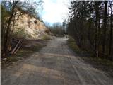 2
2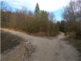 3
3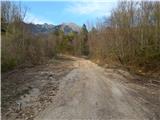 4
4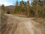 5
5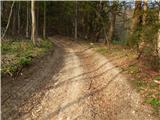 6
6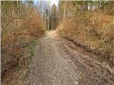 7
7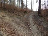 8
8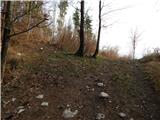 9
9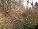 10
10 11
11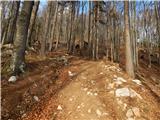 12
12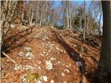 13
13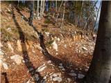 14
14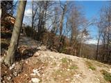 15
15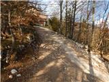 16
16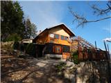 17
17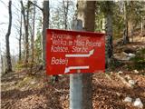 18
18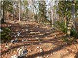 19
19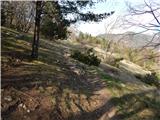 20
20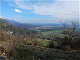 21
21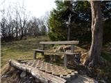 22
22 23
23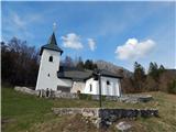 24
24 25
25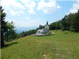 26
26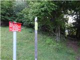 27
27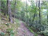 28
28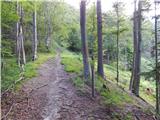 29
29 30
30 31
31 32
32 33
33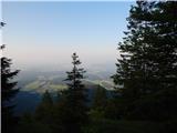 34
34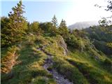 35
35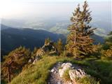 36
36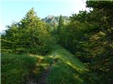 37
37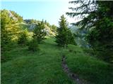 38
38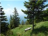 39
39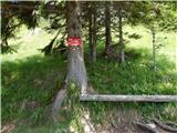 40
40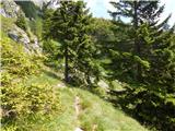 41
41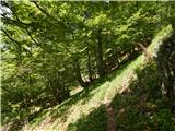 42
42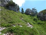 43
43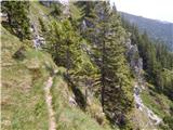 44
44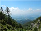 45
45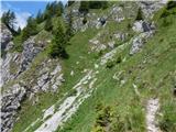 46
46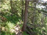 47
47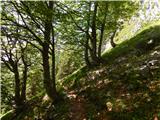 48
48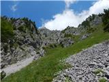 49
49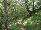 50
50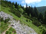 51
51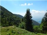 52
52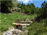 53
53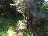 54
54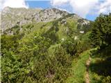 55
55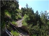 56
56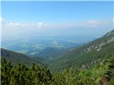 57
57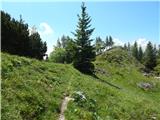 58
58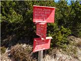 59
59 60
60 61
61 62
62 63
63 64
64 65
65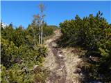 66
66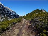 67
67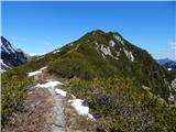 68
68 69
69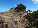 70
70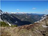 71
71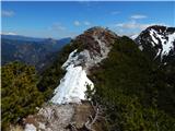 72
72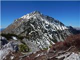 73
73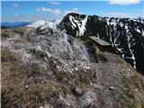 74
74 75
75
Discussion about the trail Babni Vrt - Bašeljski vrh (via Sveti Lovrenc)
|
| Roberto-MMLM20. 02. 2024 10:24:41 |
Zdravo. To pot sem prehodil 17.2.2024. Pot je izredno razgibana in izjemno neoznačena in spada pod strmo pot, nikakor ni lahka. Del poti je potegnil tudi plaz. Pot čez Bašeljsko sedlo na sam bašelj od lesenega korita kamor se pretaka voda iz potočka ni označena, označena je druga ki pelje desno od korita, bolj proti smeri Kališča. Žiga na samem vrhu sploh ni. Vsi žigi za Storžic, bašeljski vrh in samo Kališče so žal v samem domu na Kališču. Pot je bila kar zahtevna in zelo vesel da sem jo izbral, srečal pa nisem niti enega pohodnika ne tej poti, ne za gor niti dol, saj pot ni lahka. Je bilo pa polno enih pustolovščin, saj sem se odločil iti nazaj po drugi poti, torej mimo Kališča nazaj do babnega vrta oz izhodišča. Po svoje, saj poti niso niti približno dobro označene, kaj šele za kako krožno pot. Vedno imejte koordinate od vašega izhodišča. Lažje boste našli pot nazaj.  Lp
|
|
|
|
| jprim21. 02. 2024 19:59:46 |
@Roberto Kar zanimovo poročilo tvojega potepanja, sem si ga dala kar v plan, saj tudi midva zadnje čase iščeva bolj samotne poti. Storžič in ostali vrhovi okrog, me ne vlečejo več, (Bašeljskega vrha pa še res nisem osvojila )saj sva že nekajkrat prehodila številne poti okrog Kališča. A pot ni sledljiva po sami shojenosti poti? LP!
|
|
|