B station - Prestreljenik (via Krnica)
Starting point: B station (970 m)
| Lat/Lon: | 46,3478°N 13,505°E |
| |
Name of path: via Krnica
Time of walking: 4 h 25 min
Difficulty: difficult marked way
Altitude difference: 1529 m
Altitude difference po putu: 1550 m
Map: Julijske Alpe - zahodni del 1:50.000
Recommended equipment (summer): helmet
Recommended equipment (winter): helmet, ice axe, crampons
Views: 18.672
 | 2 people like this post |
Access to the starting point:
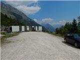
Drive into the centre of Bovec, where from the crossroads by the main square continue along the ascending road, which starts to climb past the post office towards the nearby church. Go around the church on the left and then arrive in Kaninsko vas. Bovec then ends, and the road continues westwards for some time. At a small fork, leave the main asphalt road leading to the village Plužna and continue along the road slightly to the right (after the crossroads marked for the Gozdec road). After the nearby homestead, the road splits again, and this time we take the road slightly left (slightly right Zavrzelno and the starting point of the route to Rombon). We continue to climb the dirt road, which leads us higher to the B station of the cable car to Kanin, where we park in the larger dirt parking lot.
The starting point at the B station can also be reached by a circular cable car.
Path description:
From the parking lot, we continue a few steps along the road leading higher up, and before the traffic sign prohibiting further traffic at certain times, we turn right onto a marked footpath. The path first crosses the cable car route and then enters the forest, through which we initially climb gently to moderately. The well-trodden path ends at the finishing point of one of the ziplines, and we continue on a less well-trodden marked path, which gradually turns into steep and slippery slopes, where we also cross a small wooden bridge, which is already in a questionable condition. After the bridge, there is some more exposed scrambling, then the slope becomes less steep and the path gradually becomes steeper after crossing the torrent. A few minutes higher up, we merge with the trail from Bovec, and we continue along a fairly steep path to mountain pasture Cirque, where the shepherd's hut stands.
At the hut, take the minor road, which you leave after a left serpentine and continue on the marked path, which climbs above mountain pasture and gradually passes into the forest. The forest soon ends and the path continues along the pleasant mountain valley Cirque, where the path is initially still quite grassy, but becomes increasingly rocky higher up. With fine views to the left towards Veliki Stador (2165 m) and to the right towards the walls of Jelenko, Vratni vrh and a few neighbouring peaks, the path gradually passes onto the slopes of the mighty Lope. Higher up, the path climbs slightly to the right of the valley Cirque, and as you approach Prevala, the path turns right and climbs steeply (here the old path led straight to Prevala, but was diverted slightly to the right to build the ski resort). The steepness quickly eases and you reach the ski slope and the Prevala saddle, where you go left.
From Prevala, ascend along the right edge of the Slovenian ski slope, where after a few steps on the right hand side you can see the start of the marked path leading to Prestreljenik and the upper station of the cable car to Kanin (the start of the path is not marked). The way ahead initially climbs quite steeply upwards along the steel cable, then the fixed safety gear ends, and the path is still quite steep and dangerous to slip on for some time. Soon the path turns to the left, where it first climbs transversely alongside an old military trench, then lays down and crosses steep and slip-prone slopes. After a few minutes, the path switches to less steep slopes, over which it climbs in a moderate ascent towards Sedlo (the saddle between Grdi vršič and Prestreljenik). After about half an hour's walk from Prevala, you reach the above-mentioned saddle, and a few 10 m earlier you join the ski slope (if you find the initial climb from Prevala to dangerous, you can also reach the above-mentioned saddle by following the ski slope). From Sedlo, where the 4-seater Prevala exit station is also located, you will see a large sign directing you to the west side of Sedlo. Here the marked path turns right and starts to climb steeply up the steep slope. Higher up, the path transiently lays down and then passes by the foot of Prestreljenik, where it first climbs on rubble. The path continues on to steep slopes where it then ascends transversely to the right. There is a short climb over a grassy slope, and then the path turns to a completely rocky world, where you have to help yourself in a few places. Higher up, the path leads to the main ridge, where we are helped by some injured fixed safety gear. The path then gently lays down and in a few 10 steps of further walking leads us to a scenic peak.
Starting point - mountain pasture Cirque 0:55, mountain pasture Cirque - Prevala 2:30, Prevala - Prestreljenik 1:00.

We can extend the trip to the following destinations: Prestreljenik
Pictures:
 1
1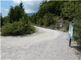 2
2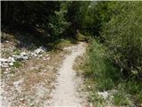 3
3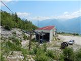 4
4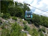 5
5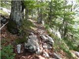 6
6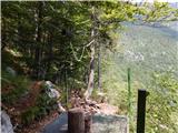 7
7 8
8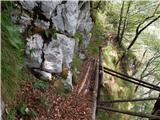 9
9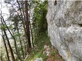 10
10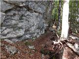 11
11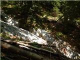 12
12 13
13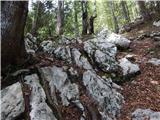 14
14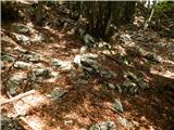 15
15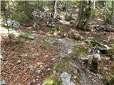 16
16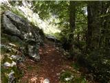 17
17 18
18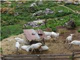 19
19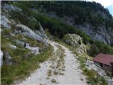 20
20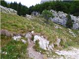 21
21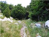 22
22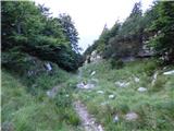 23
23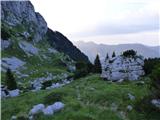 24
24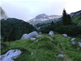 25
25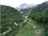 26
26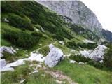 27
27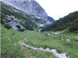 28
28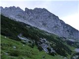 29
29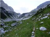 30
30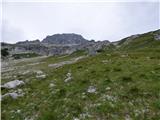 31
31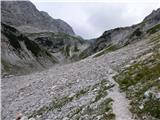 32
32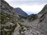 33
33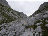 34
34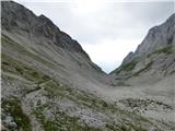 35
35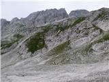 36
36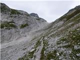 37
37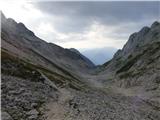 38
38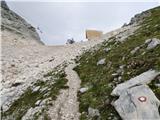 39
39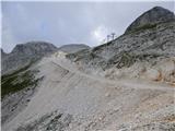 40
40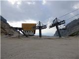 41
41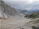 42
42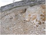 43
43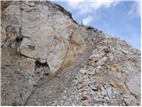 44
44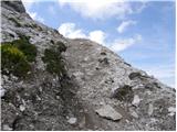 45
45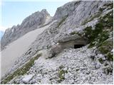 46
46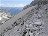 47
47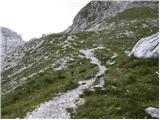 48
48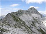 49
49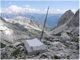 50
50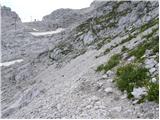 51
51 52
52 53
53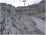 54
54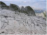 55
55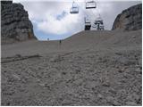 56
56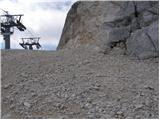 57
57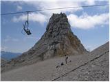 58
58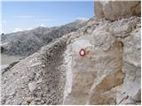 59
59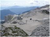 60
60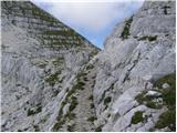 61
61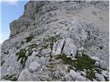 62
62 63
63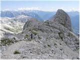 64
64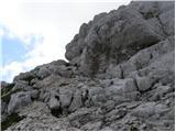 65
65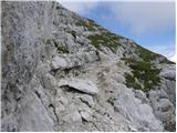 66
66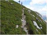 67
67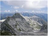 68
68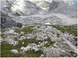 69
69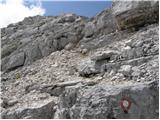 70
70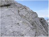 71
71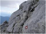 72
72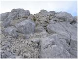 73
73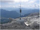 74
74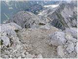 75
75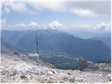 76
76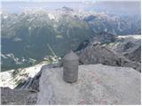 77
77 78
78
Discussion about the trail B station - Prestreljenik (via Krnica)
|
| Guest11. 09. 2006 |
 Lepa pot na kateri imamo mir. Obilo gorskega cvetja, svizcev in kozorogov. Moti le nova proga Prevala v zgornjem delu. Razgled z vrha pa je čudovit.  plp
|
|
|
|
| darinka427. 08. 2020 |
Danes 27.8. 2020 prehodila to turo. Mislim da edina po tej poti. Lepa zanimiva pot. Markirana. Srečala sva markcista , ki je od Prevale barval markacije. Vračala sva se po isti poti. Na vrhu lepi razgledi. Le precej hladno in vetrovno.
|
|
|
|
| ločanka16. 08. 2023 09:47:48 |
Včeraj sva se po njej vračala. Čudovita pot! Lepša kot sem si predstavljala. Ni čudno, da jo je tudi Igor priporočal
|
|
|
|
| winni16. 08. 2023 13:25:21 |
V kakšnem stanju je začetni del opisane poti od Postaje B do Krnice (slike 9, 10)? Mostiček?
|
|
|
|
| simon1616. 08. 2023 14:27:56 |
Do krnice je kakšno podrto drevo na poti, markacije so malo zbledele, ampak je vseeno prehodno. Lesen mostiček je tudi prehoden.
|
|
|
|
| di7. 08. 2025 14:55:19 |
Prvi del poti (do Planine Krnica) je kar zanemarjen. Na nekaterih delih težko najdeš (markirano) nadaljevanje.
Verjetno prideš ta prvi del poti bolj brezskrbno (in hitreje) naokrog po cesti.
|
|
|
|
| mirank7. 08. 2025 16:19:44 |
Najboljša varianta je da greste do odcepa za Gozdec ali še bolje do odcepa servisne ceste za C postajo.
|
|
|