Podkraj / Unterort - Končnikov vrh (Peca) (Walter Mory Klettersteig)
Starting point: Podkraj / Unterort (650 m)
| Lat/Lon: | 46,5426°N 14,7744°E |
| |
Name of path: Walter Mory Klettersteig
Time of walking: 4 h 5 min
Difficulty: very difficult marked way
Ferata: C
Altitude difference: 1459 m
Altitude difference po putu: 1480 m
Map: Koroška 1:50.000
Recommended equipment (summer): helmet, self belay set
Recommended equipment (winter): helmet, self belay set, ice axe, crampons
Views: 8.145
 | 2 people like this post |
Access to the starting point:
a) Cross Border crossing Jezerski vrh into Austria, then after about 6 km after Železna Kapla / Bad Eisenkappel turn right towards Velikowiec / Völkermarkt. Follow the main road towards Velikowiec for 2 km, then turn right again, this time towards Pliberk / Bleiburg. Continue along the Podjuna valley, then turn right at the next major junction towards Pliberk. The road continues through several roundabouts, and we follow it towards the Peca / Petzen ski resort. We continue through Bistrica near Pliberk / Feistritz near Bleiburg to the large parking lot at the bottom station of the cable car to Peca. From Border crossing Jezerski vrh to the starting point is about 40 km.
b) From Dravograd or Slovenj Gradec, drive to Ravne na Koroškem and then continue in the direction of Border crossing Holmec. Once in Austria, first drive towards Pliberk / Bleiburg, then follow the signs for the Peca / Petzen ski resort. Continue through a few villages, and we follow the road to the large parking lot at the bottom station of the lift to Peca. From Border crossing Holmec to the starting point is about 8 km.
Path description:
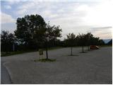
From the parking lot, first walk to the bottom station of the circular cable car leading to Peca, then take the path marked 3, 7 and 8. The path initially leads along the wide cart track, which quickly leads to the ski slope. Continue along the left edge of the ski slope, then the path turns slightly to the right and leads into a dense forest. Here it joins the cart track, which descends gently to a nearby marked crossroads.
From the crossroads, follow the ascending road to the left, where you are also guided by the signs for routes 3 and 7. A few minutes higher up, the road splits in two, where you continue to the left along route 3 (to the right, initially slightly downhill, route 3). A little over 100 m higher, join the marked trail leading from the village of Rute / Ruttach, crossing the worse forest road several times as you go. Higher up, the road finally ends, and we continue between two rocks into the forest. The path continues to climb steeply through the forest, which offers pleasant shade on hot days. Higher up, the forest gradually starts to thin out, and we start to get beautiful views of Podjuna and the Golice mountain range. A little further on, the track turns quite left and leads us under the steep slopes of Mala Peca, where a climbing route called the Walter Mory Klettersteig soon branches off to the left.
At the crossroads, continue left in the direction of the climbing route and then start climbing in switchbacks towards the wall where the climbing route starts.
Before entering the climbing part of the route, equip yourself with a helmet and a self-belay kit.
The climbing route initially ascends across a rocky slope, aided by a rope and a few pitons. The route then turns to the right and climbs up a slippery slope with a lot of sand and soil. There is a slightly less steep traverse to the left and then a steep climb right up a short gully. At the top of the gully, the path briefly becomes less difficult and leads to a crossroads.
If we find the path too difficult, we continue to the left on the easier path, otherwise we can continue to the right on the more difficult path. The harder path then leads us, after a short crossing and climb over a crumbly slope, to a registration box located in front of the most challenging part of the path. The path climbs almost vertically here, with a number of scrambles to help us. There is a steep climb along a small rock cliff. The climbing route then ends and after a short climb you reach a lookout point where there are a few benches. Continue along the wide, sloping path that leads to the macadam road where there is a marked crossroads. Continue straight ahead on the steep road to the top station of the cable car, which you can already see in front of you.
At the upper cable car station where there is a crossroads, continue straight ahead following the signs "P12 Kordeschkopf". At first you follow the slope cart track, then the path turns to the right and starts to climb up alongside the ski slope. The path then briefly turns left off the ski slope into the woods before climbing back up along the edge of the ski slope. When you reach the top of the ski slope, continue left and then climb for a short distance up along dwarf pines. Later, the dwarf pines becomes a little thinner and then there is a short climb up a grassy slope to a crossroads on the boundary ridge (Knipsovo sedlo).
At the crossroads continue right (left Petzen) and climb quickly to Končnikov vrh.

Pictures:
 1
1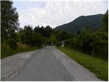 2
2 3
3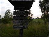 4
4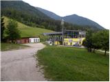 5
5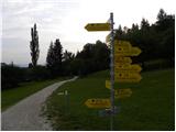 6
6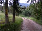 7
7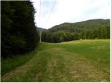 8
8 9
9 10
10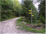 11
11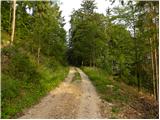 12
12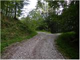 13
13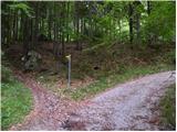 14
14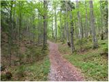 15
15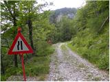 16
16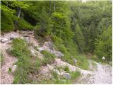 17
17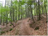 18
18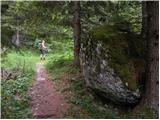 19
19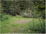 20
20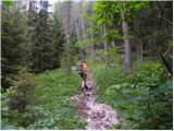 21
21 22
22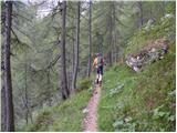 23
23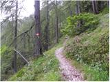 24
24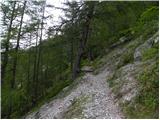 25
25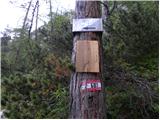 26
26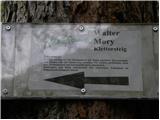 27
27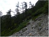 28
28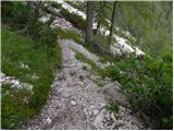 29
29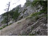 30
30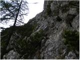 31
31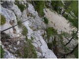 32
32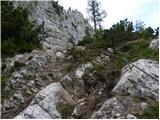 33
33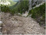 34
34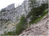 35
35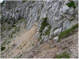 36
36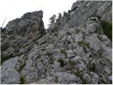 37
37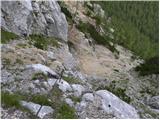 38
38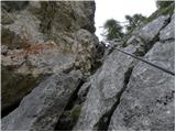 39
39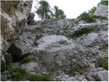 40
40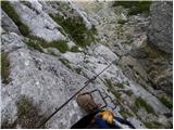 41
41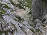 42
42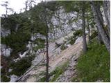 43
43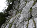 44
44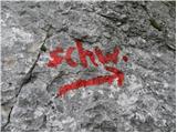 45
45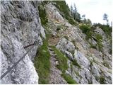 46
46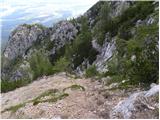 47
47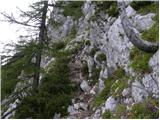 48
48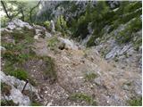 49
49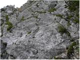 50
50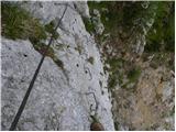 51
51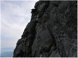 52
52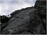 53
53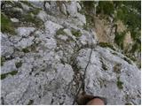 54
54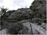 55
55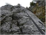 56
56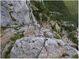 57
57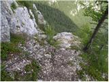 58
58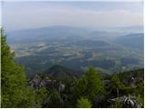 59
59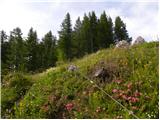 60
60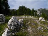 61
61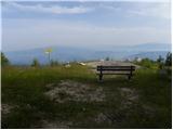 62
62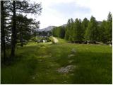 63
63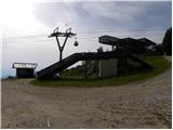 64
64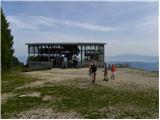 65
65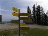 66
66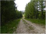 67
67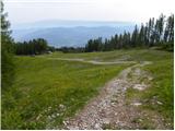 68
68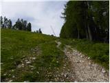 69
69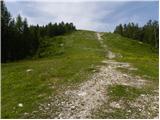 70
70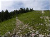 71
71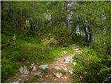 72
72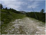 73
73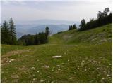 74
74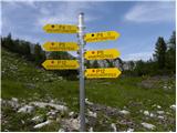 75
75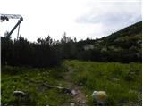 76
76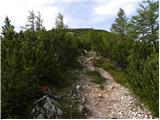 77
77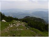 78
78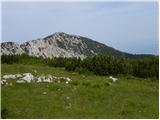 79
79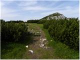 80
80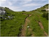 81
81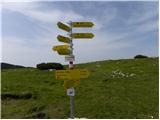 82
82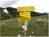 83
83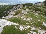 84
84 85
85
Discussion about the trail Podkraj / Unterort - Končnikov vrh (Peca) (Walter Mory Klettersteig)
|
| lepenatka2. 08. 2012 |
Zdravo, je kdo zadnje čase hodil po tej poti?
Zanima me v kakem stanju so varovala in pot na sploh.
|
|
|
|
| katja8715. 07. 2013 |
V nedeljo, 14.7.2013, smo se po tej poti preko Končnikovega vrha odpravili na Bistriško špico. Naredili smo krožno turo: Najberž (parkirišče) - Končnikov vrh (preko Walter Mory ferrate) - Bistriška špica - Najberž. Tura je trajala 8 ur. Imeli smo krasno vreme in na vrhu srečali veliko skupino avstijskih pohodnikov. Sama ferrata je zares super in jo priporočam vsem ljubiteljem ferat  Slike iz pohoda si lahko ogledate na spletni strani Planinskega društva Matica Murska Sobota: http://www.mojalbum.com/pdmaticams/20130714-bistriska-spica-walter-mory-ferata/peca/20931627
|
|
|
|
| robson27. 07. 2014 |
Včeraj opravil enako krožno turo, kot opisuje katja87, in je res krasna. Sicer sem jo opravil v petih urah in pol, ampak bolj zaradi tega, ker me je vreme preganjalo...  Verjetno je bilo vreme tudi razlog, da sem v celem dnevu na poti srečal samo tri ljudi... Ferrata je lušna in ne prezahtevna, ampak sem bil presenečen, da je precej kratka - samo do vstopa je treba narediti dobrih 900 višinskih metrov... Od tam pa si zelo hitro pri zgornji postaji žičnice. Sicer pa so varovala v dobrem stanju.
|
|
|