Zajzera - Svete Višarje / Monte Lussari (by road)
Starting point: Zajzera (897 m)
Route name: by road
Walking time: 3 h
Difficulty: easy marked way
Elevation gain: 869 m
Elevation difference along the route: 869 m
Map: Julijske Alpe - zahodni del 1:50.000
Recommended equipment (summer):
Recommended equipment (winter): ice axe, crampons
Views: 61.927
 | 2 people like this post |
Access to starting point:
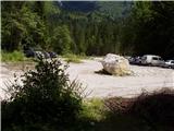
From Kranjska Gora over the border crossing Rateče we drive to Trbiž / Tarvisio. Further, we drive on the old road towards Videm / Udine. Already after a few kilometers from Trbiž / Tarvisio, the road into Ovčja vas / Valbruna branches off to the left. In Ovčja vas / Valbruna we turn left and follow the road ahead through the valley of Zajzera upwards. After a few kilometers of driving, we come to a crossroad at the bridge above the road. Here we turn left in the direction of Svete Višarje / Monte Lussari and follow the road for some tens of meters to a large parking lot, where we park.
Route description:
From the parking lot, we continue on the road ahead, which in a few steps brings us to a crossroad, where we continue left in the direction of Svete Višarje (Monte Lussari). The road then slightly descends and brings us to the bridge over the river, where a nice view opens up on the northern walls of the western Julian Alps.
On the other side the road runs past a trough with drinking water and then starts ascending. The road, which is closed to traffic, then mostly ascends through the forest and only rarely does a nice view open up. After an hour and a half of walking the forest becomes a little thinner so that beautiful views open up. The road in parts crosses some scenic area and one old military trench. Later the road brings us to the junction of paths at the chapel.
We continue on the left road, which after a good 15 minutes brings us to the hamlet on Svete Višarje.
Photos:
 1
1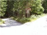 2
2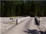 3
3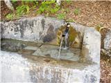 4
4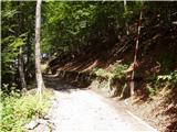 5
5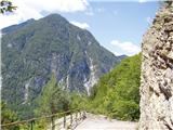 6
6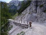 7
7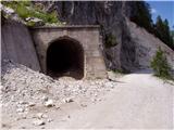 8
8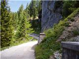 9
9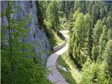 10
10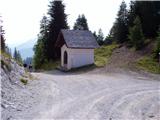 11
11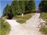 12
12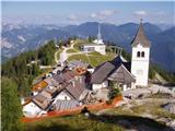 13
13
Discussion about the trip Zajzera - Svete Višarje / Monte Lussari (by road)
|
| Gost31. 12. 2007 |
yeah super... tomorrow we wouldn't go up there skiing but where are those winter idyllic pictures??!??

|
|
|
|
| rantlo9. 07. 2012 |
Unfortunately I couldn't find this parking lot, can someone provide coordinates, thanks.
|
|
|
|
| stankos10. 07. 2012 |
46 28 06.33
13 29 31.75
lp
|
|
|
|
| ZoranV28. 07. 2014 |
Eh, the links are wrong, the first is from the top, the second from the path 
I can't correct it here anymore...
|
|
|
To post a comment you must log in:
If you do not yet have a username, you must first
register.