Starting point: Planina Zaprikraj (1208 m)
Walking time: 7 h 30 min
Difficulty: difficult marked way
Elevation gain: 1036 m
Elevation difference along the route: 1200 m
Map: Julijske Alpe - zahodni del 1:50.000
Recommended equipment (summer): helmet, lamp
Recommended equipment (winter): helmet, ice axe, crampons, lamp
Views: 15.072
 | 2 people like this post |
Access to starting point:
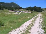
In Kobarid you leave the main road and go towards Drežnica. Drive on the main road through Drežnica towards Drežniške Ravne and at the end of this village turn right in the direction of Pl. Zaprikraj. After a few turns you will come to a plain, where there stands a trough for livestock and there is also a large space for parking. You can park here and on foot go to Pl. Zaprikraj, which will take you a good hour. I continued with the car all the way to Pl. Zaprikraj. On some parts the road is in quite bad condition, but if you have a normal car, you will slowly get to Pl. Zaprikraj. At the entrance to Pl. Zaprikraj you will run into an iron gate, which marks the border of the pasture. Before the gate is a large parking lot and there is also a sign for Triglav National Park. Park here.
Route description:
You step through the gate of the pasture and immediately behind the gate you go right on a mule track (path that the Italian army carved into the hill during the First World War) and then zig-zag directly uphill. (my friend and I started the hike on the mountain pasture on Planina Zaprikraj, which is 10 minutes from the parking lot) So after one and a half hours of walking uphill we came to the saddle Vrata, from where the path completely changed. The path goes directly below the summit of the ridge and along a narrow trail made by the Italian army, once even through a short tunnel. Visible in the photos. If you have a headlamp, you can view some caverns along the path.
At the end of the ridge the path descends a little and then we come to the path that comes from the direction of Krnsko jezero. From there the path starts ascending again. In front of you on this ascent you constantly see the summit, but when you get to it you realize that the summit is still about 15 minutes away (go, and you will see what I mean). The path from Krnsko jezero to the summit of Krn was incredibly full of hikers, as was the summit and Gomiščkovo zavetišče. We reached the summit after a total of 3 hours and 40 minutes (measured from the mountain pasture on Pl. Zaprikraj).
From the summit we also went to Gomiščkovo zavetišče, which is directly below the summit. Beer and return back to Zaprikraj. For the return from the hut to the mountain pasture we needed exactly 3 hours. Since we are among the faster hikers, I wrote in the description of this path that you need 7 hours 30 minutes. Don't forget to take water with you, as you won't find any on the path. Go in the morning, when the steepest part of the path is still in the shade (departure from the starting point no later than 9 a.m.).
Locals on Pl. Zaprikraj told me that there are quite a few more remnants of the First World War on the other part of the ridge; from the saddle Vrata towards the north.

Photos:
 1
1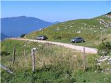 2
2 3
3 4
4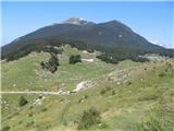 5
5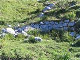 6
6 7
7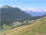 8
8 9
9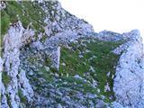 10
10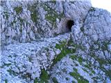 11
11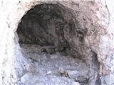 12
12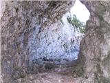 13
13 14
14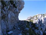 15
15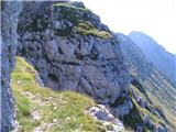 16
16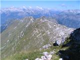 17
17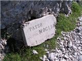 18
18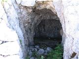 19
19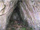 20
20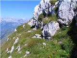 21
21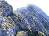 22
22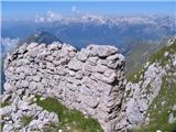 23
23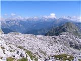 24
24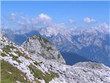 25
25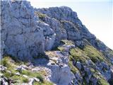 26
26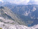 27
27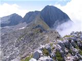 28
28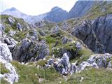 29
29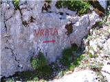 30
30 31
31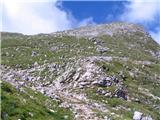 32
32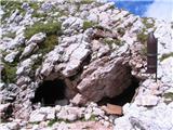 33
33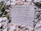 34
34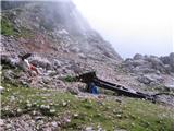 35
35 36
36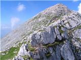 37
37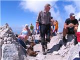 38
38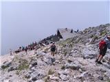 39
39 40
40 41
41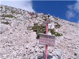 42
42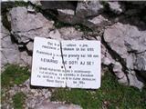 43
43 44
44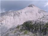 45
45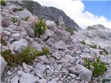 46
46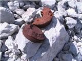 47
47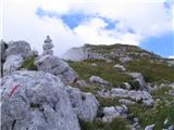 48
48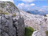 49
49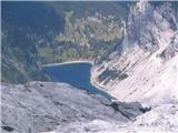 50
50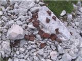 51
51 52
52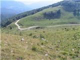 53
53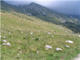 54
54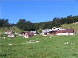 55
55
Discussion about the trip Planina Zaprikraj - Krn
|
| tulipan4. 10. 2011 |
Walking time is exaggerated. Actually the start of the trail is from planina Zapleč and it takes about four hours of normal walking. If you start at the end of the asphalt at the trough above Drežniške ravnine then it's five hours walking, which is also written on the direction sign.
|
|
|
|
| BT885. 10. 2011 |
Tulip does this path also lead through Krnčnica? Nothing written  it must be close there though. it must be close there though.
|
|
|
|
| tulipan20. 10. 2012 |
From the saddle Vrata towards Krn, the path leads past the summit of Krnčica. From the ridge of Krnčica, it is possible to ascend to the summit of Krn also via a climbing path (max II).
|
|
|
|
| navdušena25. 07. 2014 |
I've heard that due to landslides from the earthquake some paths are impassable. Has anyone been up there last year or this year already?
navrhu - original author of the description, please add your comments: how is the path marked? Is the entry (start of the path) marked (direction with arrow??) or do we have to find it ourselves as you wrote? How demanding is the path? Technically (climbing)?
Tulipan - what about normal walking? How long does it take you from the parking lot in Tacen to the top of Šmarna gora - your normal walking? Just so I can see how fast your steps are...?! Thanks for the answers
|
|
|
|
| felix25. 07. 2014 |
As far as I know, the path from Krnčica to the path running from Krnsko jezero to Krn is not among the marked paths, so the criticism of the markers by the description author is out of place (correct me if I'm wrong). Best regards!
|
|
|
|
| tulipan25. 07. 2014 |
Dear enthusiast, what are you actually?
In a private message I nicely wrote to you what the signposts say.
Given the purpose of the portal, there's no need to send anyone to Tacen, perhaps to the hills above Ljubgojna.
In PM I told you my age and where I'll celebrate. Sincerely invited!
|
|
|
|
| winni3. 09. 2020 |
How difficult or exposed is this path from Krnčica to the saddle between Krn and Batognica?
|
|
|
|
| Bocadillo5. 09. 2020 |
The path from Krnčica onwards runs along/on the ridge to the notch between Krn and Srednji vrh and is difficult and exposed just as much as from Vrata to the top of Krnčica (unprotected scree slope, partially exposed in places - caution is not superfluous). At the notch between Srednji vrh and Krn the path turns left and descends behind the top of Krn. From there onwards to the saddle between Krn and Batognice the path is easy, not exposed (crossing rocky terrain and scree).
Good luck, M.
|
|
|
To post a comment you must log in:
If you do not yet have a username, you must first
register.