Pala Barzana - Monte Raut (CAI 967)
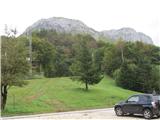
Starting point: Pala Barzana (840 m)
| Latitude/Longitude: | 46,1959°N 12,65887°E |
| |
Route name: CAI 967
Walking time: 3 h 45 min
Difficulty: partly demanding marked way
Elevation gain: 1185 m
Elevation difference along the route: 1175 m
Map: Dolomiti Friulane 1:40000 (Meridiani Montagne); Tabacco 1:25000 Piancavallo
Recommended equipment (summer): helmet
Recommended equipment (winter): helmet, ice axe, crampons
Views: 2.486
 | 3 people like this post |
Access to starting point:
From Slovenia we reach Videm (Udine), where we turn towards Spilimbergo and Maniago. Here we turn towards Poffabro (officially one of the most beautiful villages in Italy) and past Pian delle Merie in numerous zigzags we reach the saddle Pala Barzana. Large parking lot next to the TV transmitter and building for parties. We can also reach the saddle from the other side, if in Maniago we turn towards the village Andreis.
From Gorenjska we can shorten the route by a kilometer, if from the highway (or parallel state road) we turn off at Gemona or Humin.
Route description:
From the parking lot, we follow the signs through grassy and sparsely forested slope, through rugged slope, past the abandoned mountain pasture (1119 m), on steep grassy slopes, through clogged gully, over a few shorter secured wet jumps to the notch Forcella Capra (1824 m).
Path 967 from here continues into the valley, to the north to lake Selva, while we turn left along and beside the precipitous ridge, somewhat less steep than to the notch, on a marked and partly secured path to the summit.
Along the route: ostanki planine Palla Barzana (1119m), Forcella Capra (1824m)
Photos:
 1
1 2
2 3
3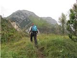 4
4 5
5 6
6 7
7 8
8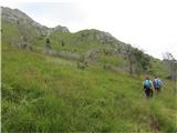 9
9 10
10 11
11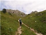 12
12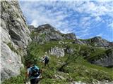 13
13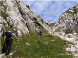 14
14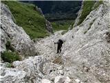 15
15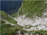 16
16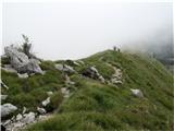 17
17 18
18 19
19 20
20 21
21 22
22 23
23 24
24 25
25 26
26 27
27 28
28 29
29 30
30 31
31 32
32
Discussion about the trip Pala Barzana - Monte Raut (CAI 967)
To post a comment you must log in:
If you do not yet have a username, you must first
register.