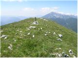
 | Volovljek - Kranjska reber (on unmarked path)
Kranjska reber, also known as Vrh Kašne planine (1435 m), is a mountain of volcanic origin. From the summit, which has a registration box with a ...
1 h 15 min |
 | Bohinjsko sedlo - Slatnik (northwestern peak) (by Lajnar)
Slatnik is a panoramic mountain located west of the Soriška Planina ski resort. From its grassy summit there is a beautiful view of the Škofjeloš...
1 h 15 min |
 | Planina Vetrh - Bela peč (via cottage Pr Zdravc)
The mountain, known mainly among climbers, is located north of Storžič on the slopes of Konjščica. From the summit there is a beautiful view of t...
1 h 15 min |
 | Kajfežev rob - Kamniški vrh
Kamniški vrh is a 1259-metre-high mountain located north of Kamnik, more precisely between Stahovica and the Korošica valley. From the summit, wh...
1 h 15 min |
 | Dom na Smrekovcu - Krnes (via Smrekovec)
The summit is located in the heart of the Smrekovec mountain range and offers a beautiful view. Peca, Uršlja gora, and part of the highest peaks ...
1 h 35 min |
 | Kozarnice - Srednji Golak (unmarked eastern way)
Srednji Golak is located between Mali and Veliki Golak on the plateau of Trnovski gozd above Predmeja. The peak is covered with dwarf pines, and ...
1 h 45 min |
 | Jezero Sobote / Stausee Soboth - Huhnerkogel/Košenjak (on unmarked path)
Košenjak is located north of Dravograd and the Drava River on the border with neighbouring Austria. Access to Košenjak is possible on foot or by ...
1 h 40 min |
 | Planina Smrečica (Poglajnov rovt) - Galetovec
Galetovec is an indistinct peak on the southeastern part of the Pokljuka plateau. From the summit, which has a logbook, there is a nice view of t...
2 h |
 | Dom Pristava in Javorniški Rovt - Španov vrh
Španov vrh is a 1,334 m high mountain located between Javorniški Rovt and Planina pod Golico. From the summit, accessible by the eponymous cable ...
1 h 30 min |
| Planina pod Golico - Španov vrh
Španov vrh is a 1,334 m high mountain located between Javorniški Rovt and Planina pod Golico. From the summit, accessible by the eponymous cable ...
1 h 15 min |
 | Planina Lom - Kobilja glava
Kobilja glava is a 1,475-meter-high peak located east of Tolmin. From the summit, where a cross stands, there is a beautiful view of Krn, the ran...
1 h 15 min |
 | Koča na planini Stador - Jalovnik
Jalovnik is a grassy peak located southeast of the slightly higher Kobilja glava. From the summit, which has a summit logbook, there is a nice vi...
1 h 30 min |
| Planina Lom - Jalovnik
Jalovnik is a grassy peak located southeast of the slightly higher Kobilja glava. From the summit, which has a summit logbook, there is a nice vi...
1 h 30 min |
 | Koča na Gozdu - Visoki Mavrinc
Visoki Mavrinc (Špica v Sedelcih) is a 1562 m high mountain between Suha, Mala, and Velika Pišnica. From the summit, where a wooden cross and ple...
1 h 15 min |
 | Križovec - Mala Golica
Mala Golica is a less distinct peak located east of Krvavka. From its grassy summit, there is a nice view of the Dravska dolina, Struško, parts o...
1 h 30 min |
 | Makekova Kočna - Skubrov vrh
Skubrov vrh is a 1276 m high mountain rising steeply above the Ravenska Kočna valley. The forested summit offers no views....
1 h 10 min |
 | Poden / Bodental - Požgani rob
Požgani rob is a 1,513-meter-high mountain north of Rjavca. The summit is surrounded by forest, so there is no good view from it, but a nice pano...
1 h 10 min |
 | Planina Loka - Kup (on Raduha)
Kup is a 1,808-meter-high peak situated on the far northeastern part of Raduha. From the summit, where a cross stands, a beautiful view opens up ...
1 h 20 min |
 | Rotek - Erbelc
Erbelc is a 1,308-meter-high peak that rises steeply above Zgornja Sorica. From the summit, which has a summit logbook, there is a fine view of t...
1 h 15 min |
| Spodnje Danje - Erbelc
Erbelc is a 1,308-meter-high peak that rises steeply above Zgornja Sorica. From the summit, which has a summit logbook, there is a fine view of t...
1 h 15 min |
 | Rotek - Tonderškofel
Tonderškofel is a 1,326-meter-high peak located between Soriška peč and Erbelc. From the partly overgrown summit, which has no marked trail leadi...
1 h 15 min |
| Spodnje Danje - Tonderškofel
Tonderškofel is a 1,326-meter-high peak located between Soriška peč and Erbelc. From the partly overgrown summit, which has no marked trail leadi...
1 h 15 min |
 | Tolminske Ravne - Javor (above Tolminske Ravne)
Javor is a 1,363-meter-high peak situated between Tolminske Ravne and Grušnica. From the summit, which features a small cross, nice views open up...
1 h 20 min |
 | Polja - Kališje
Kališje is a lesser-known peak in the western part of the Karawanks. From the summit, where transmitters are located, there are some views toward...
1 h 40 min |
 | Planina Smrečica (Poglajnov rovt) - Turn (above Bohinjska Bela)
Turn is a panoramic and precipitous peak located above Bohinjska Bela. From the summit, there is a nice view of Ratitovec, Jelovica, the Kamnik-S...
1 h 40 min |
 | Koprivna (Kumer) - Čofatijev vrh (via Šoparjev vrh)
Čofatijev vrh is a panoramic mountain between the Koprivna and Topla valleys. From the top, a beautiful view opens up on the mountains above both...
1 h 45 min |
 | Poden / Bodental - Veliki Rob / Großer Rain
Veliki Rob / Großer Rain is a 1,464-meter-high peak located on the Austrian side of the Karawanks, specifically in the ridge above the Poden / Bo...
1 h 50 min |
 | Poden / Bodental - Veronjak / Hausberg
Veronjak / Hausberg is a 1,348-meter-high peak located above the Poden / Bodental valley on the Austrian side of the Karawanks. From the summit, ...
1 h 20 min |
| Slovenji Plajberk / Windisch Bleiberg - Veronjak / Hausberg (via Veronjak / Hausberg)
Veronjak / Hausberg is a 1,348-meter-high peak located above the Poden / Bodental valley on the Austrian side of the Karawanks. From the summit, ...
1 h 25 min |
 | Erjavčev rovt - Bela peč (above Dovje)
Bela peč is a lesser-known peak located above the marked trail from Dovje to Dovška Baba. From the summit, there is a beautiful view to the south...
1 h 15 min |
 | Teichalm (Teichalmsee) - Zachenkreuz
Zachenkreuz is a 1,601-meter-high peak situated above the Teichalm mountain pasture. On the summit, mostly overgrown by sparse forest, stands a w...
1 h 20 min |
| Breitalm - Zachenkreuz
Zachenkreuz is a 1,601-meter-high peak situated above the Teichalm mountain pasture. On the summit, mostly overgrown by sparse forest, stands a w...
1 h 15 min |
 | Feistritzsattel - Großer Pfaff (easier path)
Großer Pfaff is a 1555-meter-high panoramic peak situated between the Pfaffensattel and Feistritzsattel passes. From the summit, where there is a...
1 h 45 min |
 | Feistritzsattel - Kleiner Pfaff
Kleiner Pfaff is a 1539-meter-high peak located southeast of the Pfaffensattel pass. From the summit, where a small cross stands, beautiful views...
1 h 45 min |
 | Feistritzsattel - Schöberlriegel
Schöberlriegel is a 1,704-meter-high peak situated north of Hochwechsel. From the summit, where a large cairn stands, a beautiful view opens up o...
1 h 40 min |
 | Pension Camping Holzmeister - Plankogel (via Kerscbaumalm)
Plankogel is a 1531-meter-high mountain situated in the Almenland nature park. From the panoramic summit, where a cross stands, a beautiful view ...
1 h 50 min |
 | Pension Camping Holzmeister - Zechnerschlag (Rohregg)
Zechnerschlag, or Rohregg, is a 1434-meter-high mountain situated in the Almenland nature park. From the summit, where a cross stands, a beautifu...
1 h 30 min |
 | Straßegg - Zechnerschlag (Rohregg)
Zechnerschlag, or Rohregg, is a 1434-meter-high mountain situated in the Almenland nature park. From the summit, where a cross stands, a beautifu...
1 h 30 min |
 | Dražgoše (Jelenšče) - Britmanca (gentle path)
Britmanca is a 1,231-meter-high peak on the edge of the Jelovica plateau. Slightly south and lower from the summit along a well-worn path lies a ...
1 h 15 min |
 | Bürgeralm (Panoramastraße) - Hochstein (at Mitteralm) (via Windgrube)
Hochstein is a scenic summit with a cross and summit register box in the Hochschwab mountain group, between Windgrube peak and the Mitteralm plat...
1 h 25 min |