Zidani Most - Veliko Kozje
Starting point: Zidani Most (201 m)
| Latitude/Longitude: | 46,0879°N 15,1884°E |
| |
Walking time: 2 h 30 min
Difficulty: easy marked way
Elevation gain: 792 m
Elevation difference along the route: 792 m
Map:
Recommended equipment (summer):
Recommended equipment (winter):
Views: 32.129
 | 5 people like this post |
Access to starting point:
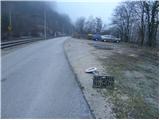
From Zasavje or Celje we drive to Zidani Most. In Zidani Most we cross the bridge over the river Savinja and right after it we turn sharply left (by the road we notice signs for Gašperjeva koča). This road, which runs along the Savinja, we follow to the parking lot, which is situated only a few meters before the railway crossing.
From Trebnje or Krško we drive to Sevnica and we follow the road further towards Zidani Most. In Zidani Most we don't cross the bridge over the river Savinja, but we continue straight ahead on the narrow road between the railway and Savinja. We park at the parking lot a few meters before the railway crossing.
Route description:
From the parking lot we continue on the road which crosses the railway track and then brings us to a crossroad, where we continue on the right upper road in the direction of the mountain hut Gašperjeva koča. Only a little further we get to another similar crossroad, where we again continue right upwards. The road, which is getting worse, then goes into the forest, where past the village ski slope in a moderate ascent it brings us to the mountain hut Gašperjeva koča.
From the mountain hut we continue upwards on a cart track in the direction of Veliko Kozje. The cart track on which we are ascending we leave after a few steps, because the blazes point us left onto a footpath which ascends diagonally across a steep forest-covered slope. The path, quite steep in places, after a short ascent brings us to a nice vantage point from which a view opens up onto Kum. Further we continue on the path which ascends along and on the side ridge of Veliko Kozje. A little higher the path descends for a few steps and turns right, where it crosses steep slopes (in snow danger of slipping and avalanche). Then follows a shorter ascent and the path brings us to a junction, where we continue left (right Radeče). Further we ascend on a moderately steep path, which after a good 20 minutes brings us to Veliko Kozje.

Photos:
 1
1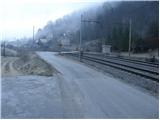 2
2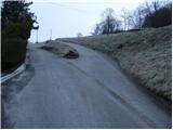 3
3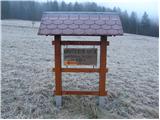 4
4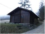 5
5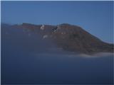 6
6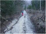 7
7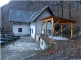 8
8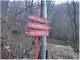 9
9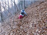 10
10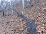 11
11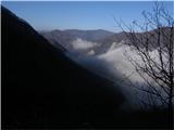 12
12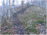 13
13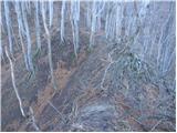 14
14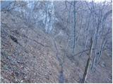 15
15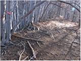 16
16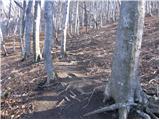 17
17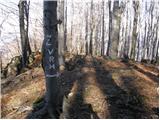 18
18 19
19
Discussion about the trip Zidani Most - Veliko Kozje
|
| andrejjerina27. 03. 2009 |
My partner Borut and I also did the ascent on the above-described trail today. The trail is quite steep, but worth visiting. You enjoy solitude all the way, only birdsong disturbs the silence. We were lucky that so many spring flowers were blooming. Recommended! LP Andrej
|
|
|
|
| ana4. 04. 2009 |
Today I walked the described path to Veliko Kozje. From there I went via Sv. Lovrenc to Lisco, then descended into the valley at Breg, where I took the train back to Zidani Most. Nice tour, takes 6-7 hours. Nice.
|
|
|
|
| anemona5. 04. 2009 |
Today with my husband we went from Zidani Most to Veliko Kozje. Excellent season start, since in winter we didn't go to the mountains (we were on cross-country skis on weekends) and as a test to see your fitness, as it is quite tricky and steep. Today it was really warm, sunny, spring flowers in full bloom, idyll. We met only one girl who continued the tour. Recommended.
|
|
|
|
| marchy27. 09. 2009 |
Hey, today I was on V. Kozja and if anyone's interested in a trip at this time I'd give some useful tips. You can follow the path description on this page but no need to park before the border crossing, you can drive to the ski hut and park there, plenty of space. From the top of V. Kozja I recommend descent towards Lovrenc, past the "dinosaur" at the junction then head right to Gašperjeva k. (you can extend the trip by another hour and see the church of St. Lovrenc, but watch to return the same way to that junction) Part of the path then runs along the road, just make sure to turn into the forest at the right time. This is then the hardest part of the path, due to leaves the path is not visible and when you spot the first mark continue only when you see the next one on the tree!!! (marks are well visible) and so on, all the way to the last junction, there head right back to the valley towards Gašperjeva k. here you can't miss it anymore. Otherwise a very nice tour, quite steep, I recommend it, lp m.
|
|
|
|
| nikolaj5922. 02. 2010 |
I also set off for the summit. From the valley already almost no snow, higher towards the summit there was some. On the western part under the rock where the avalanche had gone, I waded through it up to my knees, in lower spots even up to my waist. It took a little longer, but the view from the top was fantastic. Since it was my first time, I'll repeat the trip in spring to see what it looks like then. There were no tracks in the snow from the direction of Zidani Most (Gašperjeva koča), which shows that this peak is rather poorly visited in winter. Really a shame. 
|
|
|
|
| nikolaj5922. 02. 2010 |
I also set off for the summit. From the valley already almost no snow, higher towards the summit there was some. On the western part under the rock where the avalanche had gone, I waded through it up to my knees, in lower spots even up to my waist. It took a little longer, but the view from the top was fantastic. Since it was my first time, I'll repeat the trip in spring to see what it looks like then. There were no tracks in the snow from the direction of Zidani Most (Gašperjeva koča), which shows that this peak is rather poorly visited in winter. Really a shame.
|
|
|
|
| Zalas7. 02. 2011 |
Today I ascended this peak from the valley! Really nice views! Some snow patches! Great caution needed in places as it was very slippery! Otherwise fantastic ascent! It's a bit steep but good for stretching the muscles.
Best regards.
Milan Šuln
|
|
|
|
| Enka7. 02. 2011 |
Can I ask, by how much (time-wise) is the path shortened if you drive to the ski hut, as marchy suggests?
|
|
|
|
| smukc26. 04. 2011 |
If you park at the upper picture No. 1, you shorten the path by about 10 minutes, from the train station a little more than half an hour. Currently the gravel path is very damaged because foresters are transporting wood from the forest.
|
|
|
|
| Rudi2618. 05. 2011 |
Does anyone know if there is a stamp for the Zasavska planinska pot at the top?
|
|
|
|
| uhan118. 05. 2011 |
On 22.1.2011 the stamp was up there.
|
|
|
|
| Stolar19. 05. 2011 |
With or without the stamp, it's nice up there:
|
|
|
|
| Rozcaa7. 12. 2013 |
The start of the path is wrongly described, because we don't turn right up there when crossing the railway line, but continue straight.
|
|
|
|
| jprim9. 12. 2013 |
How is it with the hut, they probably already repaired the roof and removed the fallen trees.
LP!
|
|
|
|
| smukc9. 12. 2013 |
repaired since last December
|
|
|
|
| PlaRinka4. 06. 2017 |
The first part of the trail is not the nicest and very steep, while the second part is like a walk through an enchanted forest - wonderful!
We parked above picture no. 5. The road there is somewhat damaged, but nothing that a regular car couldn't handle.
There is a stamp at the top.
|
|
|
|
| N3bULA26. 08. 2017 |
Today I went again to my favorite Zasavje hill, namely from Zidani Most, from the train station.
I noticed that the road to Gašperjeva koča is newly arranged, so it is accessible also with a normal car.
Signposts everywhere, but I descended towards Rimske Toplice, this path is very overgrown at the beginning and has a lot of fallen wood on it, in the second part it continues on the road, so I don't recommend the path R.Toplice - V.Kozje.
Regards
|
|
|
|
| Šuška29. 05. 2018 |
Hello
Can someone please tell what the road to the ski hut is like and how much it shortens the path to Veliko Kozje summit?
And what is the path to Gašperjeva koča like and can you park normally there, and how long to the summit then?
Thanks for answers
regards
|
|
|
|
| N3bULA8. 07. 2018 |
A bit late but anyway 
A good month ago, the road to Gašperjeva koča was quite solid and drivable with a passenger car.
Next to Gašperjeva koča there is plenty of parking space, and driving to Gašperjeva koča saves you about 1 hour of walking to Veliko Kozje. Žel. Station Zidani Most - Gašperjeva koča approx. 1h, Gašperjeva koča - Veliko Kozje approx. 1h 45min.
It is true though that this path is not the most suitable for descent, too steep for me...
|
|
|
|
| modrook123. 01. 2020 |
Trail without special features, well marked. Beautiful views towards the Alps from the top. Gašperjeva koča closed.
|
|
|
|
| alazeh3. 03. 2022 18:53:48 |
Today we were at the summit. Beautiful weather, still a beautiful path, below the summit here and there still some small patches of snow, in places slightly frozen (in the morning), but not slippery. Poles helped a lot.
The view was superb, KSA could be seen like on the palm of your hand, and to the left also the Julians, with Triglav!
|
|
|
|
| jprim4. 03. 2022 18:21:18 |
@alazeh
Interested if the hut is already renovated and open?
In 2013 I asked this and haven't been to this summit since.
Lp!
|
|
|
|
| jprim4. 03. 2022 18:23:23 |
|
|
|
|
| matej7124. 03. 2022 20:17:31 |
Two years ago when we passed by, it wasn't renovated yet. Nor open, it was a Saturday in February.
|
|
|
|
| garmont5. 03. 2022 12:25:22 |
Hut was renovated, but no longer a mountain hut, but hunting. No more catering, open only as needed...for hunters.
|
|
|
|
| jprim6. 03. 2022 15:57:20 |
Thanks for the reply.
Sad, well that's how it is.
Similar on Lisca, where the mountain hut is open occasionally only for PD members or you can rent it.
LP!
|
|
|
|
| Enka7. 04. 2024 00:07:27 |
To Gašperjeva hut not very interesting forest road, from there on beautiful path with rocks, narrow paths, ridge walking, magical beech forest, flowers and more, just no people. Fantasy!
|
|
|
|
| frover11. 04. 2024 17:03:08 |
Path for the soul, on St. Lovrenc gentians are blooming
Thanks to the path markers for the nicely marked path.
|
|
|
To post a comment you must log in:
If you do not yet have a username, you must first
register.