Zaplana (sv. Urh in sv. Martin) - Ulovka
Starting point: Zaplana (sv. Urh in sv. Martin) (668 m)
| Latitude/Longitude: | 45,9702°N 14,2355°E |
| |
Walking time: 50 min
Difficulty: easy marked way
Elevation gain: 133 m
Elevation difference along the route: 165 m
Map:
Recommended equipment (summer):
Recommended equipment (winter):
Views: 5.967
 | 1 person like this post |
Access to starting point:
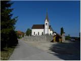
A) Leave the Ljubljana–Koper highway at the Vrhnika exit, then continue driving on the old road towards Logatec. At the end of Vrhniški klanec, continue right in the direction of Zaplana; when we arrive at Zaplana, at the crossroads continue slightly right in the direction of the tower (left Rovte). Further on, we ascend for some time, then the road flattens and takes us past the chapel to the next crossroads, where we continue on the lower left road in the direction of Zaplana (right tower). There follows a few more 100 m of driving and the road brings us to the church of St. Urh and St. Martin, where we park at the appropriate place.
B) From the Ljubljana–Koper highway, take the Logatec exit, then continue driving to Logatec. From the roundabout, where we reach the old Vrhnika–Postojna road, continue right (direction Vrhnika) and continue driving on the old road towards Vrhnika, but drive on it only a few 100 m, then turn left onto the road in the direction of Rovte and Žiri. Further on, drive on a gradually more winding road to the crossroads, where the road towards Zaplana branches off to the right. Further on, the road brings us to Zaplana, where we first drive through the settlement Prezid, then arrive at the crossroads where the road from Vrhniški klanec joins us. Here we continue sharply left and ascend for some time, then the road flattens and takes us past the chapel to the next crossroads, where we continue on the lower left road in the direction of Zaplana (right tower). There follows a few more 100 m of driving and the road brings us to the church of St. Urh and St. Martin, where we park at the appropriate place.
C) First, drive to Škofja Loka, then continue driving towards Gorenja vas and Žiri. From Žiri, continue driving on a somewhat more winding road towards Rovte and Logatec. Still before Logatec, we come to a crossroads, where the road towards Zaplana branches off to the left. Further on, the road brings us to Zaplana, where we first drive through the settlement Prezid, then arrive at the crossroads where the road from Vrhniški klanec joins us. Here we continue sharply left and ascend for some time, then the road flattens and takes us past the chapel to the next crossroads, where we continue on the lower left road in the direction of Zaplana (right tower). There follows a few more 100 m of driving and the road brings us to the church of St. Urh and St. Martin, where we park at the appropriate place.
Route description:
From the church, first cross the road, then ascend diagonally on an initially rocky cart track. The path quickly enters the forest through which it continues to the nearby new houses. At the houses, step onto the road, along which we quickly arrive at a marked junction, where we continue left in the direction of the tower (straight Lintvern, right the road that descends to the lower part of Zaplana).
Further on, we walk on the macadam road, which continues for some time without major changes in elevation, then gradually begins to descend. Just a few steps before arriving at the marked crossroads, where the road to the tower at Zavetišče na Planini nad Vrhniko branches off to the right, continue sharply left onto the marked footpath in the direction of the Ulovka summit (at the spot where we leave the road there is a signpost).
Continue through the forest on a moderately steep path, along which in less than 15 minutes of further walking we arrive from the forest to the summit of Ulovka, from where a beautiful view opens up.
Description and pictures refer to the condition in May 2013.

Photos:
 1
1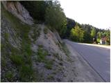 2
2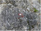 3
3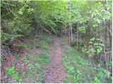 4
4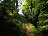 5
5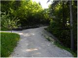 6
6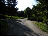 7
7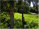 8
8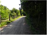 9
9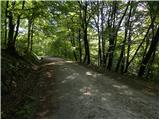 10
10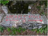 11
11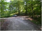 12
12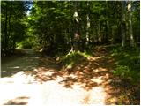 13
13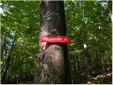 14
14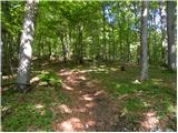 15
15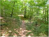 16
16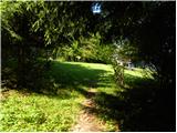 17
17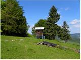 18
18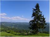 19
19 20
20
Discussion about the trip Zaplana (sv. Urh in sv. Martin) - Ulovka
To post a comment you must log in:
If you do not yet have a username, you must first
register.