Zagrad - Pečovniška koča on Grmada
Starting point: Zagrad (240 m)
| Latitude/Longitude: | 46,2117°N 15,2626°E |
| |
Walking time: 1 h 10 min
Difficulty: easy marked way
Elevation gain: 380 m
Elevation difference along the route: 400 m
Map:
Recommended equipment (summer):
Recommended equipment (winter):
Views: 9.975
 | 1 person like this post |
Access to starting point:
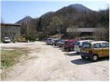
From the Ljubljana - Maribor highway, take the Celje exit and follow the road ahead in the direction of Laško. Soon after Celje (still before Laško), to the left (at the traffic light) across the bridge, the road towards Celjska koča branches off. On the other side of the bridge over the river Savinja, we continue right and follow the road for another good 200 m to the underpass under the railway track, behind which we park on the parking lot near the fire station in Zagrad.
Access is also possible from Zidani Most through Laško to Zagrad.
Route description:
From the parking lot at the fire station, we go on a marked footpath in the direction of Celjska koča, which after a short ascent brings us on an asphalt road, which we then follow for quite some time. When the asphalt road makes a right turn (by the cross), we leave it and continue the ascent straight on a wide footpath which ascends by the edge of a meadow. In the upper part of the meadow, the path turns left and brings us on the road, which we follow to the right, but only to the spot where a wide path towards Celjska koča and Grmada branches off left upwards (sharply left Grmada, steep path). The path higher again brings us on the road, where it takes us in a gentle descent past Trobiševa beech tree. After a few minutes of walk on the road, a marked cart track branches off to the left upwards, which in a diagonal ascent soon brings us to the path junction. Here we continue left in the direction of Pečovniška koča (right Celjska koča) on the path which in a gentle ascent in five minutes brings us to the mentioned mountain hut.

Photos:
 1
1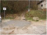 2
2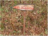 3
3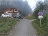 4
4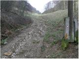 5
5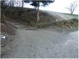 6
6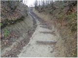 7
7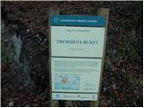 8
8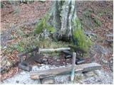 9
9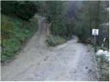 10
10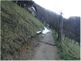 11
11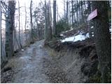 12
12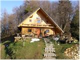 13
13
Discussion about the trip Zagrad - Pečovniška koča on Grmada
|
| lepenatka14. 03. 2010 |
Let me try here too... on Sunday 7.3. I lost a double woolen hat gray-white color-ink style between Pečovniška koča and the parking lot before the viaduct-Zagrad.
Since it's a nice memory for me, I'll be glad if the finder contacts me.
Thanks in advance
Gina
|
|
|
|
| EUGEN16. 03. 2010 |
I hope and wish that an honest finder will find it.
|
|
|
|
| garmont21. 02. 2016 |
It is also possible to climb directly to the hut via the marked shortcut, which is about 5 minutes before the junction in picture 12.
|
|
|
To post a comment you must log in:
If you do not yet have a username, you must first
register.