Zagrad - Grmada above Celje (gentle path)
Starting point: Zagrad (240 m)
| Latitude/Longitude: | 46,2117°N 15,2626°E |
| |
Route name: gentle path
Walking time: 1 h 30 min
Difficulty: easy marked way
Elevation gain: 478 m
Elevation difference along the route: 500 m
Map:
Recommended equipment (summer):
Recommended equipment (winter):
Views: 33.991
 | 2 people like this post |
Access to starting point:
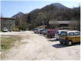
From the highway Ljubljana - Maribor we go to the exit Celje and follow the road ahead in the direction of Laško. Soon after Celje (still before Laško) left (at the traffic light) over the bridge, the road towards Celjska koča branches off. On the other side of the bridge over the river Savinja, we continue right and we follow the road for a good 200m to the underpass under the railway track, behind which we park on a parking lot near the fire station in Zagrad.
Route description:
From the parking lot at the fire station, we go on a marked footpath in the direction of Celjska koča, which after a short ascent brings us to an asphalt road which we then follow for quite some time. When the asphalt road makes a right turn (by the cross), we leave it and we continue the ascent straight on a wide footpath which ascends by the edge of a meadow. In the upper part of the meadow, the path turns left and it brings us to the road which we follow to the right, but only to the spot, where a wide path towards Celjska koča and Grmada branches off left upwards (sharply left Grmada, steep path). The path higher again brings us to the road, where in a gentle descent it takes us past the Trobiš beech tree. After a few minutes of walk on the road, a marked cart track branches off to the left upwards, which in a diagonal ascent soon brings us to the path junction. Here we continue left in the direction of the mountain hut Pečovniška koča (right - Celjska koča) on the path which in a gentle ascent in five minutes brings us to the mentioned mountain hut.
From the mountain hut, we continue on a wide path, which first ascends gently towards the summit of Grmada. After a good five minutes of walking the path narrows and ascends to a secondary peak, from which the path slightly descends. There follows a few minutes' walk on the vegetated east ridge of Grmada, from which occasionally some views open up into the valley. The pleasant path then steeply ascends and after a few minutes of additional walking brings us to the summit.

Photos:
 1
1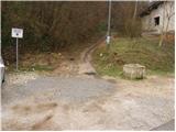 2
2 3
3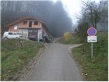 4
4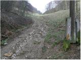 5
5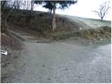 6
6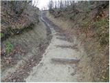 7
7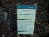 8
8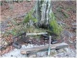 9
9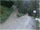 10
10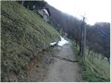 11
11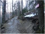 12
12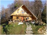 13
13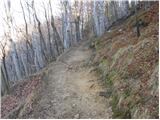 14
14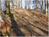 15
15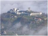 16
16 17
17 18
18
Discussion about the trip Zagrad - Grmada above Celje (gentle path)
|
| geppo3. 04. 2008 |
I usually take the steep path to Grmada, which is really steep. For the return, the path through Hudičev graben. This path is extremely pleasant in the summer months (refreshing) - after a strenuous steep ascent. There are some pegs and cables - but for a somewhat experienced hiker, no fear. This way you nicely loop the path and via Pečovnik - Zagrad return to the fire station.
|
|
|
|
| Biser gora4. 04. 2008 |
I didn't know that you Celjani also have your own Grmada. Nice, nice
|
|
|
|
| geppo4. 04. 2008 |
Jewel of the mountains, if you ever hike here - obligatory Hudičev graben. I noticed that you admire waterfalls - there are plenty here. The path leads among them and you will enjoy the freshness of this ravine. They are not that high, but still beautiful and you will enjoy them. Too bad this site doesn't allow pictures - I would show you some!
Regards
|
|
|
|
| Biser gora6. 04. 2008 |
Geppo, thanks for the tip. What about the path you mentioned after rain, is it too dangerous or is greater caution enough.
|
|
|
|
| geppo6. 04. 2008 |
The path to Grmada (steep) is not dangerous in the rain due to roots and rocky terrain (good footing). Hudičev graben, however, is a gorge through which a stream flows - it is mossy and slippery (usual for such terrain). But it is well secured. Visit it in the summer months, otherwise you won't see any big waterfalls - but it's nice and believe me it will be a nice experience.
So just be cautious!
Regards
|
|
|
|
| cvetkarozca11. 05. 2008 |
Very nice weather and a very nice Sunday trip, I recommend it to families with children, the kids really enjoyed the beautiful light green nature, and the view is worth admiring from all sides. On the path there is a wish bell and another one on top of Grmada. In Pečovniška koča you can eat very tasty farmer's goulash and apple strudel. IN SHORT: ON A CLEAR WEEKEND STRAIGHT TO GRMADA!!
|
|
|
|
| potpodnoge4. 11. 2019 |
I was with my wife on 23.10.2019 both at Grmada and then at Celjska koča. Nice trail, I would just note that those responsible at Grmada should replace the visitors' logbook. The book is in a sad state, someone even wanted to burn it and above all, there is no more space to sign as it is full. Those who cause damage in the hills and mountains should rather stay home, it will be nicer for everyone. If they cannot avoid causing damage, let them do it on their own property. I won't dwell on that.
|
|
|
|
| jure-r5. 11. 2019 |
Thanks for the information about the status of the logbook at Grmada. It has now been replaced.
|
|
|
|
| garmont5. 11. 2019 |
Praise for the promptness.
|
|
|
|
| potpodnoge6. 11. 2019 |
Wow, quite a bit surprised, praise for the timeliness and care.
|
|
|
To post a comment you must log in:
If you do not yet have a username, you must first
register.