Vrbovska Poljana - Bjelolasica (via Žuta Poljana)
Starting point: Vrbovska Poljana (1120 m)
Route name: via Žuta Poljana
Walking time: 1 h 30 min
Difficulty: easy marked way
Elevation gain: 414 m
Elevation difference along the route: 480 m
Map:
Recommended equipment (summer):
Recommended equipment (winter): ice axe, crampons
Views: 7.075
 | 1 person like this post |
Access to starting point:
Via the border crossing Petrina we drive to Delnice, where we reach the old road Zagreb - Reka. We continue right and follow the road ahead towards Mrkopalj. In the village Mrkopalj a sign for Begovo - Razdolje (highest settlement in Croatia) directs us right onto an ascending road which soon brings us to the mentioned village. At the end of the village we come to a smaller crossroads, where we continue on the right road which soon becomes macadam. This road after a few kilometers brings us to the next crossroads, where we continue left in the direction of Bjelolasica (right Janjčarica). Further we drive past the quarry after which we soon notice the hiking markers KPP, which direct us left uphill. Here we park on a smaller parking lot by the road.
Route description:
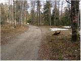
From the parking lot we head left onto a footpath which after a good 10 minutes of moderate ascent brings us to a poor macadam road, where there is a path junction. We continue left on the road in the direction of Žuta Poljana (straight Bjelolasica direct path). The poor road after a few dozen meters changes into a wide cart track which starts to descend. When the path flattens, an unmarked poorer cart track branches off right slightly upwards, by which we soon notice quite faded blazes. The cart track then ascends somewhat more steeply and after a few minutes changes into a steep footpath. The steep path soon brings us onto an initially indistinct ridge, which we follow on a barely visible path with faded blazes. Despite the poorly visible path there are no bigger problems with orientation, because the path follows the ridge, which is quite wide in places. Eventually the path brings us onto less vegetated slopes, from which increasingly beautiful views open up. The ridge then gradually narrows and the path quickly brings us to the summit of Bjelolasica.

Photos:
 1
1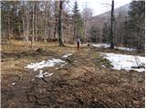 2
2 3
3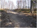 4
4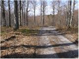 5
5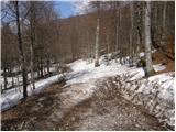 6
6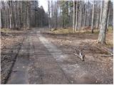 7
7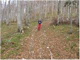 8
8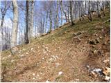 9
9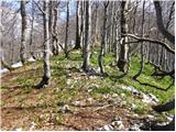 10
10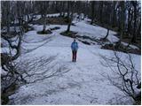 11
11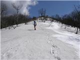 12
12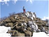 13
13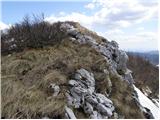 14
14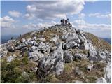 15
15
Discussion about the trip Vrbovska Poljana - Bjelolasica (via Žuta Poljana)
To post a comment you must log in:
If you do not yet have a username, you must first
register.