Tolminske Ravne - Tolminski Kuk (via planina Razor)
Starting point: Tolminske Ravne (924 m)
| Latitude/Longitude: | 46,2294°N 13,7715°E |
| |
Route name: via planina Razor
Walking time: 4 h 45 min
Difficulty: difficult marked way
Elevation gain: 1161 m
Elevation difference along the route: 1315 m
Map: TNP 1:50.000
Recommended equipment (summer):
Recommended equipment (winter): ice axe, crampons
Views: 9.860
 | 2 people like this post |
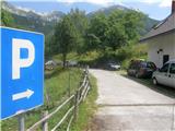
Access to starting point:
We drive to Tolmin, then continue driving in the direction of Žabče and Zadlaz (the turn-off from the main road is located on the left bank of Tolminka). When we arrive in Žabče, at the smaller junction we continue slightly right in the direction of the settlement Zadlaz. In the settlement Zadlaz-Žabče the road temporarily descends, where it crosses Zadlaščica over a bridge, then again starts ascending steeply on a narrow but all the time asphalted road. After approximately 12 km from the main road we arrive at the marked parking lot in Tolminske Ravne, where we park.
Route description:
From the parking lot, we head onto the path in the direction of the Koča na planini Razor hut and Planina na Kalu mountain pasture. Initially, we walk on a cart track that continues from the nearby house and leads us across a panoramic meadow. On the other side of the meadow, we cross a grazing fence and the path brings us to a marked junction, where we continue on the lower right cart track (slightly left Planina na Kalu).
Further on, we walk on a cart track that slightly descends to the right, then levels out and continues for a few minutes without major elevation changes. After the concrete trough, the path splits once again, and we choose the left steep path (the path that continues straight also leads to Planina Razor, but it is longer and technically undemanding).
The path ahead resumes ascending, ascending mostly to the right, only here and there making a hairpin turn. Higher up, we move onto steeper slopes, a little further onto an exposed but—except for the first few steps—well-secured ledge. When the traverse ends, the path temporarily returns to the forest, through which it ascends more steeply, then we step out of the forest and the path levels out. From here follow a few more minutes of walking with nice views of the mountains rising above the Zadlaščica river basin, and the path brings us past the cheese cottage to the Koča na planini Razor hut.
From the hut, we continue in the direction of Globoko, Vogel, Vrh nad Škrbino... on the path that crosses a strip of forest, then splits on a gentle grassy slope.
This time we continue straight in the direction of Vrh nad Škrbino and Dom na Komni (right Vogel, Globoko and Črna prst), on the path that turns slightly to the left and further ascends a slope overgrown with dwarf pines. After a few minutes, the path temporarily levels out, then north of the indistinct summit Kopecko, after a shorter moderate ascent, brings us to the next junction. We continue left in the direction of Škrbina saddle (right Vrh nad Škrbino - south path). The path soon after emerges from the dwarf pines onto interesting slopes, where on our right side we will notice steep rock slabs that form an interesting wall for climbers, which is not overly steep. The path ahead ascends transversely across the scree to the Škrbina saddle, located at 1910 m.
When we step onto Škrbina, a nice view opens onto the Bohinj side, and at the junction we continue left in the direction of Kuk (right Vrh nad Škrbino, straight down Dom na Komni and Vogel ski slope). The path ahead begins a transverse ascent across steep slabs, then both the path and the slope level somewhat. The path ahead passes under the shorter wall of Vrh Kont, then begins gently descending across occasionally steeper scree. The path ahead on the Primorska side also crosses Podrto goro and Mali vrh, then returns to the main ridge of Spodnje Bohinjske gore, reaching it right at the saddle between Mali vrh and Zeleni vrh. From here we continue in the same direction, only the path shifts from the slopes onto a locally exposed ridge. We follow the marked path, which occasionally ascends quite steeply, then with ever nicer views, all the way to the grassy Zeleni vrh.
From Zeleni vrh we descend along the marked path that begins descending more steeply to the west. The slope down which we descend quickly narrows and the path brings us to a narrow and somewhat exposed ridge. Here the path levels out, and we quickly reach the saddle, from which we begin ascending towards Tolminski Kuk. Above the saddle awaits a short steep ascent, then the path reaches the ridge, along and beside which we ascend to the highest peak of Spodnje Bohinjske gore.
Tolminske Ravne - planina Razor 1:15, planina Razor - Škrbina 2:00, Škrbina - Zeleni vrh 1:05, Zeleni vrh - Tolminski Kuk 25 minutes.

The trip can be extended to the following destinations: Podrta gora
Photos:
 1
1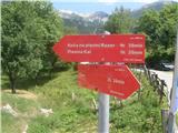 2
2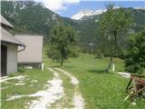 3
3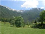 4
4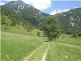 5
5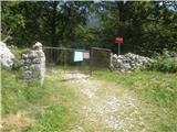 6
6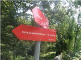 7
7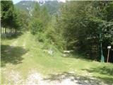 8
8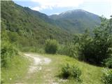 9
9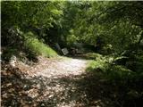 10
10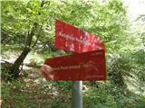 11
11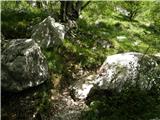 12
12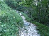 13
13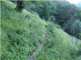 14
14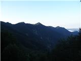 15
15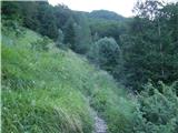 16
16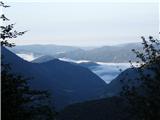 17
17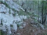 18
18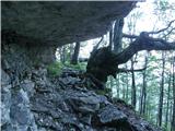 19
19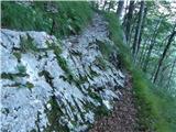 20
20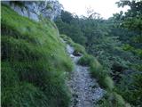 21
21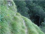 22
22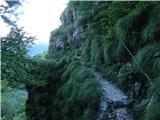 23
23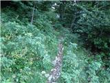 24
24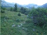 25
25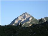 26
26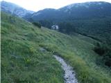 27
27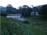 28
28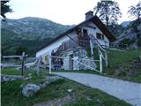 29
29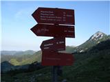 30
30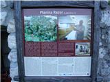 31
31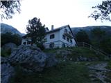 32
32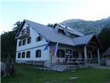 33
33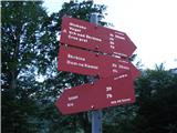 34
34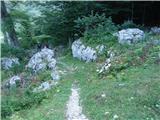 35
35 36
36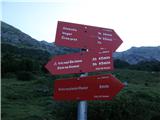 37
37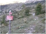 38
38 39
39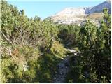 40
40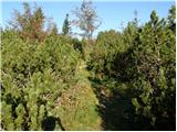 41
41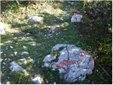 42
42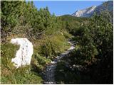 43
43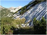 44
44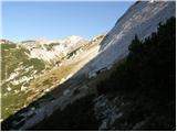 45
45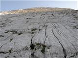 46
46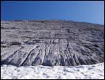 47
47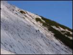 48
48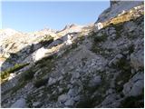 49
49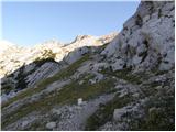 50
50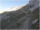 51
51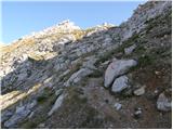 52
52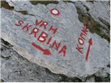 53
53 54
54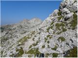 55
55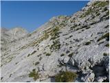 56
56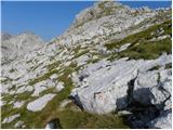 57
57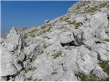 58
58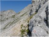 59
59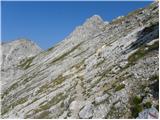 60
60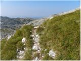 61
61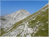 62
62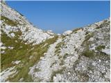 63
63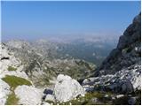 64
64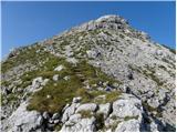 65
65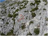 66
66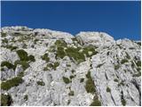 67
67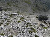 68
68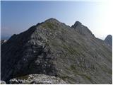 69
69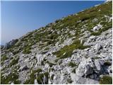 70
70 71
71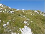 72
72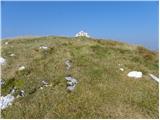 73
73 74
74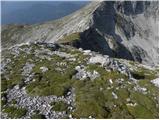 75
75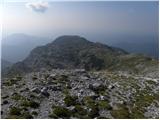 76
76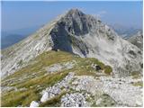 77
77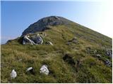 78
78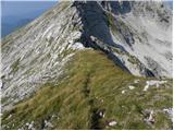 79
79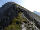 80
80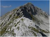 81
81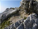 82
82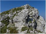 83
83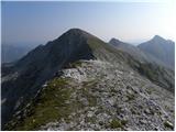 84
84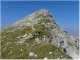 85
85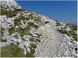 86
86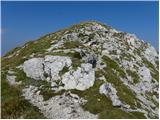 87
87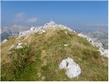 88
88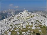 89
89 90
90
Discussion about the trip Tolminske Ravne - Tolminski Kuk (via planina Razor)
|
| darinka421. 05. 2018 |
I haven't seen anywhere how much walking there is from Tolminske Ravne to planina Kal and then to Tolminski Migovec.
|
|
|
|
| valerija11221. 05. 2018 |
To planina Na Kalu is 1 hour and 30 min, from there to Tolm. Migovec another 1 hour and 30 min.
The path from Čadrg to planina Na Kalu is also very nice, walking time is also 1 hour and 30 min.
Wish you much enjoyment.
|
|
|
|
| darinka422. 05. 2018 |
So it's somewhat shorter than if you go past planina Razor. I once went this way and then descended to Čadrg, but many years ago. Thanks for the info.
|
|
|
|
| mirank23. 05. 2018 |
You can get to Kuk from Ravne via two paths and neither is longer than 3 hours of walking, if you walk well. The start is the same for both; right after the wood at the end of the meadows on Ravne, head along the mulatiera towards Kala. About 5 min walk further a bit ahead from Vodohran, at a bend there is the first unmarked junction of the wide path to the right (the left marked one leads to Kal), which is completely unmarked for the first 50m, markings start after the first bend on this path. This brings you to that junction under Škrbinska plošča....
The one via R planina is longer than both by about 1h. Caution; the one I described is harder to follow downhill if you go it for the first time, especially the marked junction at the crossing of the transverse path in the forest somewhere in the middle is confusing (first one wrong, second barely visible)!
|
|
|
|
| darinka423. 05. 2018 |
Then I'll have to go with someone so I don't get lost. 
|
|
|
|
| akvarij1. 07. 2018 |
Yesterday we went from Tolminske Ravne past planina Kal first to Tominski Kuk and then to Tolminski Migovec; not too strenuous path, satisfactorily marked, although you can easily lose it on the "plateaus" between Migovec and Kuk.. but if the weather is clear, it's no problem, as Tominski Kuk is constantly in front of your nose and the cairns are tall enough to see from afar. For the whole tour we needed 7 hours, with a looong stop at T. Kuk and a slightly shorter one at Migovec.
Along the path lots of flowers of all colors and shapes, and also blueberries 
From the summits beautiful views in all directions!
If anyone needs a GPX track, I can send it (includes one detour where we accidentally went off path 
Path on Open Street Map
|
|
|
|
| miranm30. 05. 2019 |
Hello,
I'm interested if the path to Tolminski Kuk is snow-free.
Thanks and safe steps.
|
|
|
|
| funnyboy30. 05. 2019 |
It's not snow-free. A few days ago there was still quite a bit of snow, and some fell yesterday.
|
|
|
|
| miranm30. 05. 2019 |
Thanks for the information.
|
|
|
To post a comment you must log in:
If you do not yet have a username, you must first
register.