Tinčkova koča - Hochstuhl/Stol (via Zagon)
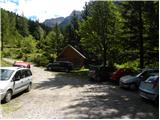
Starting point: Tinčkova koča (1070 m)
| Latitude/Longitude: | 46,4228°N 14,1991°E |
| |
Route name: via Zagon
Walking time: 3 h 45 min
Difficulty: easy unmarked way
Elevation gain: 1166 m
Elevation difference along the route: 1166 m
Map: Karavanke - osrednji del 1:50.000
Recommended equipment (summer):
Recommended equipment (winter): ice axe, crampons
Views: 18.678
 | 3 people like this post |
Access to starting point:
From the Ljubljana - Jesenice highway, we take the Lesce exit and follow the road ahead in the direction of Žirovnica and Jesenice. After a few km of driving, we will arrive at an intersection, where the road to Žirovnica and Moste branches off to the right (from the direction of Jesenice, to the left). Only a few meters ahead, at the next intersection, we turn left to Moste (right to Žirovnica). We continue driving past a monument to the fallen fighters, where the road starts to climb the hill under the railway track. At the top of the hill, we turn right (at the sign for Vila Karin) and continue towards Završniško jezero and Valvasorjev dom. The road then flattens and brings us to an intersection, where the road to the mountain hut Valvasorjev dom branches off to the left, and we continue straight on the initially still asphalted road. The road soon becomes macadam, and we follow it to the parking lot near the mountain hut Tinčkova koča. The road in the upper part is often in quite bad condition.
Route description:
At the beginning of the parking lot, we head left onto a wide path into the forest. Already after a few meters we come to a fork, where the marked path to the mountain hut Valvasorjev dom pod Stolom branches off to the left. At the fork, we continue right uphill past some huts in the forest. The path then turns slightly to the left and ascends through the forest for quite some time. The path, which is occasionally marked with red dots and some cairns, becomes less trodden in the upper part and requires more attention so as not to stray from it. Later, the path brings us out of the forest, and an ascent follows along a narrow trail through high grass and slightly overgrown dwarf pines. This path brings us to a fork, where we join the marked path from the mountain hut Koča pri izviru Završnice towards Stol.
We continue left and the path, surrounded by lush shrubbery, soon brings us into a high-mountain cirque, where the path from the mountain hut Dom na Zelenici joins from the right. We continue left in the direction of Stol along a path that ascends steeply for a short time, then brings us into the plateau terrain between Svačica and Srednja peč.
We continue straight in the direction of Stol (right Svačica and Celovška koča) along the path, which in a gentle ascent brings us to a larger scree below Celovška špica (2105m). The path then ascends over relatively steep scree and brings us to an indistinct saddle between Mali Stol and Veliki Stol. Here we continue right (left Prešernova koča 10 minutes) in the direction of Stol, whose summit we reach after 10 minutes of further walking.

Photos:
 1
1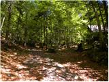 2
2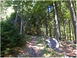 3
3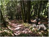 4
4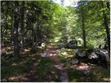 5
5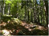 6
6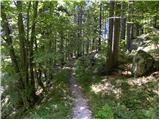 7
7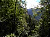 8
8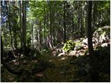 9
9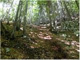 10
10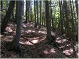 11
11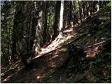 12
12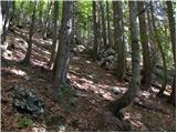 13
13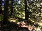 14
14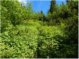 15
15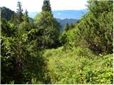 16
16 17
17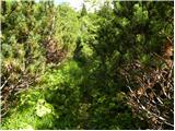 18
18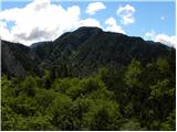 19
19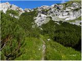 20
20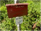 21
21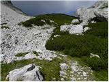 22
22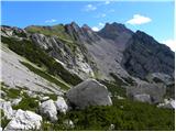 23
23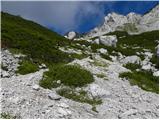 24
24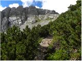 25
25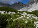 26
26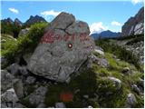 27
27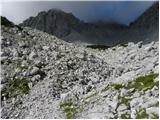 28
28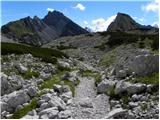 29
29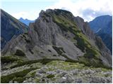 30
30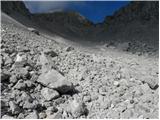 31
31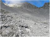 32
32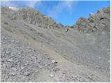 33
33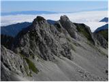 34
34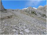 35
35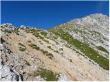 36
36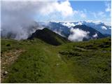 37
37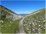 38
38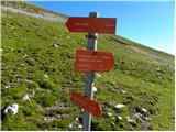 39
39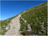 40
40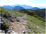 41
41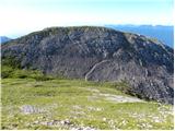 42
42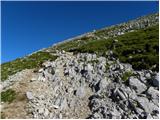 43
43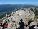 44
44 45
45
Discussion about the trip Tinčkova koča - Hochstuhl/Stol (via Zagon)
|
| Griha19. 08. 2009 |
The path is now marked with orange markers, so no problems with orientation. Nice path, it would just be wiser to use another marking method than spraying everywhere with that awful color.
|
|
|
|
| Bojan_A19. 08. 2009 |
This trail is called Pot cepca s sprejem. Horrible what was done to such nice pathless terrain. 
|
|
|
|
| Bojan_A19. 08. 2009 |
Although this specific variant past the hunting hut is a detour around Cepec s sprejem. Cepec s sprejem is the more direct variant and goes where this path crosses the gully to the left upwards.
This path, as said, crosses the gully and ascends for some time along its right side. To get to the hunting hut you have to branch left at a poorly visible junction. From the hut it's then wiser to keep left again. Unfortunately you rejoin Cepec after some time.
|
|
|
|
| Tepetl22. 08. 2009 |
The path is indeed marked with orange, but not very densely. If you're not careful, you quickly lose it in the steep forest. When there were no marks, I relied on tracks on the ground and some signs of intelligent beings (pile of stacked stones, obviously hand-placed branch on a branch fork). I quickly found myself in a dilemma, whether to turn back, but I would run out of strength for the ascent to Stol, or continue, because I knew there was a path from the hut at the source of Završnica at the top. I went on, but the vegetation was so dense that I had to veer towards the scree under Srednja peč (someone had walked there before me), where I finally managed to reach the upper path.
In short, the orange path is very nice, nicer than the one around, but you have to be careful not to stray. Regular markings would really help.
|
|
|
|
| PUHI24. 08. 2009 |
Here I went early in spring on skis from T. hut upwards and accidentally reached the hunting hut, then very steeply up 100m and crossed right (dangerous) towards Šija saddle and down to the source of Završnica and to Završnica. Please describe some easier variant, because around the hut everything is steep and dangerous in snow. I didn't dare the gully under the hut because I heard water gurgling under the snow.
best regards.
|
|
|
|
| fravnik5. 07. 2015 |
Today, my wife and I walked this path on our second attempt. It is poorly visible even though there are cairns and two or three welcome signs "cepca s sprejem". Here's how it goes:
From Tinčkova koča up the ruined forest track, keep right towards the top when it forks. We reach a nice path (picture 7), which brings us after about 20 minutes to the gully. The path crosses the gully and I assume it goes along the slope of Srednji vrh to the hut at the source of Završnica. We don't cross the gully, but continue straight up. We follow the cairns (there are a few more since today) and the poorly visible path. All the time we stay almost parallel to the gully. After about one hour we reach the hunting hut right next to the gully. From here we have two options:
1. As Bojan says, cross the gully and ascend along the left bank of the gully when viewed downhill. It joins the marked lower path to Stol about 20 min below the Šija saddle. We haven't walked this path, but I assume its course based on descriptions and observation from the next variant of this path:
We didn't cross the gully (first ascent attempt), but climbed up the gully. Traces led us to it, but they later disappeared (probably towards the left bank of the gully). The gully later splits, we continued in the right direction and reached a serious obstacle in the form of a vertical jump about 4m high. With a bit of climbing skill we overcome the jump and a few more minutes to the marked path I mentioned. It crosses the gully a bit lower below the Šija saddle.
2. From the hunting hut we go back transversely about 50 meters and continue steeply up. We follow cairns and poorly visible path. We slightly distance ourselves from the gully and later approach it again. Soon we leave the spruce forest that accompanies us all the time into mostly beech. Here the path goes slightly right, the forest becomes sparser until we reach the overgrown small gully (picture 15) and after 1.5 hours to the marked lower path to Stol. From here back to Šija saddle is almost an hour's walk. But we're not racers. I recommend this path, although climbing is also interesting. I emphasize that the gully was completely dry, which is certainly not the case in early spring or winter. The entire ascent to Stol via this path takes less than 4 hours, descent good 3.
I hope it helps and safe path!
Frenk
|
|
|
To post a comment you must log in:
If you do not yet have a username, you must first
register.