Dolina Kot - Triglavski dom na Kredarici
Starting point: Dolina Kot (950 m)
| Latitude/Longitude: | 46,4157°N 13,8977°E |
| |
Walking time: 5 h 10 min
Difficulty: difficult marked way
Elevation gain: 1565 m
Elevation difference along the route: 1650 m
Map: Triglav 1:25.000
Recommended equipment (summer): helmet
Recommended equipment (winter): helmet, ice axe, crampons
Views: 23.492
 | 3 people like this post |
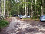
Access to starting point:
Drive to Mojstrana, then follow the signs for Kot Valley and Krma Valley. At Kosmačev Preval, leave the road leading further towards Krma, Radovna and Bled, and continue driving right onto the side road towards Kot Valley. Follow the gravel road to the mountain direction signs at the end of the drivable road in Lengarjev Rovt.
Route description:
From the end of the road, continue along the wider marked path towards Stanič Hut and Kredarica, which gently ascends through the forest. After a few minutes, arrive at the Kotarica scree field, cross it transversely to the other side, where the trail reappears.
Follows some easy walking through the forest, but after about half an hour, the path quickly becomes quite steep and, due to often slippery ground, dangerous for slipping, especially on descent, so extra caution is required on this section. On this part, a few pegs assist at the more difficult spots. Higher up, the steepness eases, and the path leads to the spring Pri studenčku, which dries up in dry weather.
Here, an unmarked path branches left towards Macesnovec; we continue straight across the torrent bed, then cross a short secured but not particularly demanding section after the torrent. Follows ascent through the dwarf pine belt; higher up, reach increasingly rocky terrain where a large boulder is visible ahead. Here, the PP trail (Planica - Pokljuka path) unobtrusively crosses our path, but with increasingly fine views, we ascend to the aforementioned boulder called Debeli kamen.
At Debeli kamen, dwarf pines occasionally end completely, and we proceed through increasingly alpine terrain, mostly ascending on scree. On this section, looking back offers a fine view of Ladja (Ladja is a prominent steep dwarf pine-covered promontory or peak rising above Kot Valley); then ascend to the marked junction where the climbing path to Vrbanove špice, or Lojze Rekar's path, branches right.
Continue on the left path towards Triglav, Rjavina, and Dom Valentina Staniča below Triglav, where steepness eases, and the path leads along the left side of Pekel cirque.
Here, first a marked very difficult secured path to Rjavina branches left; we ascend transversely above the cirque along the northwestern slopes of Rjavina. Further on, approaching Dovška vrata, a passage opens left to the Rjavina ridge, leading directly to the mentioned gates, from which a marked ridge path goes to Rjavina; we continue straight along the marked path towards Dom Valentina Staniča.
Further, mostly moderately ascend through alpine terrain, following the path to Dom Valentina Staniča below Triglav, from where a fine view opens to Triglav and surrounding peaks.
Continue towards Triglav and Triglav Hut on Kredarica (left Rjavina via ridge path, Krma valley, slightly right Vrata valley, right Begunjski vrh, Cmir, and Visoka Vrbanova špica); the path soon turns slightly left and heads south towards nearby Rž. Reaching the screes below Rž, the path turns right and ascends transversely across the screes, where later a passage to Rž summit opens left; follow the marked path increasingly approaching the ridge connecting Rž with Kredarica. Here the path becomes technically demanding and partly exposed, with safety gear at difficult spots. Follows a short unsecured descent on crumbly terrain, then onto a panoramic and occasionally exposed ridge. Approaching Kredarica summit, the ridge widens, reaching the cairn on Kredarica without major difficulties.
Beyond Kredarica summit, the ridge broadens into a gentle slope; the path turns left, descending in a few minutes to Triglav Hut on Kredarica, located above the Marija Snežna chapel.
Starting point - Pri studenču 1:25, Pri studenču - Debeli kamen 1:20, Debeli kamen - Pekel 0:45, Pekel - Dom Valentina Staniča 0:40, Dom Valentina Staniča - Kredarica 0:55, Kredarica - Triglav Hut on Kredarica 0:05.

Photos:
 1
1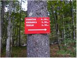 2
2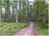 3
3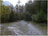 4
4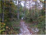 5
5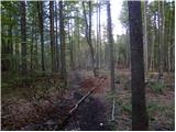 6
6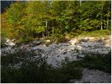 7
7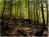 8
8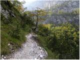 9
9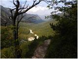 10
10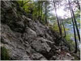 11
11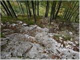 12
12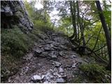 13
13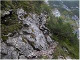 14
14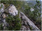 15
15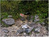 16
16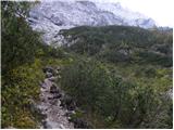 17
17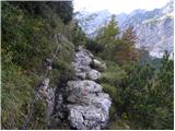 18
18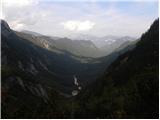 19
19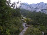 20
20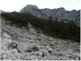 21
21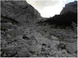 22
22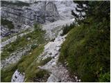 23
23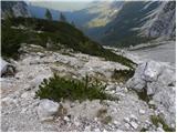 24
24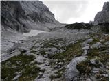 25
25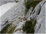 26
26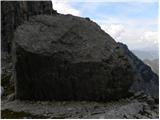 27
27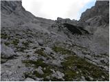 28
28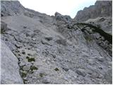 29
29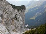 30
30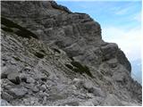 31
31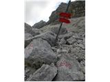 32
32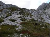 33
33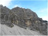 34
34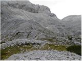 35
35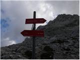 36
36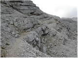 37
37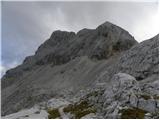 38
38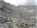 39
39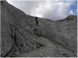 40
40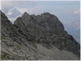 41
41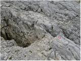 42
42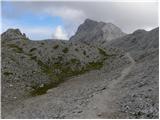 43
43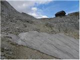 44
44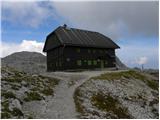 45
45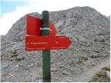 46
46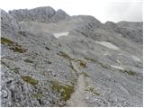 47
47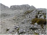 48
48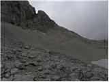 49
49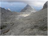 50
50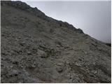 51
51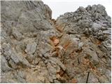 52
52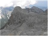 53
53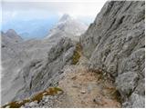 54
54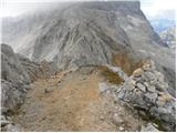 55
55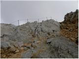 56
56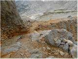 57
57 58
58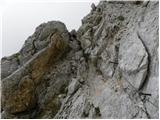 59
59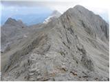 60
60 61
61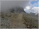 62
62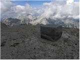 63
63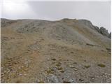 64
64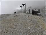 65
65 66
66
Discussion about the trip Dolina Kot - Triglavski dom na Kredarici
|
| zamet18. 04. 2008 |
Has anyone walked from Kot to Kredarica recently, is it suitable or are there avalanche risks.
|
|
|
|
| Tadej19. 04. 2008 |
In the Julian Alps, half a meter of snow has fallen in the last two days and it is still snowing, so the avalanche danger has increased.
|
|
|
|
| pemi25. 08. 2015 |
I'm interested in what the path from the station to Kredarica is like, it's marked as difficult, so I'm wondering if it's really demanding, exposed, are there fixed protections and how much approximately?
|
|
|
|
| garmont25. 08. 2015 |
The secured section is about 15 minutes and nowhere particularly exposed.
|
|
|
|
| Viper25. 08. 2015 |
There are some difficult sections, but nothing too demanding. There are some exposures, but not too scary to look at. There are some fixed protections, but not many.
|
|
|
|
| pemi26. 08. 2015 |
super thanks to both for the info..hope it will go through..because I'm more fearful about these things...
|
|
|
|
| pemi2. 09. 2015 |
edited..nothing difficult,
but I'm a bit disappointed with the staff's attitude both at the valley hut and at Kredarica, I think it would be better if those young people went to do something else, maybe someone would gladly help out 
|
|
|
|
| Mira.k22. 06. 2016 |
Does anyone know what the conditions on the path are like, is there still snow?
|
|
|
To post a comment you must log in:
If you do not yet have a username, you must first
register.