Dolina Kot - Rjavina (ridge way)
Starting point: Dolina Kot (950 m)
| Latitude/Longitude: | 46,4157°N 13,8977°E |
| |
Route name: ridge way
Walking time: 6 h 10 min
Difficulty: very difficult marked way
Elevation gain: 1582 m
Elevation difference along the route: 1745 m
Map: Triglav 1:25.000
Recommended equipment (summer): helmet, self belay set
Recommended equipment (winter): helmet, self belay set, ice axe, crampons
Views: 52.700
 | 3 people like this post |
Access to starting point:
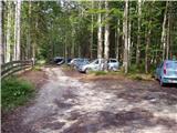
We drive to Mojstrana, then follow the signs for the Kot and Krma valleys. At Kosmačev preval, we leave the road leading further towards Krma, Radovna and Bled, and continue driving right onto the side road in the direction of the Kot valley. This is followed by driving along a gravel road to the mountain direction signs at the end of the drivable road in Lengarjev Rovt.
Route description:
From the end of the road, continue along the wider marked path towards Stanič Lodge and Kredarica, which gently ascends through the forest. After a few minutes, we reach the Kotarice scree, which we cross transversely to the other side, where the trail reappears.
This is followed by some easy walking through the forest, but after about half an hour, the path quickly becomes quite steep and, due to often slippery ground, also dangerous for slipping, especially on the descent, so extra caution is needed on this section. On this part, a few pegs assist at the more difficult spots. Higher up, the steepness eases, and the path leads to the spring Pri studenčku, which dries up in dry periods.
Here, an unmarked path branches left towards Macesnovec, but we continue straight across a torrent bed, and after it, cross a short secured but not particularly demanding section. This is followed by an ascent through a belt of dwarf pines, higher up entering a more rocky terrain, where we can already see a large boulder ahead. Here, our path is unobtrusively crossed by the PP trail (Planica - Pokljuka trail), but we ascend with increasingly beautiful views to the aforementioned boulder called Debeli kamen.
At Debeli kamen, the dwarf pines occasionally end definitively, and we continue through increasingly high-mountain terrain, mostly ascending on scree. On this section, looking back offers a nice view of Ladja (Ladja is a prominent sheer promontory or peak overgrown with dwarf pines rising above the Kot valley), and we then ascend to a marked junction, where a climbing path to Vrbanove špice, or Lojze Rekar's path, branches right.
We continue on the left path towards Triglav, Rjavina and Valentin Stanič Lodge below Triglav, where the steepness eases, and the path leads along the left side of the Pekel cirque.
Here, first a marked very demanding secured path to Rjavina branches left, but we ascend transversely above the cirque along the northwestern slopes of Rjavina. As we approach Dovška vratca somewhat further, a passage opens to the left onto the Rjavina ridge, or the passage leads directly to the mentioned gate, from where a marked ridge path leads to Rjavina, but we continue straight towards the marked path to Valentin Stanič Lodge.
Continuing, we mostly ascend moderately through high-mountain terrain, following this path all the way to Valentin Stanič Lodge below Triglav, from where a nice view opens onto Triglav and surrounding peaks.
Continue left towards Rjavina along the ridge path and Krma valley (straight Triglav, Triglav Lodge at Kredarica, slightly right Vrata valley, right Begunjski vrh, Cmir and Visoka Vrbanova špica) and first gently, then moderately ascend. After about 15 minutes of ascent from Valentin Stanič Lodge, we stop ascending and reach a small ridge with a marked junction.
Continue left towards Rjavina (straight Krma and Konjsko sedlo) and begin descending along the scenic ridge. We descend for quite some time, losing about 100 meters of elevation, and at Dovška vratca, we stop descending.
Here, the aforementioned shortcut joins from the left, shortening the path by about 45 minutes, but we continue straight and begin steeply ascending the western slopes of Rjavina, where looking back offers a nice view of Triglav. From the steep slope, with the help of some protections, we reach the western ridge of Rjavina, and with exceptional views, continue towards the western subpeak or Mala Rjavina (2530 m).
This is followed by some descent, and from the left, the climbing path from Kot valley joins.
Continue straight and soon reach a chimney, down which we descend vertically for about 30 meters of elevation, assisted by numerous pegs and brackets on the descent, no wire rope. After this very demanding passage, the path becomes less demanding, passing two natural windows, through one of which a really nice view of Škrlatica opens, and we quickly reach the summit of Rjavina.
Start - Pri studencu 1:25, Pri studencu - Debeli kamen 1:20, Debeli kamen - Pekel 0:45, Pekel - Dom Valentina Staniča 0:40, Dom Valentina Staniča - Ravnica pod Ržjo 0:15, Ravnica pod Ržjo - Dovška vratca 0:20, Dovška vratca - Mala Rjavina 1:00, Mala Rjavina - Rjavina 0:25.

Along the route: Pri studencu (1330m), Debeli kamen (1810m), Pekel (2089m),
Dom Valentina Staniča (2332m), Ravnica pod Ržjo (2371m), Dovška vratca (2267m), Mala Rjavina (2530m), Okno v Rjavini (2492m)
Photos:
 1
1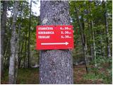 2
2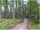 3
3 4
4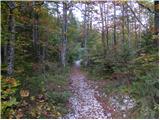 5
5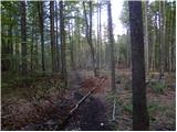 6
6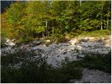 7
7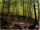 8
8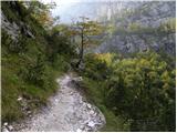 9
9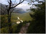 10
10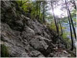 11
11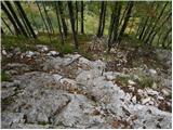 12
12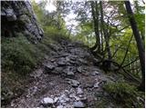 13
13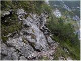 14
14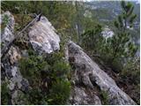 15
15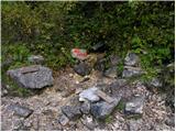 16
16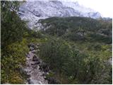 17
17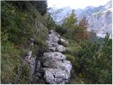 18
18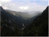 19
19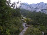 20
20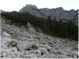 21
21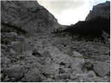 22
22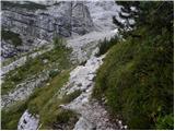 23
23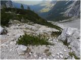 24
24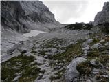 25
25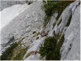 26
26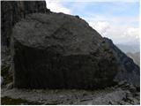 27
27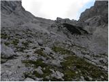 28
28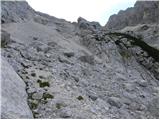 29
29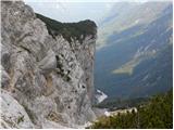 30
30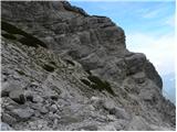 31
31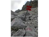 32
32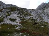 33
33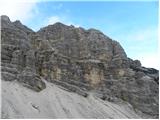 34
34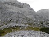 35
35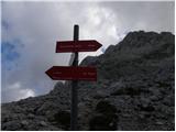 36
36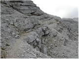 37
37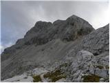 38
38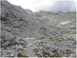 39
39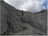 40
40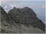 41
41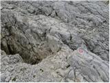 42
42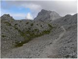 43
43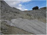 44
44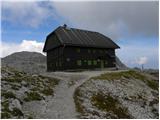 45
45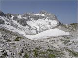 46
46 47
47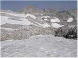 48
48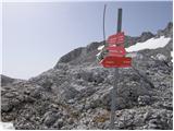 49
49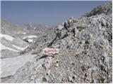 50
50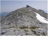 51
51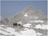 52
52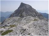 53
53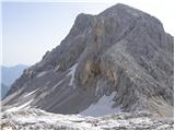 54
54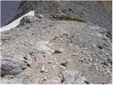 55
55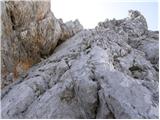 56
56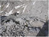 57
57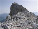 58
58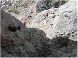 59
59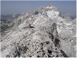 60
60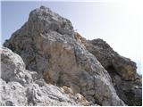 61
61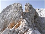 62
62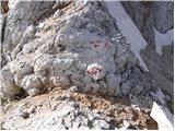 63
63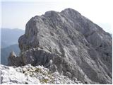 64
64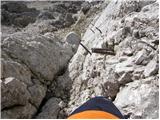 65
65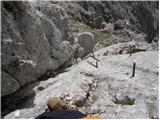 66
66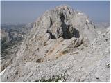 67
67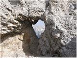 68
68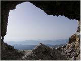 69
69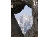 70
70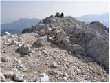 71
71 72
72
Discussion about the trip Dolina Kot - Rjavina (ridge way)
|
| jersy6. 11. 2007 |
If you go up the climbing path to Rjavina, then this path is suitable for the return
|
|
|
|
| mkonci4. 05. 2011 |
What are the conditions on Rjavina, is there still snow up there?
If the weather is nice I would go on Sunday 8.5.2011...
|
|
|
|
| Klin4. 05. 2011 |
There's still a lot of snow up there. According to our meteorologists' data at Kredarica almost 3 meters.
|
|
|
|
| mkonci4. 05. 2011 |
thanks, I'll postpone the hike for a while
|
|
|
|
| JusAvgustin4. 05. 2011 |
or crampons in the backpack and ice axe on the backpack, and brains in the head...  rjavina is a spectacle rjavina is a spectacle
|
|
|
|
| dejan878. 08. 2011 |
hi. I'm wondering if there's still any snow up there. Namely, on Saturday 13.8 I plan to head to Rjavina. Nice regards
|
|
|
|
| stom210. 09. 2011 |
Does the spring along the path 'work'?
LPP
|
|
|
|
| janna10. 09. 2011 |
It works ... at least last week it did.
|
|
|
|
| pupek5. 08. 2013 |
I'm interested in how long the hike is from the hut to the summit
|
|
|
|
| pupek8. 08. 2013 |
I'm wondering if you have to pay for parking in Kot.
|
|
|
|
| dragovo15. 08. 2014 |
Hello!
Please give me information about the condition of the road into Dolina Kot. Thank you!
|
|
|
|
| Jana2416. 08. 2014 |
The path to Kot is completely fine, was there 14 days ago. Good luck wherever you're going.
|
|
|
|
| Matjaz_6526. 08. 2016 |
ascent past Stanic's hut along the ridge and descent via climbing path
PHOTOS
|
|
|
|
| el_mano23. 06. 2020 |
The section of the path between Mala Rjavina and Rjavina with vertical climbing on pegs and brackets is definitely very demanding!
|
|
|
|
| MPS6. 08. 2020 |
I agree with el man. That vertical climbing is quite demanding. I am writing because someone might take Rjavina as a less demanding mountain, since the description is "only" a difficult path. I am attaching a short video where the path through the ridge is recorded, unfortunately I did not record the most demanding passage because I put the camera in the backpack. We went from Krma, but I think most hikers go from Kot, that is why I am writing here. I hope the video will help someone with the presentation of the path itself and safe steps in the mountains. Video at the link: Rjavina, 2532 m
|
|
|
|
| gaber@marolt28. 02. 2022 18:30:09 |
We haven't been to Rjavina yet but we're curious about the view. And also: Has anyone of you been to Mladi vrh? If so, can you tell us why Mladi vrh has that name.
|
|
|
|
| Kafetarca18. 10. 2022 14:54:29 |
Do I really need SVK for the ridge path? :S
|
|
|
|
| bo_zl18. 10. 2022 21:10:22 |
This ridge path isn't really easy either. Especially that part where you descend into the notch just before the summit was quite demanding for me. That was a few years ago, I don't know maybe they added some pegs, back then they were sparse. With SVK it's up to everyone to judge, I don't use it.
|
|
|
|
| Spelcarocket19. 10. 2022 08:29:43 |
I agree, the last part below the summit has a vertical ladder in between, which instills a bit of fear into some people's blood but nevertheless the path is full of pegs and other protections.
The rest of the ridge path is nothing special.
|
|
|
|
| amarko5. 07. 2024 08:49:07 |
Is the path dry? How is the descent via the climbing path to Kot?
|
|
|
|
| Lota8. 07. 2024 12:12:58 |
Climbing section is dry (except 5m which is no problem to cross without gear).
|
|
|
To post a comment you must log in:
If you do not yet have a username, you must first
register.