Sveti Jurij - Donačka gora (eastern way)
Starting point: Sveti Jurij (320 m)
| Latitude/Longitude: | 46,2537°N 15,7384°E |
| |
Route name: eastern way
Walking time: 2 h
Difficulty: difficult marked way
Elevation gain: 564 m
Elevation difference along the route: 650 m
Map: Rogaška Slatina z Bočem in Donačko goro 1:25.000
Recommended equipment (summer):
Recommended equipment (winter): ice axe, crampons
Views: 61.021
 | 7 people like this post |
Access to starting point:
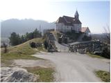
From the highway Ljubljana - Maribor we take the exit Dramlje and follow the road ahead in the direction of Šentjur, Rogaška Slatina and Rogatec. In Rogatec signs for Donačka gora direct us to the left. Only a little further, we come to the next crossroads, where we continue right again in the direction of Donačka gora. Further, we drive towards the village Sveti Jurij (do not follow the signs for Donačka gora ahead). In the village Sveti Jurij we turn left upwards towards the church of St. Jurij by which we park. We can park already a little lower on the parking lot by the road.
Route description:
From the church of St. Jurij we continue on the road upwards. After 100 meters of walking, we come to the crossroads, where we continue left. After a further few dozen steps of walking, we come to a farm, where a marked footpath turns right upward. The path at first ascends through a meadow, then turns right, where it crosses a belt of bushes and then brings us to the cross at the next farm. Here we continue upwards on a marked cart track which over a panoramic slope soon brings us to a path junction, where we continue right in the direction of Donačka gora.
We continue on a cart track which barely ascends towards the east. From the cart track on which we walk, views open up towards the nearby Macelj and villages below Donačka gora. After some time the cart track, which gradually becomes quite steep, starts turning to the left side. When we almost circle Donačka gora we come to a path junction, where we continue left upwards. After a short ascent on the newly made path the path from the mountain hut Rudijev dom joins from the right. Here we continue in the direction of Donačka gora on the path which further ascends quite steeply. When the steepness decreases there follows a traverse of steep slopes. The path ahead brings us below the steep summit slope of the eastern peak of Donačka gora. Next follows a very steep ascent on a well-secured path to the ridge. Here, 20m to the left from the path is the eastern peak of Donačka gora (marked, last meters secured with pitons).
We continue right on a path, which at first descends a little and then ascends along the ridge of Donačka gora. After approximately 20 minutes of walking on a steep vegetated ridge we arrive at the western peak, where there is also a logbook box.

Photos:
 1
1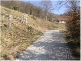 2
2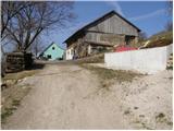 3
3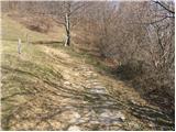 4
4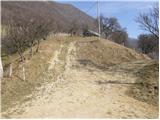 5
5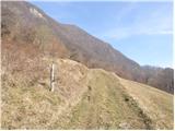 6
6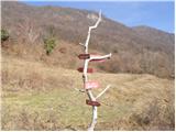 7
7 8
8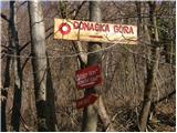 9
9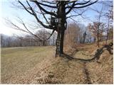 10
10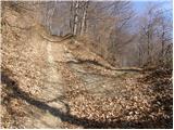 11
11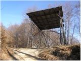 12
12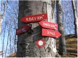 13
13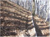 14
14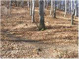 15
15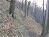 16
16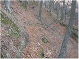 17
17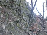 18
18 19
19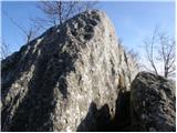 20
20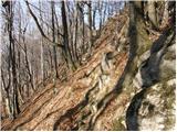 21
21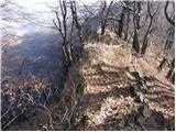 22
22 23
23
Discussion about the trip Sveti Jurij - Donačka gora (eastern way)
|
| anta130. 04. 2009 |
From the village Sveti Jurij to the top of Donačka gora, the markings have been renewed, so no problems with orientation. From the top we descend to Rudijev dom (new caretaker) and from there continue to the church Sv. Donat and further to the village Sveti Jurij. Very nice circular tour.
|
|
|
|
| Lj30. 04. 2009 |
Last Sunday I was on Donačka gora for the first time, which is quite distinctive, especially the eastern summit and ridge. We went from Sv. Donat to the eastern summit, then along the ridge to the western summit, descended to Rudijev dom and further to the starting point at Sv. Donat. The ascent to the eastern summit is almost alpinistic, the western summit is nicely accessible even for children. Interesting tour and beautiful places!
|
|
|
|
| marta.m1. 01. 2011 |
Today I was on Donačka gora from Sveti Jurij via the eastern path  I wouldn't say the ascent is almost mountaineering, since my little dog handled it without problems I wouldn't say the ascent is almost mountaineering, since my little dog handled it without problems
|
|
|
|
| SasG18. 11. 2011 |
On 17.11.2011 I completed the circular eastern path. Praise for the markings, only at the junction for the eastern summit there could be some additional text on the sign that the path is secured with a steel cable (so that no one would be surprised or would know they are on the right path). Otherwise an interesting and nicely maintained path. At the summit I was a bit surprised by the unusual way of stamping the logbook .
Rudijev dom was closed. Notice that they are open Friday 10-17, Saturday and Sunday 7-19.
|
|
|
|
| frajer14. 05. 2013 |
Today I hiked the described trail... weather wonderful... the trail is really beautiful! Most of the trail is shaded, so it's not too hot.
From the top we descended to Rudijev dom and then along the road to the signpost for the source of Sotla, where we turned left. The path took us to the church of Sv. Donata and then along the cart track to the junction for Sv. Jurij. Nice loop trail.
I recommend it...
|
|
|
|
| smatjaz15. 05. 2013 |
12.05.2013 Hiked this trail, the path from the church of sv. Donata to the farm by the road is slippery and slightly dangerous due to damage and fallen trees, caution is not superfluous in slippery conditions. Otherwise super and pleasant. Fascinating beech forest from Rudijev dom to the summit with huge trees. I also added a GPS track.
|
|
|
To post a comment you must log in:
If you do not yet have a username, you must first
register.