Strahomer - Krim (via Strmec)
Starting point: Strahomer (309 m)
| Latitude/Longitude: | 45,9424°N 14,4878°E |
| |
Route name: via Strmec
Walking time: 2 h 10 min
Difficulty: easy marked way
Elevation gain: 798 m
Elevation difference along the route: 798 m
Map: Ljubljana - okolica 1:50.000
Recommended equipment (summer):
Recommended equipment (winter):
Views: 38.504
 | 2 people like this post |
Access to starting point:
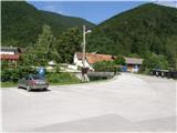
From the southern Ljubljana bypass, we head to the Rudnik exit and follow the road ahead in the direction of Ig. At the crossroads in Ig, we continue right in the direction of Iška vas, then in the village of Staje we continue right towards the village of Vrbljene. In Vrbljene, we continue left towards the village of Strahomer, and there on a well-maintained asphalt parking lot by the river Iška we also park.
Route description:
From the parking lot, we head onto an asphalt road which over a bridge crosses the river Iška. The road ahead starts slightly ascending and past the church brings us to a marked junction, where we continue right in the direction of Krim over Strmec (straight Krim over Kramarca).
We continue the ascent on a cart track which goes by the utility building into the forest. At first, the gently sloping cart track quickly ascends steeply, then turns more and more towards the right. Higher, the steepness eases and the cart track, which crosses a road, brings us to the spot where a quite overgrown path from Vrbljene joins us from the right.
We continue in the direction of Krim on a gently sloping path, which a little further brings us to the next junction, where we join a wide cart track. We continue slightly left in the direction of Krim (right downwards Tomišelj) on a somewhat steeper cart track which higher crosses a forest road. The cart track, which all the time runs through the forest, flattens again and a little further brings us to the next junction, where the path from Podpeči and Preserje joins us from the right. We continue on a wide, moderately steep cart track which higher brings us to a macadam road which leads to Krim. We follow the mentioned road to the left, and it quickly brings us to a larger parking lot or turning area, where the path from Iški Vintgar joins us from the left (also the path from Iška vas and the path over Kramarca, on the latter we can also descend). Here we continue right across a meadow, on the path which past a cross brings us to the summit of Krim in a few more minutes of walking.

Photos:
 1
1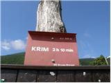 2
2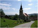 3
3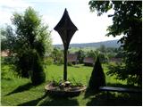 4
4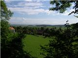 5
5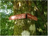 6
6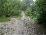 7
7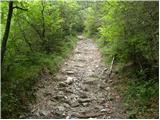 8
8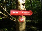 9
9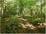 10
10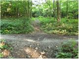 11
11 12
12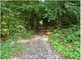 13
13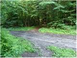 14
14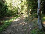 15
15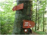 16
16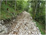 17
17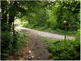 18
18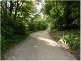 19
19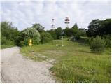 20
20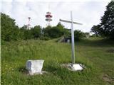 21
21 22
22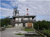 23
23 24
24
Discussion about the trip Strahomer - Krim (via Strmec)
|
| bojanu29. 11. 2015 |
The path is closed due to road widening and timber hauling along the path route at least until April 2016.
|
|
|
|
| Eisheth6. 07. 2016 |
Today went down this trail. The lower part is rutted and destroyed due to timber dragging. I recommend the trail via Kramarca.
|
|
|
|
| pclop12. 03. 2017 |
Forestry works have been more or less completed for some time now, so the path is normally passable again. Unlike in the "old days", the path in the lower section has been replaced by a forest road. I prefer it over the "stretched-out" Kramarce.
|
|
|
|
| robi210722. 04. 2018 |
According to Geopedie data, the approach via Kramarce is about 400 m shorter than the variant via Strmec. But I also prefer this one. Matter of taste. You can shorten this trail by about 500 m if, when you reach the road (pic 18), you don't turn left and continue on the road, but just cross the road and immediately head into the trees on the other side. You'll reach the hut from the back. This part is not marked, but the path is trodden enough to follow. Otherwise, the entire trail from Strahomer to the summit has no special features, just occasional fallen trees that you can cross or bypass without issues.
|
|
|
|
| Mikens23. 06. 2019 |
IMPORTANT!
I ask all hikers to keep their dogs on a leash! (bear area.)
Best hunting regards.
Klement Mal, LD Tomišelj
|
|
|
|
| pclop6. 04. 2021 08:45:31 |
Photos of the lower path section are outdated and misleading, as there's a forest road there for a couple of years already.
|
|
|
To post a comment you must log in:
If you do not yet have a username, you must first
register.