Srednja vas - Koča na Uskovnici (via Lom)
Starting point: Srednja vas (583 m)
| Latitude/Longitude: | 46,2975°N 13,9231°E |
| |
Route name: via Lom
Walking time: 1 h 40 min
Difficulty: easy marked way
Elevation gain: 571 m
Elevation difference along the route: 571 m
Map: Triglav 1:25.000
Recommended equipment (summer):
Recommended equipment (winter):
Views: 40.140
 | 2 people like this post |
Access to starting point:
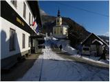
From the Ljubljana-Jesenice motorway, take the Lesce exit and follow the road towards Bled and further to Bohinjska Bistrica. Just before Bohinjska Bistrica, at the settlement of Bitnje, continue sharply right towards Pokljuka. After a short ascent, the road levels out and quickly brings us to the Upper Bohinj Valley. At the junction here, continue left (right Pokljuka) and follow the road to Srednja vas. In the second part of the village, notice the signs for the church of St. Martin, which direct us right onto a narrower and quite steep road, along which we quickly arrive at the church and primary school. Park in a suitable place by the school or church.
Route description:
To the left of the primary school (looking uphill) we will notice a wide, moderately steep cart track that after a few dozen steps brings us to a water intake. Here there is a sign "Uskovnica" already visible from the school, telling us we are on the right path. The cart track then enters a strip of forest and ascends steeply for a short time. The steepness soon eases as the cart track brings us to a wide gravel road, which we follow to the right. Soon to the right, a marked cart track branches off the road, which we follow uphill. The mentioned cart track crosses the aforementioned road several more times higher up, but when the slope we are walking on levels out, we continue the ascent on the already mentioned gravel road. The relatively gentle road then brings us to the Lom parking lot, but we continue on the forest road closed to public traffic, which a little further brings us to a marked junction. We continue right towards Koča na Uskovnici (straight Uskovnica) on a somewhat steeper road, along which in 15 minutes of further walking we ascend to the aforementioned mountain hut.
From the hut, we can ascend in five minutes to the nearby chapel, from which a nice view opens up.
Srednja vas - Lom 1:25, Lom - Koča na Uskovnici 0:15.

Along the route: Lom (1076m)
The trip can be extended to the following destinations: Planina Zajamniki,
Planina Konjščica (1 h 10 min),
Planina pod Mišelj vrhom (2 h 55 min),
Velo polje (3 h 35 min),
Vodnikov dom (3 h 20 min),
Ablanca,
Jezerski Stog,
Viševnik,
Mali Draški vrh (3 h 15 min),
Vernar (4 h 35 min),
Veliki Draški vrh,
Tosc (4 h 5 min),
Dom Valentina Staniča,
Dom Planika (4 h 50 min),
Triglavski dom na Kredarici,
Triglav (6 h 5 min)
Photos:
 1
1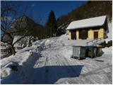 2
2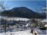 3
3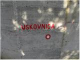 4
4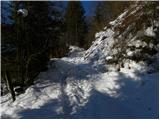 5
5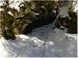 6
6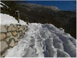 7
7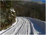 8
8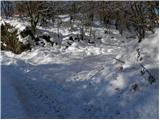 9
9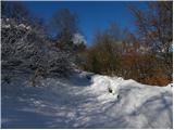 10
10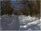 11
11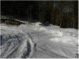 12
12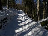 13
13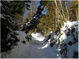 14
14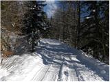 15
15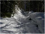 16
16 17
17 18
18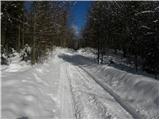 19
19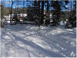 20
20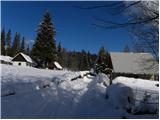 21
21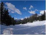 22
22 23
23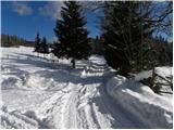 24
24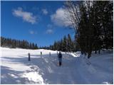 25
25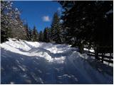 26
26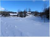 27
27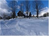 28
28 29
29 30
30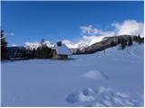 31
31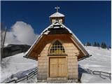 32
32
Discussion about the trip Srednja vas - Koča na Uskovnici (via Lom)
|
| Bojan_A18. 02. 2010 |
Is it possible to sledge down this road? I've been wondering that for a long time.
|
|
|
|
| Tadej18. 02. 2010 |
Usually not, as they plow the road very low, so there's quite a lot of sand in places. The road is also quite busy and thus dangerous for descent.
|
|
|
|
| Pohodnica5618. 01. 2013 |
This one's not a bad variant either, of course if there's snow. Continue to Zajamniki, the views up there are gorgeous.
|
|
|
|
| arnika21. 01. 2013 |
We were pleasantly surprised by the friendly welcome of the new caretaker Mr. Janez at the hut on Uskovnica. We need such people in our mountain huts! That's why we gladly return to them and recommend them to friends and acquaintances. We wish Mr. Janez that his ideas about the offerings come true. Greetings from Posavje!
|
|
|
|
| matjazp6022. 01. 2013 |
Arnika, hello.
can you tell me what the road to Koča na Uskovnici is like. Is it possible to get there by car.
best regards
|
|
|
|
| arnika22. 01. 2013 |
Matjazp60
I was at Uskovnica before the last snow, and on foot from Rudno polje, so I don't have fresh information! Best regards
|
|
|
|
| Pohodnica5625. 01. 2013 |
I was at Uskovnica on foot from Srednja vas on Saturday. The road was snowy, a couple of cars made it to the parking lot. Arnika is right, Janez is correct. I also like returning up there.
|
|
|
|
| ana24. 04. 2013 |
Today I was at Uskovnica from Srednja vas. I went along the marked path past the church, the path is muddy. Mr. Janez kindly served me tea, even though I forgot my wallet at home. I'll stop by him again soon, of course with money.
|
|
|
|
| luky6825. 04. 2013 |
Janez is a really special kind of person that you rarely meet nowadays, friendly, talkative and good-natured. We will gladly come back for some tea!
|
|
|
|
| robi141. 05. 2013 |
Hi!
I'm looking and looking, but can't find...
How much time would one need for a trip from Stara Fužina to Uskovnica and further to Voje and back to St. Fužina?
Thanks and best,
robi
|
|
|
|
| Pohodnica561. 05. 2013 |
After a quick look at the map, I think about five hours. At least I remember taking almost six hours a couple of years ago, because I was "gazing" at the Mostnica gorges, stopped at Voje, then at Uskovnica. But I'm more slowly "tuned". 
|
|
|
|
| AdryBK2. 01. 2014 |
hello, is there snow at Uskovnica or can you get there normally without crampons? Thanks, best regards
|
|
|
|
| jax2. 01. 2014 |
To Uskovnica I really think you should make it without...
|
|
|
|
| Borut126. 01. 2023 20:19:51 |
Somewhere before picture 17, there is now an arrow painted on a tree, where we continue straight on the cart track for the gentler path over Lom, to the right the path goes along steep forest slopes and mostly avoids the road (path to Ribnica).
|
|
|
To post a comment you must log in:
If you do not yet have a username, you must first
register.