Ruski križ - Koča v Krnici
Starting point: Ruski križ (1036 m)
| Latitude/Longitude: | 46,4444°N 13,7746°E |
| |
Walking time: 45 min
Difficulty: easy marked way
Elevation gain: 77 m
Elevation difference along the route: 155 m
Map: Kranjska gora 1:30.000
Recommended equipment (summer):
Recommended equipment (winter):
Views: 40.886
 | 3 people like this post |
Access to starting point:
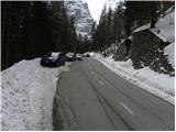
We drive to Kranjska Gora, where we continue left in the direction of Vršič or Bovec. Just before the 3rd hairpin bend of the Russian or Vršič road, we will notice a small parking lot by the road, where we park. On the opposite side of the road from the parking lot, we can see a cross, and a few meters further on the left side, the turnoff of the forest road and hiking signs for Koča v Krnici. We can also descend along the mentioned poorer macadam road towards Suha Pišnica, where there is also a somewhat larger parking lot. Some parking spaces are also located a little further along the main road between the 4th hairpin bend and Mihov dom.
We can also reach the starting point from the Primorska side, namely via the Vršič pass.
Route description:
From the starting point we head onto the poorer macadam road, which immediately begins to descend moderately through the forest. Soon a path branches off to the right upwards, leading towards Mihov dom and further to Vršič. We continue along the descending road and after a few minutes it brings us to the parking lot near the bed of Suha Pišnica. Here by the parking lot there is also drinking water. We continue right past the parking lots and then continue along the road which is closed to public traffic in the further course.
The road first crosses the Suha Pišnica stream and then turns slightly left and brings us out of the forest onto the expansive grassy slopes of Planina v Klinu, where we notice a solitary hut on the right and a smaller memorial park Mali Tamar on the left. The path ahead completely levels out, then joins a forest road that comes from the former Hotel Erika or the bridge over Velika Pišnica. Here we continue right and soon reach a junction where a footpath branches off to the right, which also leads to Koča v Krnici. We continue straight on the macadam road. In the continuation we then follow the relatively steep forest road all the way to Koča v Krnici, which we reach after approximately 20 minutes of further walking.
Starting point - Planina v Klinu 0:20, Planina v Klinu - Koča v Krnici 0:25.

Along the route: Mali Tamar (996m), Planina v Klinu (980m)
The trip can be extended to the following destinations: Pogačnikov dom na Kriških podih (4 h 25 min),
Gubno (4 h 15 min),
Križ,
Planja (6 h 10 min),
Špik (4 h 15 min),
Stenar (5 h 30 min),
Dolkova špica (5 h),
Razor (6 h 25 min),
Velika Martuljška Ponca (6 h 15 min),
Veliki Oltar (5 h 15 min),
Škrlatica (6 h 45 min)
Photos:
 1
1 2
2 3
3 4
4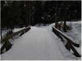 5
5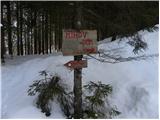 6
6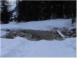 7
7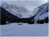 8
8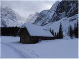 9
9 10
10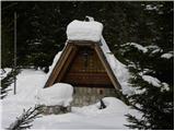 11
11 12
12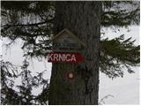 13
13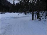 14
14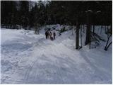 15
15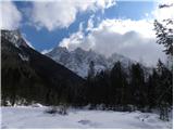 16
16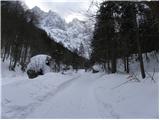 17
17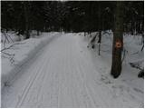 18
18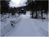 19
19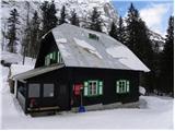 20
20 21
21
Discussion about the trip Ruski križ - Koča v Krnici
|
| birch23. 05. 2009 |
Today I was here (in 2001).The path is easy, only on the way back I went along Pišnica, and the path drags on too much.It mostly runs in the sun.
|
|
|
|
| kris20. 03. 2010 |
I'm wondering if anyone has been to Krnica recently, what's the path like
|
|
|
|
| fiky20. 03. 2010 |
We were there on Sunday, path is OK, suitable also for sledding (wide trodden), and some skiers too. As in the photos above. Crampons not needed, and without gaiters it works too. In the hut excellent mushroom soup. Highly recommended.
|
|
|
|
| kris20. 03. 2010 |
can you park before the 3rd serpentine is it plowed
|
|
|
|
| fiky20. 03. 2010 |
Yes it is plowed but you need to be early enough. We parked at Erika and walked the road. Around 11am it was barely possible to park before the third serpentine anymore.
|
|
|
|
| kris20. 03. 2010 |
thanks for the info cheers.
|
|
|
To post a comment you must log in:
If you do not yet have a username, you must first
register.