Rifugio Pederü - Piccola Croda Rossa / Kleine Gaisl
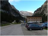
Starting point: Rifugio Pederü (1548 m)
| Latitude/Longitude: | 46,63867°N 12,0414°E |
| |
Walking time: 4 h 45 min
Difficulty: easy pathless terrain
Elevation gain: 1311 m
Elevation difference along the route: 1430 m
Map: Tabacco 03 1:25.000
Recommended equipment (summer): helmet
Recommended equipment (winter): helmet, ice axe, crampons
Views: 2.041
 | 2 people like this post |
Access to starting point:
A) From Kranjska Gora over Korensko sedlo to Austria, where at the first major intersection we continue left towards Podklošter / Arnoldstein and Trbiž / Tarvisio. At the end of the settlement Podklošter signs for Šmohor / Hermagor direct us right onto a regional road, along which, past the mentioned settlement, we drive to the end of the Gailtal valley, or more precisely to the settlement Kötschach-Mauthen, where we turn right towards the settlement Oberdrauburg. The route ahead leads us over the alpine pass Gailbergsattel (982 m), after which we descend into the mentioned settlement. After crossing the bridge over the river Drau, we continue left towards the settlement Lienz. In the main roundabout in Lienz we continue "left" in the direction of the settlement Sillian and Italy. Further, we cross the border between Austria and Italy, and we follow the main road past the settlements Dobbiaco / Toblach, Villabassa / Niederdorf, Monguelfo - Tesido / Welsberg - Taisten, Brunico / Bruneck. Only a little after the last-mentioned settlement, past which a bypass road leads, we turn left into the Val Badia valley. Further, we drive along the mentioned valley and in the settlement Longega we turn left towards the settlement San Vigilio. In San Vigilio, at the intersection, we then turn left following the signs »Pederü«. After approximately 200 meters, we then turn right also following the signs »Pederü«. We follow this road all the way to the large parking lot in front of the mountain hut Rifugio Pederü.
B) From Nova Gorica we drive into Italy and further along the motorway towards Venice / Venezia. Near the town Portogruaro we leave the motorway towards Venice and continue right along the motorway towards the town Pordenone. At the next motorway junction near the town Conegliano we continue right towards the town Belluno. Near Belluno the motorway ends, and at the following intersections we continue in the direction of Cortina d'Ampezzo. When we arrive in Cortina d'Ampezzo, we follow the signs for the alpine pass Passo Falzarego. At the pass Passo Falzarego (2105 m) we turn right in the direction of the pass Valparola and further towards Alta Badia. In the settlement La Villa we turn right towards the settlement Brunico. We then follow the road to the settlement Longega, where we turn right towards the settlement San Vigilio. In San Vigilio, at the intersection, we then turn left following the signs »Pederü«. After approximately 200 meters, we then turn right also following the signs »Pederü«. We follow this road all the way to the large parking lot in front of the mountain hut Rifugio Pederü.
Route description:
From the mountain hut Rifugio Pederü we continue left onto the macadam road where signposts for the hut direct us. The road, closed to traffic, at first ascends very steeply in zigzags and beautiful views of the surrounding peaks begin to open up. Further on, the road becomes slightly less steep and mostly runs through forest. After a good half hour of walking from the starting point, the road brings us to a marked junction.
Straight ahead the road leads to the Fodara hut, while we continue left following the signs »Rif. Sennes Hütte«. At the junction we slightly descend and cross a stream. The path here is fairly level for a while, then turns left and ascends across steep slopes towards the northwest. Higher up the path turns right and soon we join the road from the Fodara hut.
Further on we walk along the road, which steadily ascends gently, and gradually ever better views open up. The forest along the road is replaced by dwarf pine scrub and from the right a footpath from the Fodara hut joins us.
Further on the road becomes somewhat gentler and soon we reach a junction where the road to the huts Rifugio Ra Stua and Rifugio Biella branches off right. At the junction we continue left, and to the Rifugio Sennes hut only a short walk remains along the level road.
From the hut we continue along the macadam road following the signs »Munt de Sennes, Seekofelhütte«. The road ascends somewhat more steeply and soon brings us to a marked junction. At the junction we continue right onto the footpath following the signs »Rif. Biella, Seekofelhütte«. The path then ascends for a while longer and a fine view opens towards the summit Muntejela de Sennes and the Tofana mountain group. Further on the path levels out and runs across grassy slopes below the summit Croda del Beco (Seekofel). Later the path begins gently to descend, taking us from the Fanes-Sennes-Prags nature park into the Ampezzo nature park. After a gentle descent we reach a marked junction where we rejoin the macadam road.
At the junction we continue left along the macadam road, followed by a gentle ascent along the scenic road to the hut.
At the hut we continue eastwards and the path soon brings us to a marked junction. To the right downwards a path branches off to Lago di Fosses lake and the Rifugio Ra Stua hut, while we continue left towards the Forcela Cocodain notch.
From the junction the path runs eastwards, slowly ascending towards the ridge. When we reach the ridge, a fine northerly view opens up. Further on the path follows the ridge and later also gently descends. This brings us to the Forcela Cocodain notch.
At the notch the marked path turns left, but we head right onto the unmarked path and descend towards the scree below the slopes of Remeda Rossa peak (Rote Wand). When we reach the scree, on the right we notice a somewhat less steep slope towards which we head. Here a track is visible, marked by numerous cairns. The path runs southwards and later brings us to a ridge from where the view opens to Piccola Croda Rossa peak. We continue left, ascending gentler slopes on the right side of the ridge. Here the track fades, but orientation is not overly difficult as numerous cairns assist us. A short ascent along the broad ridge follows and soon we reach the summit of Remeda Rossa.
From the summit we continue along the ridge, first gently descending to the saddle between Remeda Rossa and Piccola Croda Rossa peaks. From the saddle we begin ascending the western slopes of Piccola Croda Rossa peak. The rocky slope we ascend is relatively gentle and presents no difficulties, with numerous cairns aiding orientation. Further on we continue ascending along the west side of the peak, from where we have a very fine view over much of the Dolomites. When we spot the cross on the summit, only a short ascent remains over even gentler terrain to the top. On the summit a superb view also opens to the neighbouring Croda Rossa peak.

Photos:
 1
1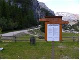 2
2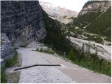 3
3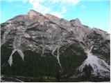 4
4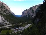 5
5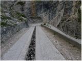 6
6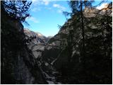 7
7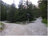 8
8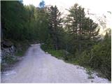 9
9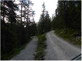 10
10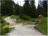 11
11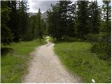 12
12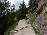 13
13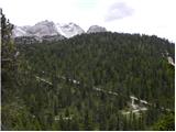 14
14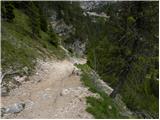 15
15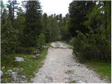 16
16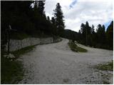 17
17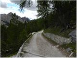 18
18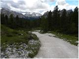 19
19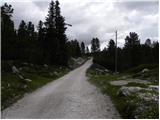 20
20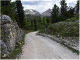 21
21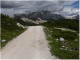 22
22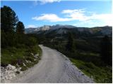 23
23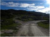 24
24 25
25 26
26 27
27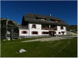 28
28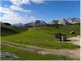 29
29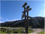 30
30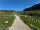 31
31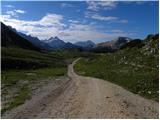 32
32 33
33 34
34 35
35 36
36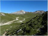 37
37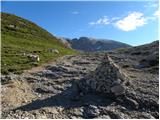 38
38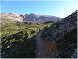 39
39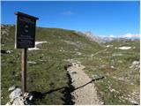 40
40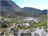 41
41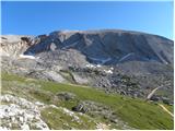 42
42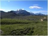 43
43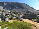 44
44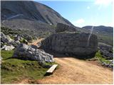 45
45 46
46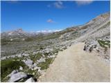 47
47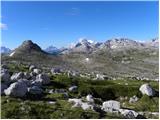 48
48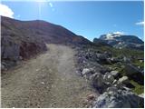 49
49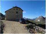 50
50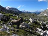 51
51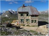 52
52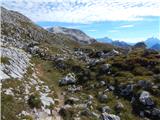 53
53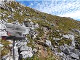 54
54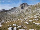 55
55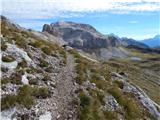 56
56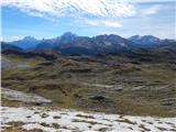 57
57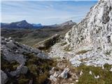 58
58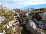 59
59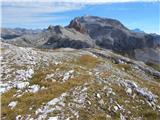 60
60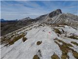 61
61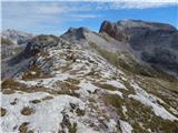 62
62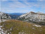 63
63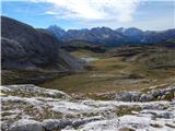 64
64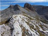 65
65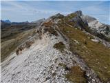 66
66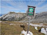 67
67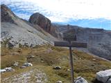 68
68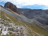 69
69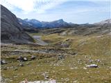 70
70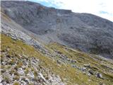 71
71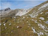 72
72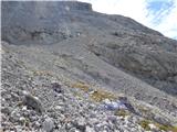 73
73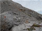 74
74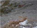 75
75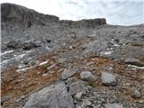 76
76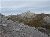 77
77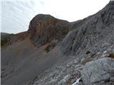 78
78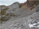 79
79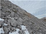 80
80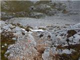 81
81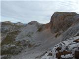 82
82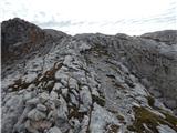 83
83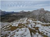 84
84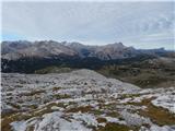 85
85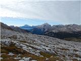 86
86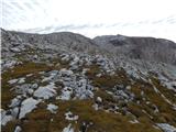 87
87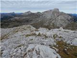 88
88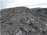 89
89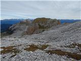 90
90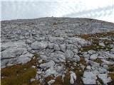 91
91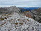 92
92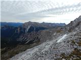 93
93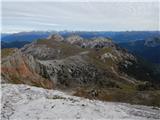 94
94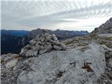 95
95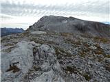 96
96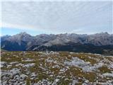 97
97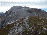 98
98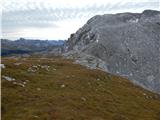 99
99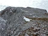 100
100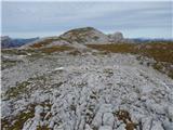 101
101 102
102 103
103 104
104 105
105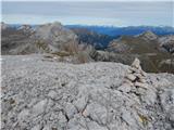 106
106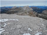 107
107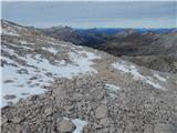 108
108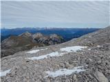 109
109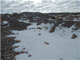 110
110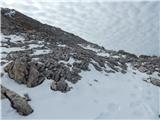 111
111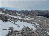 112
112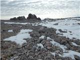 113
113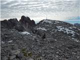 114
114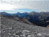 115
115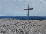 116
116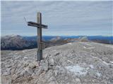 117
117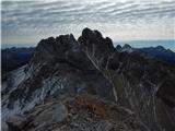 118
118
Discussion about the trip Rifugio Pederü - Piccola Croda Rossa / Kleine Gaisl
To post a comment you must log in:
If you do not yet have a username, you must first
register.