Poldov rovt (Vrata) - Šplevta (via bivouac)
Starting point: Poldov rovt (Vrata) (941 m)
| Latitude/Longitude: | 46,4216°N 13,86289°E |
| |
Route name: via bivouac
Walking time: 4 h 30 min
Difficulty: difficult unmarked way
Elevation gain: 1331 m
Elevation difference along the route: 1331 m
Map: Triglav 1 : 25.000
Recommended equipment (summer):
Recommended equipment (winter): ice axe, crampons
Views: 12.157
 | 2 people like this post |
Access to starting point:
We drive to Mojstrana, then follow the signs for the valley of Vrata. We continue driving through the valley of Vrata, about 100 meters before the road sign 10 km, and we will notice a cart track that branches off to the right perpendicularly to the main road. Here is the start of the described path. The marked parking lot where parking is allowed is located about 500 meters further along the main road.
Route description:
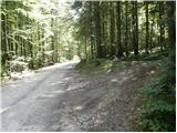
We go on a cart track which runs into the forest and then past a smaller house, where we continue slightly to the left on a footpath. Through the forest, we are ascending slightly to the left towards the stream Rdeči potok. A little before the stream, the path over Brinje branches off to the right (placed cairn, and on the tree is carved some kind of face and letter L). The path then brings us to the riverbed of the stream. Here the path goes on the right side (left bank) upwards and then soon crosses the stream to the left side. The path ascends through a small valley until a smaller wall blocks the path, where we usually also encounter a spring. The path goes from here to the right and steeply ascends through a natural passage. Slightly exposed and not secured. We are above a small waterfall (if there is water). Here we come out of the forest and ascend over some scree fields. The path over the scree is not comfortable as storms and avalanches destroy it every year. The path soon turns slightly to the right and for a short time ascends a grassy slope. Then follows ascent beside scree fields and soon we come to the bivouac at Bivak na Jezerih, which we will notice on our left. Here we can sleep overnight or just shelter in case of a thunderstorm. Here the terrain flattens. The view of Triglav is very nice from here.
The path from the bivouac onwards slowly disappears but we can still follow it. We continue slightly to the right towards the saddle between Dovški Križ and Šplevta. On the saddle we turn right and continue the ascent in pathless terrain initially relatively steeply upwards. After a few minutes the steepness eases and the increasingly panoramic "path" brings us to the summit of Šplevta after a few more 10 steps.

Photos:
 1
1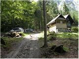 2
2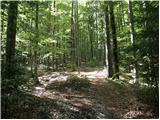 3
3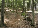 4
4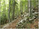 5
5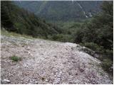 6
6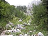 7
7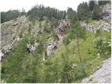 8
8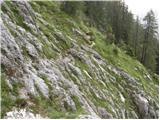 9
9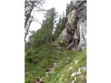 10
10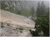 11
11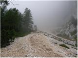 12
12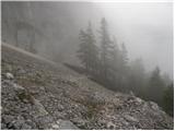 13
13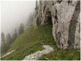 14
14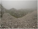 15
15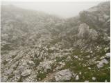 16
16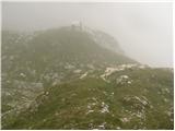 17
17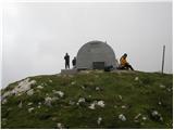 18
18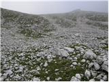 19
19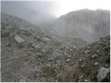 20
20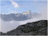 21
21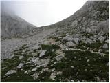 22
22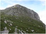 23
23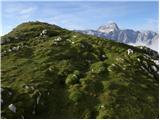 24
24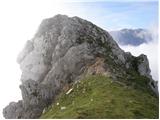 25
25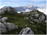 26
26
Discussion about the trip Poldov rovt (Vrata) - Šplevta (via bivouac)
|
| bbugari14. 11. 2017 |
Today I also described the ascent to Šplevta via Brinje. Followed descent to Bivak II and continuation of descent to Vrata. This path is, except for the section in the beautiful larch forest at the bottom of the big scree, quite demanding orientation-wise. In the first part I went a bit to the right from the bivouac, not on the scree. This path is much nicer to me, even if not shorter, just need to watch to move away from Mali Matterhorn in time and return left to the screes, before the valley narrows into a narrow impassable short gully. Carefully descend through grass and wall littered with scree onto the big scree and across it past the hole under MM to the left. Here there's a much nicer path through the larch forest than continuing on the scree (and not faster!). When finally the scree is crossed to the left under the walls (intro picture 11), follows a very dangerous descent down the gully, after the larch at the bottom of intro picture no. 9.
At the bottom of the gully a nice little path is found but I don't know if I left it before the gully or in the gully, or if it's the path going to Kališče?
Descent along the bed of Rdeči potok drags on quite a bit. The path is harder to follow and not particularly interesting.
Sorry for the bad Slovenian...

|
|
|
To post a comment you must log in:
If you do not yet have a username, you must first
register.