Pod Zjabci - Plaski Vogel (via Travnik)
Starting point: Pod Zjabci (745 m)
| Latitude/Longitude: | 46,3261°N 13,6982°E |
| |
Route name: via Travnik
Walking time: 5 h 45 min
Difficulty: difficult pathless terrain
Elevation gain: 1603 m
Elevation difference along the route: 1680 m
Map: TNP 1 : 50.000
Recommended equipment (summer): helmet
Recommended equipment (winter): helmet, ice axe, crampons
Views: 20.016
 | 3 people like this post |
Access to starting point:
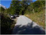
A) First, we drive to Kranjska Gora, and then we continue driving through the Vršič mountain pass towards Bovec. Soon after the Berebica gallery, we will arrive in the village of Soča, where we turn left over the bridge across the Soča River (direction tourist farm Jelinčič and camp Korita). After the bridge, we don't turn left towards the camp, but we continue driving straight on an ascending asphalt road. Further, we ascend over expansive meadows, in the middle of which stand some individual cottages, and then the road passes into the forest. Higher up, the road turns quite to the left and brings us to Pod Zjabcev, where we notice mountain signposts for the mountain pasture Planina Za skalo, Dom na Komni and Triglavska jezera. We park in a suitable place by the road.
B) From the Primorska side, first we drive to Bovec, and then we continue driving towards Trenta. Towards the end of the village Soča, we turn right in the direction of the tourist farm Jelinčič and camp Korita. After the bridge, we don't turn left towards the camp, but we continue driving straight on an ascending asphalt road. Further, we ascend over expansive meadows, in the middle of which stand some individual cottages, and then the road passes into the forest. Higher up, the road turns quite to the left and brings us to Pod Zjabcev, where we notice mountain signposts for the mountain pasture Planina Za skalo, Dom na Komni and Triglavska jezera. We park in a suitable place by the road.
Route description:
From Pod Zjabcev we head onto the marked path, which bypasses the nearby cottages on the right side. Behind the cottages, the path goes into the forest and quickly brings us to a smaller junction, where we continue right over the stream. On the other side of the stream, the path turns left and begins to ascend moderately through dense forest. We continue the ascent along an old mule track, which is already quite eroded in several places, and which higher up brings us to a short steep rocky section. Across the mentioned section, a well-maintained and wide mule track leads us, and the path above the mentioned section brings us to a vantage point from which a beautiful view opens onto Bavški Grintavec.
From the vantage point, the path returns to the forest and quickly ascends to an old trough with water (here by the path is a small spring, which dries up in dry periods). Above the trough, the path turns slightly left, then ascends in numerous zigzags through the forest. Higher up, the trail levels out somewhat and brings us to a less noticeable junction, where an abandoned path branches off to the left towards Planina Za skalo.
From here we continue straight ahead, and a somewhat steeper path, after 10 minutes of further walking, brings us to the next junction, which is this time completely unmarked. Here a unmarked trail branches off to the right, leading to the nearby hunting cottage and further towards Planina za Črnim vrhom, to the left a hunting path branches off towards Planina Za skalo, while we continue straight to the nearby next junction, which is somewhat better marked.
Here we continue left in the direction of Planina Za skalo (straight ahead the path continues towards Komna and Triglav Lakes) along the path that crosses the slopes to the left. Soon we step out of the forest, where the trail descends slightly to the left (here another, unmentioned trail joins from the left), and we continue along the initially clearly visible trail, which descends to Planina Za skalo and the TNP cottage there.
From the mountain pasture we return somewhat and ahead of us on the slope we will notice a trail that ascends across the scree towards Travnikova dolina. We head onto the mentioned unmarked trail, which ascends over already slightly overgrown scree. The path then transitions to a grassy slope, turns slightly right and ascends steeply. On this section of the path, a steel cable also assists us. The path then becomes less steep and continues along the grassy slope past increasingly sparse trees. The trail then runs along the right side of the valley, where on our right we will notice the entrance to a chasm. We continue ascending through the valley and on the right side a view soon opens towards Čelo. On this section the trail becomes increasingly difficult to follow, but orientation is not overly challenging, as we simply continue along the wide valley. Ahead we can already see the summit of Travnik. When the valley begins to turn right, we head left and begin ascending steep grass towards Travniška škrbina (the notch left of Travnik). The summit of Travnik can otherwise be reached also via the notch at the end of the valley on the right side of Travnik. Upon reaching Travniška škrbina we head right and continue along the panoramic ridge upwards to the summit of Travnik.
From the summit of Travnik we continue along the ridge towards Plaski Vogel. When the ridge becomes quite steep we descend slightly right downwards towards the scree, where we will then find a passage across the steep grassy slope towards the south ridge of the mountain. Upon reaching the ridge we continue left upwards and ascend along the relatively steep ridge towards the summit. In the last section of the path (along the south ridge) numerous cairns also assist us in finding easier passages.
Pod Zjabci - Planina Za skalo 2:15, Planina Za skalo - Travnik 2:30, Travnik - Plaski Vogel 1:00.

Photos:
 1
1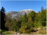 2
2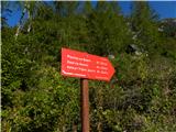 3
3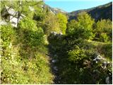 4
4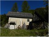 5
5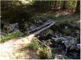 6
6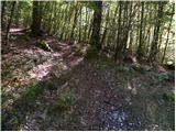 7
7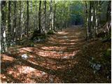 8
8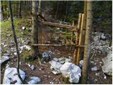 9
9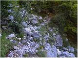 10
10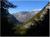 11
11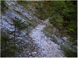 12
12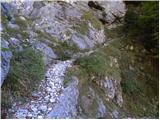 13
13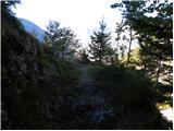 14
14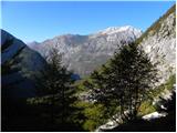 15
15 16
16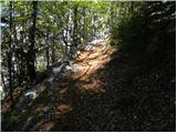 17
17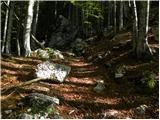 18
18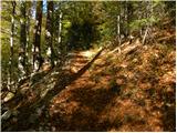 19
19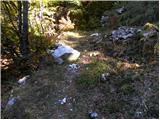 20
20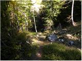 21
21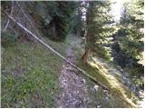 22
22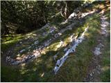 23
23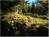 24
24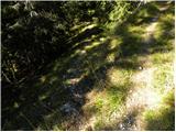 25
25 26
26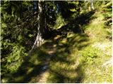 27
27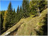 28
28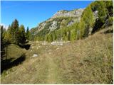 29
29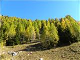 30
30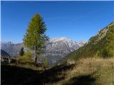 31
31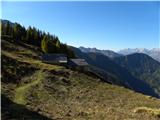 32
32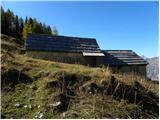 33
33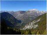 34
34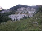 35
35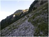 36
36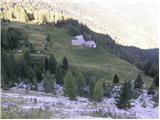 37
37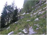 38
38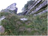 39
39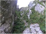 40
40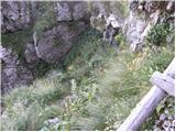 41
41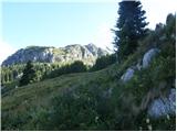 42
42 43
43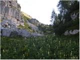 44
44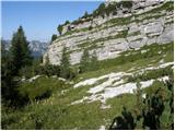 45
45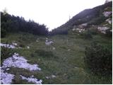 46
46 47
47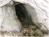 48
48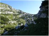 49
49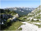 50
50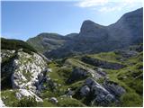 51
51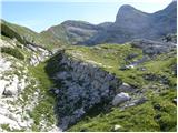 52
52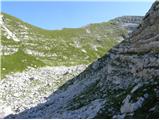 53
53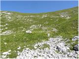 54
54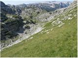 55
55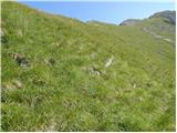 56
56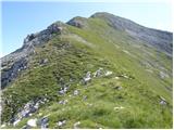 57
57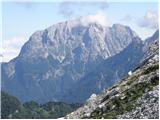 58
58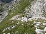 59
59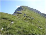 60
60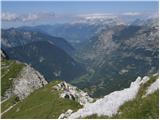 61
61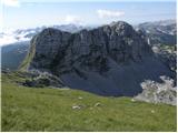 62
62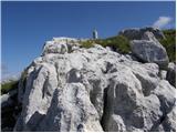 63
63 64
64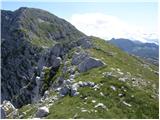 65
65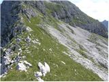 66
66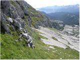 67
67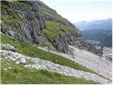 68
68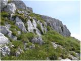 69
69 70
70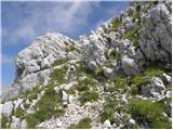 71
71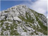 72
72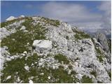 73
73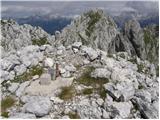 74
74
Discussion about the trip Pod Zjabci - Plaski Vogel (via Travnik)
|
| Rakar10. 08. 2008 |
Another pathless terrain is marked with a red line! Actually it's not pathless, as in the comments under the photos of the photo report I counted more than 25 uses of the word path (of course in different cases).
While I'm writing, two warnings. Fog can turn the "marked" trail into a very demanding pathless terrain. Instead of green grass, when losing the otherwise quite clear direction, unpleasant scree can suddenly appear all around us … Oh yes, the pristine environment is home to pristine animals – both types of vipers are teeming!
|
|
|
|
| triglavski10. 08. 2008 |
The description is actually not as good as it looks. Most will get lost from Planina za Skalo onwards. I would supplement Rakar with the fact that a bear is constantly lingering in the mentioned area.
|
|
|
|
| uros f30. 09. 2009 |
I confirm that there is a bear in this area!!! When ascending from Planina za Skalo, before the entrance to Travnik Valley on the right side there's a smaller valley and from it came several minutes of such horrific bear roaring that I'm still shivering! An acquaintance also told me that on the path between Planina za Skalo and Koča pri Triglavskih Jezerih she has already walked in bear tracks (in the snow)!
|
|
|
|
| janav30. 09. 2009 |
Last year my boyfriend and I headed to Travnik. On the descent back to Planina Za Skalo we got lost (even though we had a map and GPS with us - which didn't perform well, as it mixed up Krnsko jezero with Črno jezero?!?))...The sun was already "dangerously" setting, so we called GRS, who managed to navigate us. Thanks again to mountain rescuer Lad! To the question why this path isn't marked, we got the answer that this area is "intended?!?" for janez janša (I deliberately don't use capital letters for this name), so it's not desirable for too many people to walk there... (I deliberately don't use capital letters for this name), so it's not desirable for too many people to walk there...
|
|
|
|
| cenc30. 09. 2009 |
I think the "trip" to Travnik and/or Plaski Vogel is not at all as complicated as it appears above. Once you enter Travnik Valley from Planina za Skalo (the "jump-through" entrance is clearly visible from the Planina) you can't get lost, as you are surrounded left and right by peaks between which there are only small notches.
The valley and surroundings are intended for those who love it and occasionally venture into this untouched (and unspoiled) nature, where only "natives" dwell
(obviously also the bear)...
|
|
|
|
| cufarb14. 09. 2010 |
On 11.9.2010 my colleague and I heard a bear roaring at Planina za Skalo, coming from the entrance to Travnik Valley and then moving away to the east. It lasted between 5:30 and 8:00.
|
|
|
|
| husky14. 09. 2010 |
Are you sure it was a bear?
Quite a few people have already heard a bear in Travnik Valley, but it is most likely a mouflon.
|
|
|
|
| igorf14. 09. 2010 |
Yes.
About five years ago or so, sometime in June, there was still quite a bit of snow in the valley, bear paw prints were clearly visible.
|
|
|
|
| cufarb24. 09. 2010 |
Regarding the bear, I was informed by an experienced hunter that it only roars if injured. In this case, it was an early deer rut.
|
|
|
|
| loto22. 08. 2011 |
Last Saturday we conquered Travnik and Plaski vogel in wonderful and hot weather. Fairy tale in the wilderness and solitude! No sign of a bear, only chamois watched us at every step! According to the supervisor, bears do occasionally come to these areas - but only passing through and during the day there is no danger of encountering one. The roaring that some mention is, according to the supervisor, deer calling!
|
|
|
|
| Trobec29. 08. 2016 |
What is the "path" (or rather terrain) like directly from Velika vrata towards Čelo and then on to Plaski Vogel. Well, from Velika vrata to Čelo it is marked on the map as ski touring, but I'm interested in how it is in dry conditions. Is it passable at all, or too much scrub?
|
|
|
|
| mailman29. 08. 2016 |
Trobec, the path is not easy, not direct, you have to make detours because of screes. Stick to the ridge on Glava for the hut, rather slightly right, because in the middle it's a slightly fractured hill. When you reach the top, then only along the ridge to Čelo.
|
|
|
|
| Trobec29. 08. 2016 |
Thanks to both. It's planned in the near future (maybe already this weekend) but I planned from the direction of Dvojnega jezera. That's why I was wondering if there's another path, so as not to lose 400m of elevation from Velikih vrat to planina Za skalo 
|
|
|
|
| ljubitelj gora30. 08. 2016 |
Already walked around Čelo via ledges, descended to Zgornjo Komno and Travnikovo dolino. When you reach Čelo you go back a bit from the top and turn right towards Travnikove doline. Bypass Vrašac on the left side of the scree and climb to Travnik, Plaski Vogel. Here at least I know you won't enter the bushes, stay under the wall, whereas on Zg.Komna you quickly enter the bushes. Check my albums and you can ask there.
|
|
|
|
| ljubitelj gora28. 10. 2019 |
Yesterday in these parts along the Kuka ridge to Plaski Vogel. In picture 65 you can see the grassy ledge above, descending there is not difficult.
|
|
|
|
| darinka46. 09. 2023 22:47:13 |
It was its turn. Today in the blue. It's a viewpoint. We went by the upper path that's drawn in the navigation. We left the vehicle at the barrier. Two guys came behind us who went to Vršac. They said first time. They studied the path. This little path gets lost in the forest. But it joins the lower path along which we walked through Travnik Valley. It's led through the grass where there's slope. I think along that new path of ours. The watch showed 16 km and 1500 elevation gain. These days it's being written about snakes being out. We didn't see a single one, even though the day was very warm.
|
|
|
|
| Evjuna7. 09. 2023 09:30:46 |
Darinka, do you perhaps know how traceable the lower path from the ramp towards Planina Za skalo is and how much longer it is time-wise compared to the one starting from Pod Zjabci?
|
|
|
|
| dprapr7. 09. 2023 09:40:27 |
The path from the ramp is nicely maintained. There are some fallen trees in between, which you bypass on the already trodden path. In between, they're salvaging sick spruces with a cable crane. Be careful there.
Darinka, I saw you both ascending to Plaski Vogel.
|
|
|
|
| darinka47. 09. 2023 09:57:09 |
Thanks if you mean the path from the ramp when you cross the little bridge, no issues regarding the path, as Drago wrote. We too, if we hadn't found that upper path or junction, would have gone along the lower path. These paths are long. All-day tours. Especially if you're searching along the way where to go, the walking time extends. Drago, where were you when there was no one on the path except two guys going to Vršac?
|
|
|
|
| dprapr7. 09. 2023 10:14:57 |
I watched you two ascending to the summit from the top of Travnik. I was tempted to join you there, but my companions would have had to wait. We started late. We were still at breakfast in the hotel in Kranjska Gora at 7:30. Yesterday was a more relaxed hike after Tuesday's in Stena.
The best descent from Travnik, and also ascent, is diagonally across the slope from the saddle to the left. We found an abandoned path there. This path starts at the break where there is a distinct cairn.
Cheers, from the ramp to Planina za skalo it's 1.5 hours of walking.
|
|
|
|
| darinka47. 09. 2023 10:45:05 |
Well, when you think there's no one around. We were looking at Travnik. Took a picture of it, but saw no one. Those two guys were clearly visible on Vršac. We planned to go to the summit right along the grass. Then the cairns were helpful. From the saddle we descended over the steep southeast slopes. Then to the summit it wasn't difficult anymore. We had this route marked. It was helpful. Too bad we didn't meet. I heard there's another way up, but demanding.
|
|
|
|
| dprapr7. 09. 2023 10:59:43 |
We also saw those two climbing to Vršac. I then thought they were the ones ascending to Plaski Vogel. There was also another couple, a guy and a girl, whom we overtook above Planina za skalo on the descent. We didn't ask them where they had been.
Otherwise, this year about 20 people signed in at Travnik. As many as sign in.
|
|
|
|
| Evjuna7. 09. 2023 11:37:24 |
Many thanks for the information. Good luck!
|
|
|
To post a comment you must log in:
If you do not yet have a username, you must first
register.