Pod Zjabci - Koča pri Triglavskih jezerih
Starting point: Pod Zjabci (745 m)
| Latitude/Longitude: | 46,3261°N 13,6982°E |
| |
Walking time: 5 h 45 min
Difficulty: easy marked way
Elevation gain: 940 m
Elevation difference along the route: 1385 m
Map: TNP 1:50.000
Recommended equipment (summer):
Recommended equipment (winter): ice axe, crampons
Views: 15.066
 | 3 people like this post |
Access to starting point:
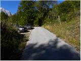
A) First, we drive to Kranjska Gora, and then we continue driving over the Vršič Pass towards Bovec. Soon after the Berebica gallery, we arrive in the village of Soča, where we turn left over the bridge across the Soča River (direction tourist farm Jelinčič and camp Korita). After the bridge, we do not turn left towards the camp, but continue driving straight on the ascending asphalt road. Further, we ascend across expansive meadows, amid which stand a few individual huts, and then the road enters the forest. Higher up, the road turns quite sharply to the left and brings us to Pod Zjabcev, where we notice mountain signposts for Planina Za skalo, Dom na Komni and Triglavska jezera. We park in a suitable place by the road.
B) From the Primorska side, first we drive to Bovec, and then we continue driving towards Trenta. Towards the end of the village of Soča, we turn right in the direction of tourist farm Jelinčič and camp Korita. After the bridge, we do not turn left towards the camp, but continue driving straight on the ascending asphalt road. Further, we ascend across expansive meadows, amid which stand a few individual huts, and then the road enters the forest. Higher up, the road turns quite sharply to the left and brings us to Pod Zjabcev, where we notice mountain signposts for Planina Za skalo, Dom na Komni and Triglavska jezera. We park in a suitable place by the road.
Route description:
From Pod Zjabcev we head onto the marked path, which bypasses the nearby huts on the right side. Behind the huts the path enters the forest and quickly brings us to a smaller junction, where we continue right across the stream. On the other side of the stream, the path turns left and begins to ascend moderately through dense forest. We continue the ascent along an old mule track that is badly eroded in several places, which then higher up brings us to a short steep rocky section. A well-maintained and wide mule track leads us through this section, and the path above it brings us to a viewpoint from which a fine view opens onto Bavški Grintavec.
From the viewpoint, the path returns to the forest and quickly climbs to an old water trough (there is a small spring by the path here, which dries up in dry periods). Above the trough the path turns slightly left, then ascends in numerous zigzags through the forest. Higher up the trail levels out somewhat and brings us to a less noticeable junction where an abandoned path to Planina Za skalo branches left.
From here we continue straight ahead; a somewhat steeper path then after 10 minutes of further walking brings us to the next junction, which is completely unmarked this time. Here a small unmarked path branches right to the nearby hunting hut and onwards to Planina za Črnim vrhom, a hunters' path branches left to Planina Za skalo, while we continue straight to the next nearby junction, which is somewhat better marked.
Here we continue straight or slightly right along the marked path towards the Triglav Lakes and Komna. We follow a gentle path through coniferous forest to a fork.
From the fork we take the left path towards Koča pri Triglavskih jezerih (straight to Komna and Lanževica), which bypasses Dol za Bajarjem on the left. The path then crosses the slopes for a while, then climbs briefly to bring us to a small valley where we reach a minor junction. At the junction we continue left on the marked path (straight is an unmarked path/mule track leading to Mali vrata), which then ascends obliquely across moderately steep grassy slopes. Higher up the path leads through a series of small indistinct valleylets, then climbs more steeply to bring us below cliffs, where there is the next less noticeable junction. Here we continue right (left past a small cairn a partly pathless route leads to Travniška dolina) and cross the slopes below the cliffs for a while, then the path continuing along the old mule track turns slightly left and begins to ascend more steeply. After a short steeper section the marked path turns right (straight ahead continues the pathless approach to Čelo, marked by cairns) and brings us to Velik vrat, where we notice the old border stone of the Rapallo Border.
Here a pathless approach to Kal branches right, while we continue on the marked path, which descends to nearby škraplje. We continue across the limestone pavement terrain, where orientation in fog is very difficult despite the marks. With a view of the ridge above Dolina triglavskih jezer we soon reach the eastern edge of the extensive škraplje, where the marks lead left into a short gully through which we descend steeply for a few metres. The path soon levels out and gradually enters a belt of dwarf pines, scrub and low sparse woodland. Less trodden but always marked, it leads lower across tall grasses, descending through them to Planina Lopučnica.
On the planina we join a broader, better-trodden path from Komna, following it left towards Koča pri Triglavskih jezerih. On the far side of the planina the path enters partly open woodland through which it ascends moderately, at times steeply. Higher up it levels out and turns left. A few minutes' descent follows and the path brings us to Dvojno jezero, from where it is only a few dozen steps to the nearby mountain hut.

The trip can be extended to the following destinations: Dom na Komni,
The lake Jezero v Ledvicah,
Rušnata glava,
The lake Zeleno jezero,
The lake Rjavo jezero,
Zasavska koča na Prehodavcih,
Mala Tičarica,
Velika Tičarica,
Koča na Doliču,
Kopica,
Vodnikov Vršac (Vršac nad Zadnjico),
Čelo,
Mala Zelnarica,
Malo Špičje,
Velika Zelnarica,
Vrh Hribaric,
Veliko Špičje,
Vršaki (Vzhodni vrh),
Kanjavec,
Triglav
Photos:
 1
1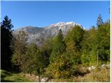 2
2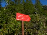 3
3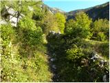 4
4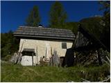 5
5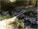 6
6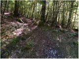 7
7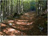 8
8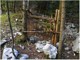 9
9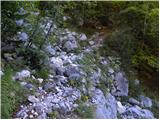 10
10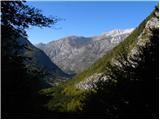 11
11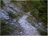 12
12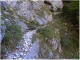 13
13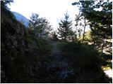 14
14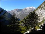 15
15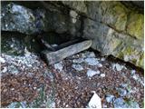 16
16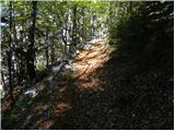 17
17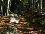 18
18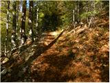 19
19 20
20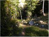 21
21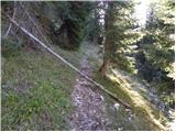 22
22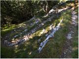 23
23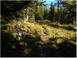 24
24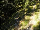 25
25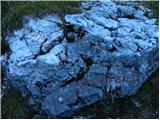 26
26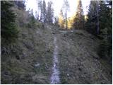 27
27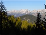 28
28 29
29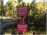 30
30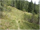 31
31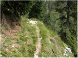 32
32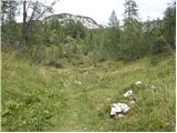 33
33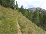 34
34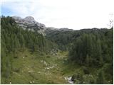 35
35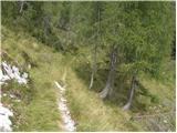 36
36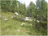 37
37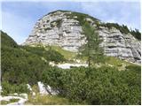 38
38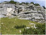 39
39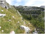 40
40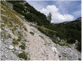 41
41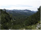 42
42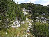 43
43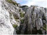 44
44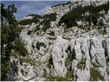 45
45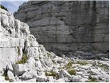 46
46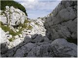 47
47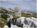 48
48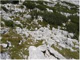 49
49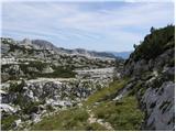 50
50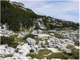 51
51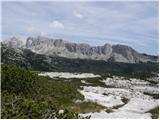 52
52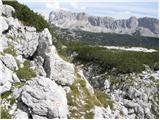 53
53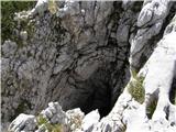 54
54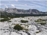 55
55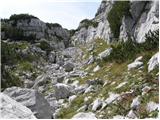 56
56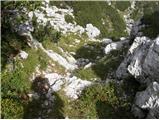 57
57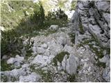 58
58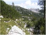 59
59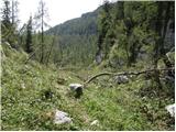 60
60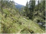 61
61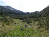 62
62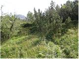 63
63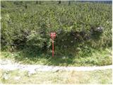 64
64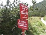 65
65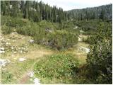 66
66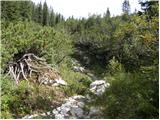 67
67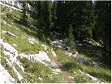 68
68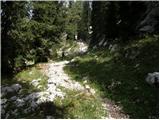 69
69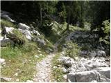 70
70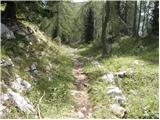 71
71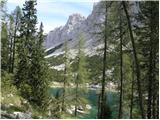 72
72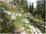 73
73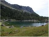 74
74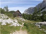 75
75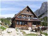 76
76
Discussion about the trip Pod Zjabci - Koča pri Triglavskih jezerih
|
| ziga00128. 06. 2013 |
I can't find a description anywhere for the path -> Dom pri Krnskih jezerih - Planina za črnim vrhom - Planina pod skalo. Interested in the difficulty and time? thanks
|
|
|
|
| adry3. 08. 2015 |
Hiked on Saturday 1.8. in the opposite direction, from Triglav Lakes to Pod Zjabci. The trail is quite overgrown with tall grasses from planina Lopučnica to Velikih vrat. Thanks to the one who cut the brushwood and made the trail more passable to Planina za Skalo. Very solitary trail, met no one.
|
|
|
|
| Met2. 08. 2020 |
Given that the path described above is very sparsely visited, does anyone know how overgrown it is currently or if anyone maintains it, what is its condition. Thanks.
|
|
|
|
| babica 52. 08. 2020 |
I walked this path in autumn 2019, it is nicely passable, not overgrown, marked okay. At Planina Lopučnica I made a long stop to observe marmots. So many at once I had never seen anywhere before. Wonderful. Met, enjoy the solitude!
|
|
|
|
| madeira2. 08. 2020 |
I walked this path on July 12 this year. Actually I joined it at Planina za skalo. The path is marked and nicely traceable. But really need to watch that the area around Velikih vrat is not in fog or clouds. In poor visibility orientation there is impossible. For me only the path through Lopučnica valley dragged a bit. Grasses are really high and you can hardly see where to step. Unfortunately I didn't see any marmots.
|
|
|
|
| Met3. 08. 2020 |
Big thanks to both! In about 14 days I'll be wandering around these parts and check the marmot situation. I can hardly wait to enjoy the dear peace.
|
|
|
|
| navdušena16. 08. 2022 11:18:55 |
Has anyone walked this path this year yet?
What's the condition like?
|
|
|
|
| ppegan16. 08. 2022 14:13:42 |
As far as I know, the path is still there as it was  Generally speaking, there are no special features or difficult sections on this path, so the condition is fine. Generally speaking, there are no special features or difficult sections on this path, so the condition is fine.
|
|
|
To post a comment you must log in:
If you do not yet have a username, you must first
register.