Planina Kuhinja - Lake Jezero v Lužnici
Starting point: Planina Kuhinja (991 m)
| Latitude/Longitude: | 46,2413°N 13,663°E |
| |
Walking time: 3 h
Difficulty: easy marked way
Elevation gain: 810 m
Elevation difference along the route: 850 m
Map: TNP 1:50.000
Recommended equipment (summer):
Recommended equipment (winter): ice axe, crampons
Views: 23.189
 | 3 people like this post |
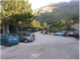
Access to starting point:
From Tolmin we drive towards Kobarid or vice versa, but only to the spot where signs for Kamno direct us to the right (from the direction of Kobarid, to the left) over the bridge. We then follow a relatively narrow and ascending road in the direction of the village Vrsno and higher Krn. From the village Krn we continue in the direction of the Koča na planini Kuhinja. When we arrive at the large parking lot, where the road continues slightly to the left towards the Koča na planini Kuhinja, we park at the large parking lot.
Route description:
From the parking lot at the smaller quarry we continue on the right upper road in the direction of the mountain pasture Kašina (left mountain pasture Kuhinja 3 minutes). The road, which further moderately ascends, already after a few steps of further walking brings us to the next junction, where we again continue right (left mountain pasture Zaslap). The relatively gentle road, which gradually changes into a cart track, soon brings us to ample grassy slopes, where we step onto the pastures of the mountain pasture Kašina.
Here the road or cart track turns even more to the right, then makes a sharp left turn, and then continues crossing the slopes to the right. After approximately 45 minutes (from the starting point) of moderate ascent, the relatively panoramic path brings us to the mountain pasture Leskovca overgrown with nettles.
From the mentioned mountain pasture we continue slightly left on the marked and initially quite gentle mountain path. The path, which passes onto the western and increasingly steep grassy slopes, higher up is joined from the right by a somewhat less trodden path from the mountain pasture Sleme. We continue left on the already very steep path, which ascends at the foot of the steep walls of Maselnik (1906 m). A little higher, another path from the mountain pasture Sleme joins the path, which due to its considerable steepness is exposed to falling rocks. We continue straight on the path, which levels out somewhat higher up, then turns quite to the left, where it passes into a smaller valley. A short somewhat steeper ascent follows, and to the left somewhat below us we spot the Jezero v Lužnici (1801 m). We descend to it along a short unmarked path.

Photos:
 1
1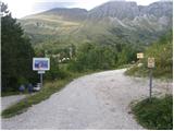 2
2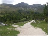 3
3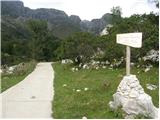 4
4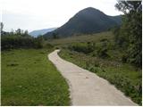 5
5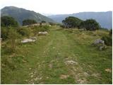 6
6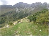 7
7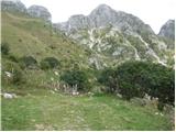 8
8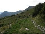 9
9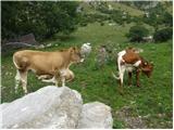 10
10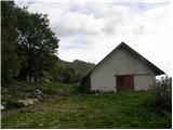 11
11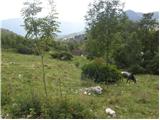 12
12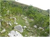 13
13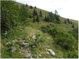 14
14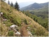 15
15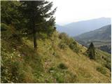 16
16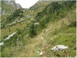 17
17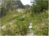 18
18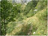 19
19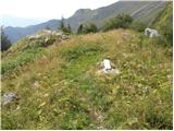 20
20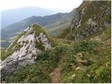 21
21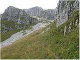 22
22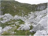 23
23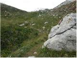 24
24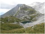 25
25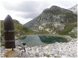 26
26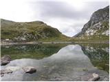 27
27
Discussion about the trip Planina Kuhinja - Lake Jezero v Lužnici
|
| Jimy6. 10. 2007 |
I walked this section of the trail in mid-August in the opposite direction. My wife and I were returning from Krn towards planina Kuhinja, where we started early in the morning. Very nice and scenic path, but I would mention falling rocks and boulders from Maslenik, which were dangerously rolling towards the steep trail below it. After a short stop, things calmed down, so we quickly left the dangerous section of the path, climbed left into the grassy slope, and descended towards planina Leskovca. At planina Kašina, we also bought good cheese and cottage cheese.
|
|
|
|
| lecy22. 07. 2013 |
I'm interested in how much walking there is from the lake in Lužnica to the summit above Peski?
|
|
|
|
| B222. 07. 2013 |
A bit more than an hour of not too fast walking...
|
|
|
|
| Melita111. 09. 2017 |
Nice and very accurate description of the ascent from Planina Kuhinja for 3/4 of the path. Then the accuracy is simply lost. The junction for Rdeči rob is not mentioned anywhere. Here you continue in the direction of Krna. This might be better information than just 'left', 'right'.
|
|
|
|
| Janez Seliškar11. 09. 2017 |
The junction cannot be mentioned because it doesn't exist, since there is no marked path to Rdeči rob.
|
|
|
|
| keti111. 09. 2017 |
Given that the path is clearly visible, the description seems quite accurate enough to me. The branch to Rdeči rob is indeed marked, but that little path is significantly worse than the main path to Lužnica and Krn, so there's no risk of someone straying there. Anyway, you should always have a good map too, not just the description, and then there are no problems.
|
|
|
|
| Nymeria15. 03. 2025 12:17:03 |
On 17.2., a Super Sparrow thermos (olive green color) was found a little below the lake in Lužnica, if you miss it, write to me.
|
|
|
To post a comment you must log in:
If you do not yet have a username, you must first
register.