Planina Kuhinja - Batognica
Starting point: Planina Kuhinja (991 m)
| Latitude/Longitude: | 46,2413°N 13,663°E |
| |
Walking time: 3 h 20 min
Difficulty: partly demanding marked way
Elevation gain: 1173 m
Elevation difference along the route: 1185 m
Map: TNP 1:50.000
Recommended equipment (summer): helmet
Recommended equipment (winter): helmet, ice axe, crampons
Views: 38.176
 | 1 person like this post |
Access to starting point:
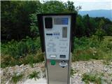
a) We drive to Kobarid, then follow the signs for Drežnica. After crossing the Soča river via Napoleon's Bridge, turn right towards Tolmin and Vrsno (Drežnica is slightly to the left) and gradually start ascending. We continue driving past the settlements of Ladra, Smast and Libušnje to the settlement of Vrsno, where the birth house of Simon Gregorčič is located. Here the road from the settlement of Kamno joins from the right, while we continue following the signs towards the village of Krn and the mountain pasture Kuhinja. There is still quite a long drive along a relatively narrow road; at junctions we always follow the direction for the mountain pasture Kuhinja. Just a short distance before the mountain pasture, turn left where the barrier for paying the parking fee is located. Beyond the barrier, a few parking spaces are already available along the road, with many more on a small flat area. It is also possible to park a little further ahead, in front of the Koča na planini Kuhinja.
b) We drive to Tolmin, then follow the signs for Kobarid. On the flat section of the road, turn right towards the settlement of Kamno, which we reach via a narrow bridge over the Soča river, then follow the signs for the village of Vrsno. In Vrsno we join the road coming from Kobarid and continue following the signs towards the village of Krn and the mountain pasture Kuhinja. There is still quite a long drive along a relatively narrow road; at junctions we always follow the direction for the mountain pasture Kuhinja. Just a short distance before the mountain pasture, turn left where the barrier for paying the parking fee is located. Beyond the barrier, a few parking spaces are already available along the road, with many more on a small flat area. It is also possible to park a little further ahead, in front of the Koča na planini Kuhinja.
Route description:
From the parking lot in front of the mountain pasture Kuhinja, we turn onto the lower left road that leads towards Koča na planini Kuhinja (slightly to the right lies mountain pasture Leskovica, Jezero v Lužnici...) and along which there are signs for Gomiščkovo zavetišče and Krn. A short distance before Koča na planini Kuhinja the path forks; we can choose the right branch, which is slightly shorter than the one that passes the hut, or continue straight ahead on the slightly longer variant that passes the hut.
At the memorial to fallen mountaineers in the Krn mountain range, both paths rejoin, and we continue following the marked trail towards Krn. This is followed by a few minutes of moderate ascent during which we cross several grazing fences; when we reach the access road to the nearby mountain pastures we only cross it (to the left is the Italian chapel on Planica and the nearby mountain pastures) and then begin to ascend steeply. The ascent continues up an increasingly panoramic grassy slope; higher up we reach mountain pasture Slapnik, where several identical buildings stand.
We bypass the buildings on the right side, then cross the road leading towards the mountain pasture Zaslap twice, where during the grazing season it is possible to buy some dairy products. Higher up, two more turn-offs also lead from the road to the mentioned mountain pasture, but we continue on the path that gradually transitions to steeper slopes, where we ascend in several longer zig-zags. Higher up, we ascend diagonally to the left and at an altitude slightly over 1600 metres reach an unmarked junction, where the marked path continues straight ahead, while a well-trodden shortcut branches off to the right.
We continue straight ahead on a gently sloping path that traverses the slopes, in places even slightly descending, then reach the start of the ridge of the nearby peak Kožljak, where the marked path turns right and passes onto the steep western slopes of Krn, where just a little further on we join the usual path from Drežnica.
We continue in the direction of Krn and start ascending again; the path ahead leads us along an old military mule track that at first still runs along the steep western slopes, then gradually ascends onto the Krn plateau, where the slope becomes less steep.
On this section, we leave the normal path towards Krn and take the path that leads towards Krnska škrbina.
Continuing, the path ascends mostly diagonally to the right in a few hairpin turns, leading us across the Krnska plošča; as it approaches Krnska škrbina, the slope becomes quite steep, but the path remains fairly wide. Further on, the slope becomes slightly less steep, while the path itself gets steeper and climbs to a junction at Krnska škrbina, from where a beautiful view opens towards the north.
Here we continue along the right path towards Batognica (left towards Krn, straight down to Krnsko jezero), which becomes technically more demanding. The path leads us along an exposed route with the help of steps along the precipitous southern slopes of Batognica. In wet or snowy conditions, there is a serious risk of slipping. A few metres below the summit, the path flattens and brings us to the top without major difficulties.
Starting point - Koča na planini Kuhinja 0:05, Koča na planini Kuhinja - planina Slapnik 0:40, planina Slapnik - Krnska škrbina 2:15, Krnska škrbina - Batognica 0:20.

Photos:
 1
1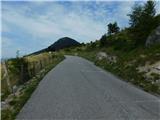 2
2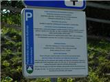 3
3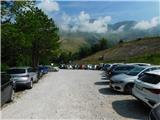 4
4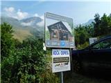 5
5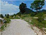 6
6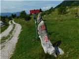 7
7 8
8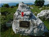 9
9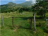 10
10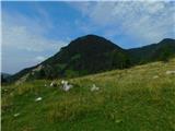 11
11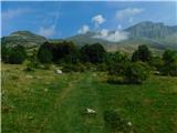 12
12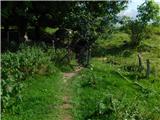 13
13 14
14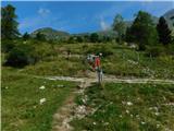 15
15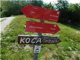 16
16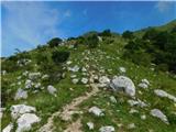 17
17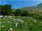 18
18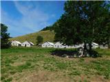 19
19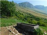 20
20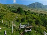 21
21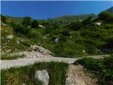 22
22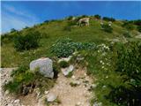 23
23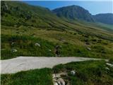 24
24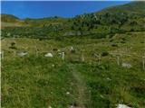 25
25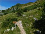 26
26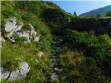 27
27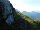 28
28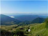 29
29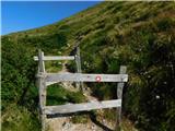 30
30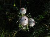 31
31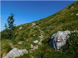 32
32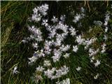 33
33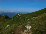 34
34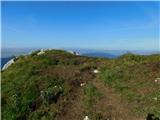 35
35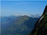 36
36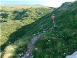 37
37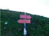 38
38 39
39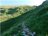 40
40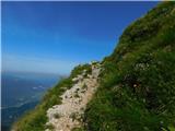 41
41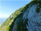 42
42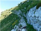 43
43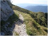 44
44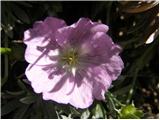 45
45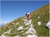 46
46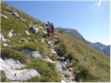 47
47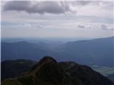 48
48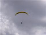 49
49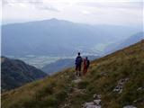 50
50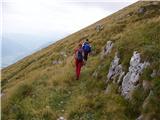 51
51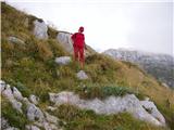 52
52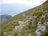 53
53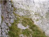 54
54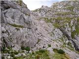 55
55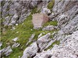 56
56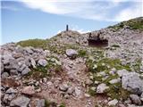 57
57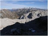 58
58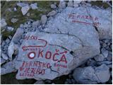 59
59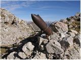 60
60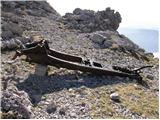 61
61 62
62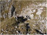 63
63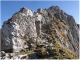 64
64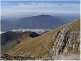 65
65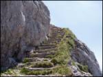 66
66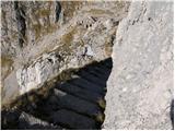 67
67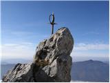 68
68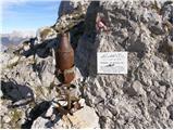 69
69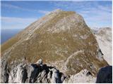 70
70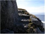 71
71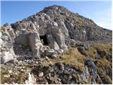 72
72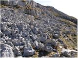 73
73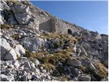 74
74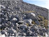 75
75 76
76 77
77
Discussion about the trip Planina Kuhinja - Batognica
|
| Gost27. 08. 2007 |
I suggest first climbing to Krn and then descending to Batognica, where you should take time to visit the caverns from World War I. Then continue along the Batognica ridge on the marked trail, from the top descend right (direction Lužnica). Continue past Lužnica lake and then after the saddle right to Planina Leskovca, from there it is another 5 minutes to the parking lot. The circular route takes 6-7 hours.
|
|
|
|
| slavkola11. 07. 2011 |
The trail with switchbacks to the top of Krn is quite monotonous. Paradise for lovers of alpine flowers. The sheer wall of Krn wakes me up. Almost there at the shelter. A bunch of Italians brought everything with them. The little horse, all tired, rests in the shade. The cavern above the shelter full of trash. Diamond in the mud! Shame! But the view from the other side at the window takes your breath away. Kanin, Mangart, Jalovec, Škrlatica, Triglav. All glowing! In the distance the Dolomites gleam white. At the top a group of Italians. Descent to the notch. Batognica. A flock of sheep comes towards me on the stairs. I watch in fear if any will fall down. They are incredible! I pass all the caverns. Shrapnel for souvenir. Lunar landscape to the lake in Ložnica. Silence. I am completely alone. Only the skeleton of a lost sheep greets me along the path. For two hours I hear only my steps and ptarmigans. The stone man high on the left watches me worriedly. Crystal-clear lake... Paradise! Angels in the sky? No, just a swarm of paragliders. Rest and slow descent down the steep trail. One day in heaven that you won't forget!
|
|
|
|
| ales5018. 07. 2011 |
Italians left their lives and a whole lot of iron alongside the Austrians during the Soča Front and even now much of it can be found that hasn't been taken to museums, yes some hikers really don't respect the mountains and litter everywhere, because this is just a mountain, respect for the mountain itself and in memory of the fallen where so much blood was spilled and sadly people don't realize it, selfishness knows no bounds.
|
|
|
To post a comment you must log in:
If you do not yet have a username, you must first
register.