Ovčja vas / Valbruna - Kamniti lovec / Cima del Cacciatore
Starting point: Ovčja vas / Valbruna (807 m)
| Latitude/Longitude: | 46,4964°N 13,5006°E |
| |
Walking time: 4 h
Difficulty: difficult marked way
Elevation gain: 1264 m
Elevation difference along the route: 1400 m
Map: Julijske Alpe - zahodni del 1:50.000
Recommended equipment (summer): helmet
Recommended equipment (winter): helmet, ice axe, crampons
Views: 7.440
 | 1 person like this post |
Access to starting point:
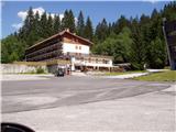
From Kranjska Gora across the border crossing Rateče we drive to Trbiž / Tarvisio. Further, we drive on the old road towards Videm / Udine. Already after a few kilometers from Trbiž / Tarvisio, the road into Ovčja vas / Valbruna branches off to the left. We follow the road to a large parking lot at the lower station of the old circular cabin cable car.
Route description:
From the parking lot, we continue on the road ahead, but only for a minute, as we then notice a rough forest road that heads left uphill. The road, which initially ascends, later barely ascends noticeably. After approximately 20 minutes of walking from the parking lot, the road crosses a torrent, about 10 meters before the torrent a marked path to Svete Višarje branches off to the left. Already at the very beginning of the footpath we encounter an overgrown path, which through high grass and bushes brings us into the forest. The path through the forest is easier to follow, but quite steep. Further the path is marked, but the blazes are already faded. The steep path leads us along locally very steep slopes, which when wet are dangerous for slipping. The steepness eases when the path brings us to a forest-covered ridge. The steepness then continues to ease, and the path brings us to the ruins of old wooden huts. On this part the path crosses overgrown terrain, then again starts moderately ascending. The path further leads us past two similar ruins, then ascends under the old cableway. The marked path from here onwards gets lost in high grass, so it is recommended to head right uphill, where in a few steps we reach the ski slope.
The path continues on a stony track that runs along the edge of the ski slope.
In winter walking on the ski slope is forbidden!
While walking on the ski slope beautiful views open up for us. Slightly higher we reach the intersection of two ski slopes, and we head steeply uphill to the right. Here ahead of us we see the transmitters on Svete Višarje. When the steepness eases we bypass the transmitters on the left side and the path brings us to the upper station of the circular cabin cable car.
Follows only a short ascent to the church. A few meters above the church there is a wonderful view of the surrounding mountains.
On Višarje we notice a gravel road which starts to descend moderately (the road is located on the right side of the hamlet on Svete Višarje). We follow this road for approximately 15 minutes to the chapel, where the signs for Kamniti lovec / Monte Cacciatore direct us to a footpath beside the chapel. The path initially runs almost horizontally, then starts ascending and soon brings us from the eastern slopes to the western ones. The path soon leaves the forest and brings us to the scree under Beraški križ.
Follows a somewhat steeper ascent to the cirque below Kamniti lovec. Here we see our goal already very close. The path ahead turns slightly right and ascends to the scree below Kamniti lovec. Follows crossing the scree in a gentle ascent to the entrance to the more demanding part of the path. The blaze directs us right into the gully uphill. Here the path ascends steeply, and a steel cable assists us. After a few meters the path leaves the gully and turns right. After a few meters the path brings us to the adjacent gully. The connection between the gullies is well secured. Follows the ascent up the gully, which is locally secured, locally we must assist with hands. During the ascent and descent in this part we take care not to dislodge stones. At the top of the gully we head right and in a few steps reach the panoramic summit.
Ovčja vas - Svete Višarje 2:30. Svete Višarje - Kamniti lovec 1:30.

Along the route: Planina Limerca (1300m), Svete Višarje (1766m)
Photos:
 1
1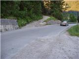 2
2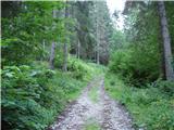 3
3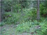 4
4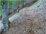 5
5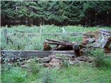 6
6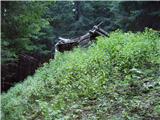 7
7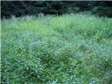 8
8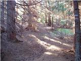 9
9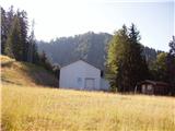 10
10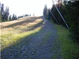 11
11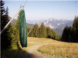 12
12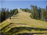 13
13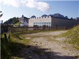 14
14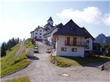 15
15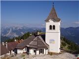 16
16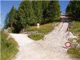 17
17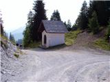 18
18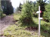 19
19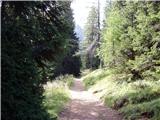 20
20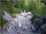 21
21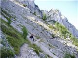 22
22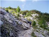 23
23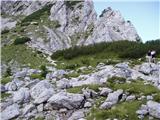 24
24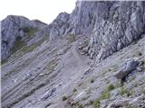 25
25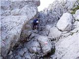 26
26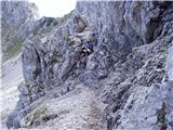 27
27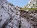 28
28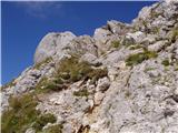 29
29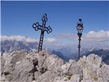 30
30
Discussion about the trip Ovčja vas / Valbruna - Kamniti lovec / Cima del Cacciatore
|
| navdušena30. 06. 2019 |
Has anyone gone on this path this year yet?
|
|
|
|
| ločanka1. 07. 2019 |
enthusiastic, read under Zajzera Kamniti lovec, Mrzle vode - current conditions
|
|
|
|
| mirank7. 07. 2020 |
Too bad the most interesting access to this mountain is missing,
access via Mrzla voda valley. And the descent can also be combined via a completely different trail, making a full circular tour.
|
|
|
To post a comment you must log in:
If you do not yet have a username, you must first
register.