Na Jasi (Bled) - Dobra gora
Starting point: Na Jasi (Bled) (485 m)
Walking time: 20 min
Difficulty: easy unmarked way
Elevation gain: 135 m
Elevation difference along the route: 135 m
Map: Karavanke - osrednji del 1:50.000
Recommended equipment (summer):
Recommended equipment (winter): ice axe, crampons
Views: 9.319
 | 2 people like this post |
Access to starting point:
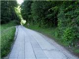
From the highway Ljubljana - Jesenice we take the Lesce exit and drive towards Bled, where we first drive straight through the traffic-light intersection, and after 50 meters (in front of the post office) we turn left. The road leads windingly uphill past hotels on the right, after which it turns first to the left and then to the right, and continues straight through the settlement Dindol in the south direction towards Selo. After a good kilometer of flat terrain, a little before the road descends beside the forest, on the right we notice a smaller wooden sign with the inscription Dobra gora. We park at a suitable place nearby.
Route description:
We step onto the path which leads right into the forest and start ascending along embedded stairs which occasionally accompany us all the way to the top. A wide and easy-to-follow path, which first turns right, during further ascent through a nice and mostly deciduous forest occasionally winds in the northwest direction. A little higher it turns twice to the left (second time at the smaller junction on flat ground). Right below the summit, the path crosses the slope a little to the right towards the destination on the summit of Dobra gora, where a beautiful view opens up. We encounter benches with a logbook box and an information board.
Photos:
 1
1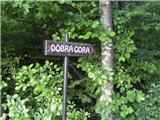 2
2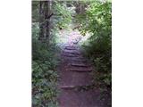 3
3 4
4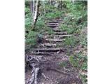 5
5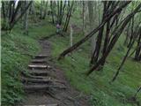 6
6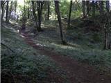 7
7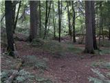 8
8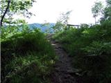 9
9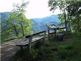 10
10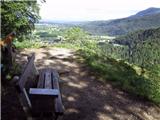 11
11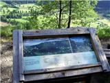 12
12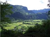 13
13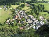 14
14
Discussion about the trip Na Jasi (Bled) - Dobra gora
|
| funnyboy23. 03. 2025 09:14:57 |
Interesting 
|
|
|
To post a comment you must log in:
If you do not yet have a username, you must first
register.