Ljubelj - Vrh Ljubeljščice (Triangel) (via Ljubeljščica)
Starting point: Ljubelj (1058 m)
| Latitude/Longitude: | 46,4324°N 14,2602°E |
| |
Route name: via Ljubeljščica
Walking time: 2 h 30 min
Difficulty: very difficult unmarked way
Elevation gain: 646 m
Elevation difference along the route: 750 m
Map: Karavanke - osrednji del 1:50.000
Recommended equipment (summer): helmet, self belay set
Recommended equipment (winter): helmet, self belay set, ice axe, crampons
Views: 25.226
 | 1 person like this post |
Access to starting point:
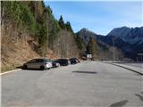
From the highway Ljubljana - Jesenice, we take the Ljubelj exit and follow the road ahead to the border crossing. Only a few meters before the border crossing, we will notice a parking lot on the right side, where we park.
Route description:
At the end of the parking lot, we notice signposts for the mountain hut Koča na Ljubelju, which after some stairs take us to the old Ljubelj road. We follow this road, which is moderately ascending and in winter time converted into a sledding track, all the way to the mountain hut Koča na Ljubelju. With partly nice views on Košutica, Veliki vrh and Begunjščica, we reach it after a little less than an hour of walking.
At the end of the parking lot, we notice signposts for Koča na Ljubelju, which after a few stairs take us to the old Ljubelj road. We follow this road, which is moderately ascending and in winter time converted into a sledding track, all the way to the mountain hut Koča na Ljubelju. With partly nice views on Košutica, Veliki vrh and Begunjščica, we reach it after 45 minutes of walking.
From the mountain hut, we continue left in the direction of Zelenica and Povna peč (Polna peč). The path ahead goes past the mountain hut and immediately behind it starts ascending. The steepness soon decreases and the path brings us to a mostly vegetated ridge, from which we occasionally get some views. After a few more minutes, we already see the peak of Polna peč in front of us, which the path bypasses on its northern side along steep slopes. The path, which almost circles the peak, brings us to a path junction only a few steps below the summit. Here we continue left in the direction of Povna peč (Polna peč) on the path which in a few steps brings us to the panoramic summit (right Zelenica).
From Povna peč, we return about 10 steps back to the last junction, then continue along the ridge in the direction of Zelenica or the ridge of Ljubeljščica. The path, which continues towards the west, first leads us along a partly forested ridge, then temporarily descends steeply along the edge of a steep grassy slope. When the path flattens, the ridge narrows and on the right side we cross an exposed gully, behind which we quickly return to the ridge. Some easy ascent follows, then we arrive at the spot where there is (was) the sign "end of safe path", but the safe path already ended at the crossing of the first gully.
A moderate descent follows on a crumbly exposed ridge, then the path starts ascending again and further mostly ascends moderately. The path ahead also leads us through a few passages dangerous for slipping, and the sign Zelenica a little further temporarily leads us to the Slovenian side of the ridge. When we return to the ridge, the path brings us to the technically most difficult part of the path, where with the help of fixed safety gear we descend steeply (even though this part is technically the most difficult, some prior unsecured passages are more dangerous). Further, we walk in a moderate ascent along a very panoramic ridge, then signs for Zelenica - secured path direct us left, transversely downwards, where we cross a shorter scree. When the scree ends, with the help of fixed safety gear we ascend steeply to a side ridge, from it also with the help of fixed safety gear we descend to the other side, but the descent is not particularly demanding. An ascent follows, where we return to the border ridge, after which some more ascent follows to the saddle Čez Pod, where we go left towards Vrh Ljubeljščice and reach it after one more minute of walking.
Ljubelj - Koča na Ljubelju 0:45, Koča na Ljubelju - Povna peč 0:30, Povna peč - Vrh Ljubeljščice 1:15.
We descend to Zelenica and from there along the marked path back to Ljubelj.

Photos:
 1
1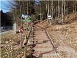 2
2 3
3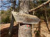 4
4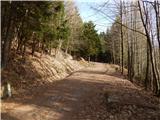 5
5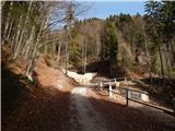 6
6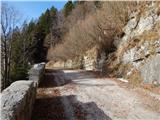 7
7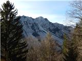 8
8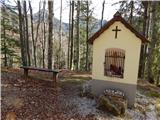 9
9 10
10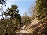 11
11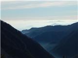 12
12 13
13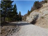 14
14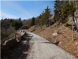 15
15 16
16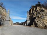 17
17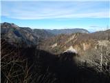 18
18 19
19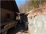 20
20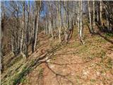 21
21 22
22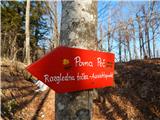 23
23 24
24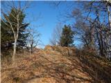 25
25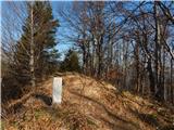 26
26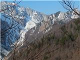 27
27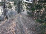 28
28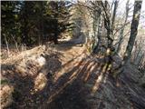 29
29 30
30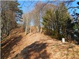 31
31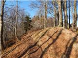 32
32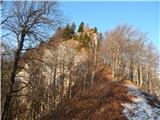 33
33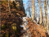 34
34 35
35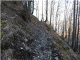 36
36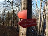 37
37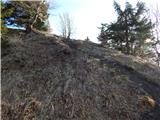 38
38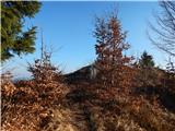 39
39 40
40 41
41 42
42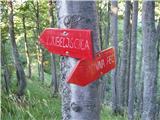 43
43 44
44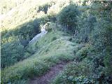 45
45 46
46 47
47 48
48 49
49 50
50 51
51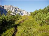 52
52 53
53 54
54 55
55 56
56 57
57 58
58 59
59 60
60 61
61 62
62 63
63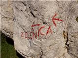 64
64 65
65 66
66 67
67 68
6869
 70
70 71
71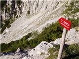 72
72 73
73 74
74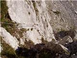 75
75 76
76 77
77 78
78 79
79 80
80 81
81 82
82 83
83 84
84 85
85 86
86 87
87 88
88 89
89 90
90
Discussion about the trip Ljubelj - Vrh Ljubeljščice (Triangel) (via Ljubeljščica)
|
| JusAvgustin24. 02. 2014 |
Yesterday we checked the entire route from the hut to the Triangle. Due to huge amounts of snow, detours to the north side are necessary because crossing the last avalanche path is too risky. From wind slabs of dry snow to boot crust. We went to the jump with snowshoes, further with crampons and ice axe. Nice day, given that we were alone on the entire ridge - below on Zelenica there were really lots of people.
|
|
|
|
| martinkarpan22. 05. 2014 |
Today did this path. No living soul on the path, only two joined me at the Triangle. Except for a small snow patch the path is dry. Near the Ljubelj hut quite a lot of fallen trees on the path, probably from the last wind blast. One piton is loose and some cables looser, otherwise fine. Some direction signs are erased, specifically on pictures 8, 12 and 19. Also did not notice the inscription on 21. Otherwise nice, panoramic and exposed path. Helmet won't hurt, SVK in my opinion really not needed, although recommended above.
|
|
|
|
| SunBurned4. 07. 2014 |
This afternoon I went on this path for the first time, but turned back already at the first gully (picture 17). To me it seemed much more than just "slightly exposed" crumbly gully. If you slip on that scree, you won't stop anymore. The ground there was downright awful, path practically without maintenance.
So I recommend really only to experienced ones, I'll train my unmarked paths on easier routes...
|
|
|
|
| dare295. 07. 2014 |
SunBurned shame you turned back so quickly. The path hasn't crossed the gully for some time, but is routed left uphill (viewed from the Ljubelj direction) to the ridge.
Crossing the gully is really a toboggan slide to the valley.
|
|
|
|
| garmont5. 07. 2014 |
Correct decision. Even the short ridge on picture 20 is demanding and the vertical section with the cable is also demanding on descent. Therefore, a path for the experienced.
|
|
|
|
| SunBurned6. 07. 2014 |
Dare29, thanks for the info, I have to admit that when I saw the gully and the "path" through it, it took away all my will to explore around. So I'll have to go look again.
One more observation I forgot last time: from the hut at Ljubelj onwards along the ridge it's quite overgrown with tall grass (the path is otherwise well visible), so long pants are mandatory.
|
|
|
|
| irska7. 07. 2014 |
yes, this trip report would be good to thoroughly renew - it is really very old  ... although the path is a ridge path and there are no orientation problems ... although the path is a ridge path and there are no orientation problems 
|
|
|
|
| kop328. 07. 2014 |
From the Triangel-Ljubelj direction at the beginning
on the descent to the first wire ropes
you need to watch your step a bit. On Saturday I almost
stepped on a viper.
Otherwise, the path doesn't seem anything special to me in summer time.
|
|
|
|
| Majdag12. 08. 2014 |
... Yesterday... wild and solitary
|
|
|
|
| Macesna6. 11. 2015 |
Yesterday walked this ridge. Very nice and romantic. But careful steps needed, as ravines cross several times and exposed sandy sections, and below in the forest steep slopes and narrow path. Otherwise very nice.
|
|
|
|
| garmont15. 06. 2016 |
The wooden sign in picture no. 19 is no longer there.
|
|
|
|
| 75'er19. 06. 2016 |
I also looked for the mentioned sign, but I didn't see it.
|
|
|
|
| roker28. 08. 2020 |
Today went over this ridge and tried to do it "properly" and where it says Zelenica left down, went right and up one gully to the "pre-summit" of Vrh Ljubeljščice, which seems to me a completely independent peak. Up crumbly II, down a bit left of the ridge towards Ljubeljščice. Solitary, but the path far from very demanding.
|
|
|
|
| capraibex30. 08. 2020 |
Don't mislead. Just because it's easy for you doesn't mean it's easy for others. Dangerous for slipping, especially in the part where the ridge narrows, not to mention the climbing section.
|
|
|
|
| marko2224. 10. 2022 08:31:33 |
Yesterday in cloudy and windy weather I did the hike, didn't meet anyone from the old Ljubelj all the way to the top, wonderful! According to previous reports the path has been renovated, two signs added warning that the path becomes dangerous. Self-belay kit needed if it's your first time, as the most difficult section has an exposed descent and psychology plays its part. Given its shortness, the tour is very varied and scenic.
|
|
|
|
| Majdag31. 10. 2022 18:46:28 |
28.10.... Wandering along the ridge of Ljubeljščica. We start at Ljubelj, return along the usual path past the hut at Zelenica. It is still open. The path through the forest is nice, mostly dry. The ridge sections are still narrow, sandy. Only that loose chain at the beginning of the rocky part is no longer loose, it is fixed. The descent is easier and the continuation is pleasant. Views wonderful, day bathed in sun..
https://jelenkamenmajdag.blogspot.com/2022/10/ljubelj-zelenica-po-grebenu-ljubeljscice.html
|
|
|
To post a comment you must log in:
If you do not yet have a username, you must first
register.