Ljubelj - Planina Korošica (via Koča na Ljubelju)
Starting point: Ljubelj (1058 m)
| Latitude/Longitude: | 46,4329°N 14,2617°E |
| |
Route name: via Koča na Ljubelju
Walking time: 2 h 15 min
Difficulty: difficult marked way
Elevation gain: 496 m
Elevation difference along the route: 600 m
Map: Karavanke 1:50.000 - osrednji del
Recommended equipment (summer):
Recommended equipment (winter): ice axe, crampons
Views: 20.620
 | 1 person like this post |
Access to starting point:
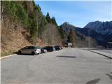
We leave the Gorenjska motorway at the Podtabor junction, and then we continue driving towards Tržič and Celovec. When we get to Ljubelj, before the tunnel we turn right onto a larger asphalted parking lot, where we park.
Route description:
From the starting point, we head on the path in the direction of the Koča na Ljubelju mountain hut. After a short ascent, we reach the macadam road, on which we continue the ascent. Next follows an ascent on a quite steep road which leads us across a few gullies and past a chapel and a pleasant spring with a bench. Higher, the road makes a few more hairpin turns; at the last left hairpin a nice view opens up on Košutica and Veliki vrh, and then we already arrive at the Koča na Ljubelju mountain hut.
From the hut we walk along the road to the state border, cross it, then on the Austrian side descend to a marked junction a few minutes away. From the junction we continue right in the direction of the marked path to Košutica / Loibler Baba and continue the path along a poorer road. The marked path soon turns right uphill from the road and initially ascends steeply. The path soon levels out and turns left. Next follows a traversing ascent to the left on a path that is usually quite slippery. After a few minutes of traversing ascent, the path brings us to the border ridge, where it initially ascends gently to moderately, higher up quite steeply for some time. During the steep ascent, a nice view opens up towards Stol, Vrtača, Palec... on looking back, and the steep path brings us to a metal ladder, where with the aid of safety devices we ascend steeply. Above the ladder a few more steel cables follow, then the path levels out and the demanding section over the Rjave peči is behind us. A little further we cross a pasture fence, then the path leads us across the grassy slopes of Grunt. With nice views of Lokovnikov Grintovec, Košutica (Ljubeljska Baba), Veliki vrh in the Košuta ridge and other surrounding mountains, we soon arrive at a marked junction, where we continue right in the direction of the Korošica mountain pasture and Hajnževo sedlo (straight to Košutica, slightly left to Lokovnikov Grintovec).
The path ahead leads us along a cart track that descends slightly, crossing some springs meanwhile. A little lower a hunting path from the Ljubelj concentration camp joins from the right, we continue straight ahead and in a few minutes of further walking arrive at the Korošica mountain pasture, where on the right side on a smaller rise we notice the mountain dairy.
The description refers to the condition in May 2017, and the pictures are from December 2016 and May 2017.

Photos:
 1
1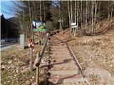 2
2 3
3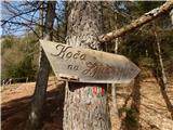 4
4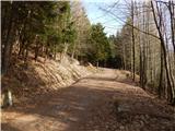 5
5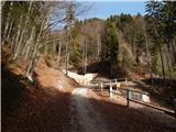 6
6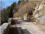 7
7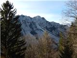 8
8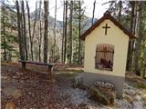 9
9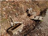 10
10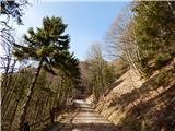 11
11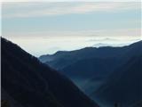 12
12 13
13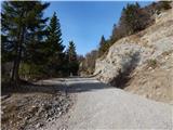 14
14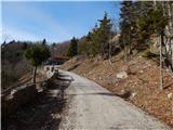 15
15 16
16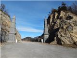 17
17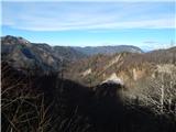 18
18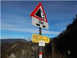 19
19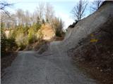 20
20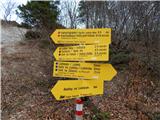 21
21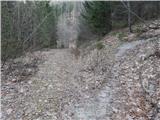 22
22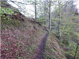 23
23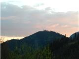 24
24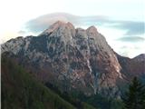 25
25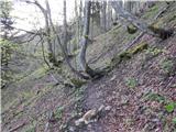 26
26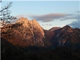 27
27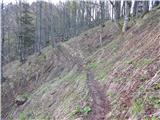 28
28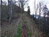 29
29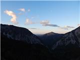 30
30 31
31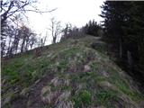 32
32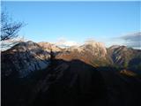 33
33 34
34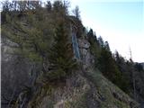 35
35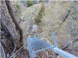 36
36 37
37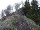 38
38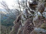 39
39 40
40 41
41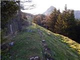 42
42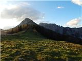 43
43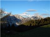 44
44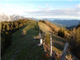 45
45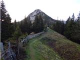 46
46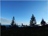 47
47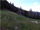 48
48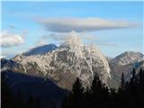 49
49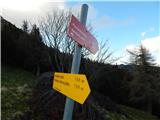 50
50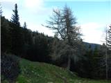 51
51 52
52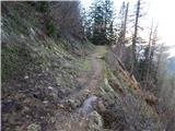 53
53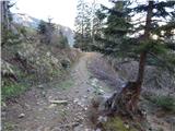 54
54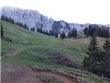 55
55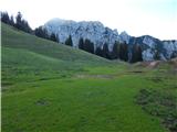 56
56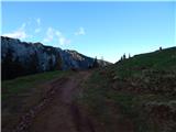 57
57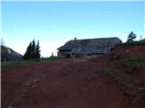 58
58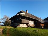 59
59
Discussion about the trip Ljubelj - Planina Korošica (via Koča na Ljubelju)
|
| marjan.mrak5. 09. 2021 18:41:19 |
Today I walked this path. To the second paragraph, which refers to picture 22, let me add this:
From the junction, turn sharply right 'around the corner' onto the footpath, and after about 10 meters onto the marked trail, whose markers in 'green' seasons are overgrown with undergrowth, towards Košutica... etc.
The marker from the mentioned junction was not visible; from that point, a forestry road leads left, and a footpath right...
Also, the "hunter's path" does not start from KT Ljubelj, but from the parking lot at the last bend before the border crossing.
Otherwise, the tour itself is one of the most beautiful.
|
|
|
To post a comment you must log in:
If you do not yet have a username, you must first
register.