Starting point: Ljubelj (1058 m)
| Latitude/Longitude: | 46,4324°N 14,2602°E |
| |
Walking time: 2 h 55 min
Difficulty: very difficult unmarked way
Elevation gain: 966 m
Elevation difference along the route: 966 m
Map: Karavanke - osrednji del 1:50.000
Recommended equipment (summer): helmet
Recommended equipment (winter): helmet, ice axe, crampons
Views: 38.202
 | 2 people like this post |
Access to starting point:
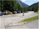
From the highway Ljubljana - Jesenice we take the exit Ljubelj and follow the road ahead to the border crossing. Only a few meters before the border crossing signs for Zelenica direct us to the left and after some 10 meters of additional driving the road brings us to the parking lot below the ski center Zelenica.
Route description:
From the parking lot, we head onto the footpath in the direction of Zelenica, Vrtača and Stol. The cart track, which runs along the left side of the ski slope, brings us after approximately 15 minutes of moderate ascent through the forest to the aforementioned slope, along which we then ascend. The path, which offers nice views of the extensive scree of Begunjščica on the left and the ridge of Ljubeljščica on the right, then brings us in a gentle ascent to the hut on Vrtača. From the hut we continue straight on the marked path, which slowly turns slightly to the left and brings us after a shorter transverse ascent into a belt of dwarf pines. Further on, the path steeply ascends for a short time and then brings us to a cart track (transport rescue road), which we then follow in a moderate ascent to the mountain hut Dom na Zelenici.
From the Dom na Zelenici hut we continue right in the direction of Stol and Vrtača (left Begunjščica) on the path which immediately behind the hut turns left and ascends alongside the children's ski lift. Somewhere halfway up the ski lift we come to a less noticeable junction, where we continue right and transversely ascend across the ski slope (straight to Koča pri izviru Završnice). Further on we cross a short belt of forest and the path brings us to the next ski lift, which we cross in a gentle descent. On the other side of the ski slope we notice a larger rock and on it a marker that directs us into the forest. The path then gently descends and after a few minutes of further walking brings us to the end of the valley of Suhega ruševja, where an unmarked path to Palec branches off to the right upwards.
We continue in the direction of Palec (straight Stol and Vrtača) on the path which ascends through a belt of forest and higher brings us below the scree of Vrtača and Palec. Here the steepness eases, and the path then leads us through the valley of Suhega ruševja. Higher up the path turns slightly right and once again steeply ascends. After a few minutes of further walking we reach the border ridge (Žleb 1916m) from where a view opens onto the Austrian side.
We continue left (right Palec) on the path which transversely ascends across the scree below Zelenjak. After a few minutes of ascent the path brings us to the next saddle, this time on the western side of Zelenjak. From here we continue right on a poorly visible path which transversely ascends the very steep summit slope of the mountain. The path, on which cairns indicate the direction, leads us along the steep slope which is dangerous for slipping. After approximately 10 minutes of difficult terrain we step onto the panoramic summit.
Great caution is required on the descent from the summit.
Ljubelj - Zelenica 1:20, Zelenica - Zelenjak 1:35.

Photos:
 1
1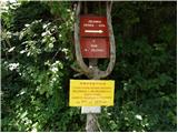 2
2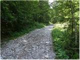 3
3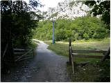 4
4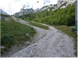 5
5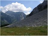 6
6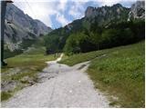 7
7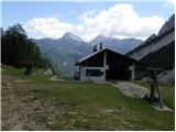 8
8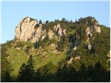 9
9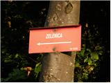 10
10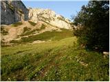 11
11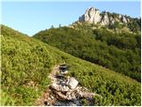 12
12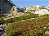 13
13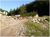 14
14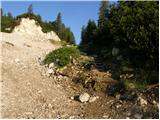 15
15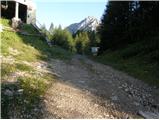 16
16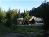 17
17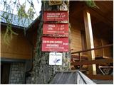 18
18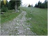 19
19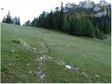 20
20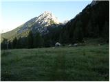 21
21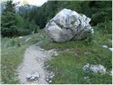 22
22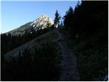 23
23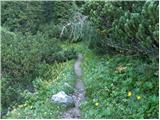 24
24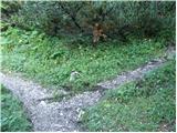 25
25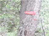 26
26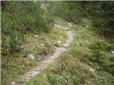 27
27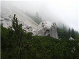 28
28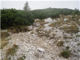 29
29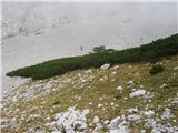 30
30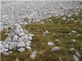 31
31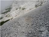 32
32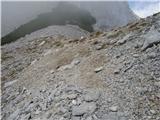 33
33 34
34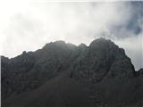 35
35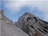 36
36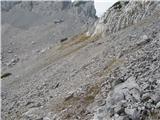 37
37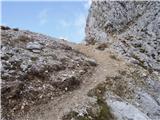 38
38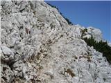 39
39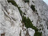 40
40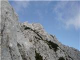 41
41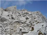 42
42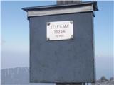 43
43
Discussion about the trip Ljubelj - Pautz/Zelenjak
|
| Gost15. 11. 2007 |
Is it possible to continue non-alpinistically from the top of Zelenjak towards Vrtaca? Thanks for the answer Frenk
|
|
|
|
| Gost15. 11. 2007 |
Via gully Y in the snow it's relatively "easy" access. Below Zelenjak on the left side (on the slopes of Vrtace) a gully opens up, which is initially passable, higher up it becomes steep up to 45 degrees incline. At least some alpinistic knowledge is needed, I think.
Hire a guide
|
|
|
|
| anda27. 05. 2009 |
Does anyone know how the snow is on the path to Zelenjak?
|
|
|
|
| JUREE28. 05. 2009 |
I was this afternoon on Palec. Ruševje is still partly under snow that doesn't sink in,
so walking is without problems.
Melišće is clear, on the path from the border ridge towards Palec summit there is only one "tongue" of remaining snow left.
I didn't go to Zelenjak, below it there is
still some snow, but the slopes looked clear.
|
|
|
|
| velkavrh14. 06. 2011 |
Today Zelenjak was mine too. From below it might seem undemanding, but you can spice it up like I did and turn it into a small alpinistic adventure. Somewhere in the middle I veered more to the left and climbed almost to the top. The passages can be found nicely. But you have to be careful not to get entangled while climbing. Really, this summit is not for everyone. Otherwise, the rock section is short. At the top there is a nice cross and a logbook. Be careful on the descent too. There are wonderful views if the weather is nice. Today I mostly sensed them. Both summits are right next to each other, I think Palec or Zelenica as written on the old sign at the top, so you have two two-thousanders hiked at once.
|
|
|
|
| Klin14. 06. 2011 |
You would really be early.
|
|
|
|
| velkavrh14. 06. 2011 |
Yes Klin, I often do half-day hikes before work in the morning or after work in the afternoon. Saturdays, Sundays or days off are reserved for full-day hikes. In this direction I'll soon go to Vrtača and Begunjščica too. For Stol I plan to go from the Jesenice side. Best regards.
|
|
|
|
| magroman26. 07. 2014 |
Today with my colleague I did a morning dash to Zelenjak, and from there also to Palec. Mostly cloudy, but no rain. So it wasn't hot, but due to the overnight rain we were both wet as hens while pushing through the dwarf pines (thicket). On the descent we went a bit above the pines over the scree. A really enjoyable hike for me, I recommend it.
|
|
|
|
| Grenaleva19. 10. 2015 |
Through the brush it goes fine, it is indeed cut, but the junction is no longer marked with a cairn. You have to search for it, about 20 minutes from the hut at Zelenica.
|
|
|
|
| J.P.24. 10. 2021 21:38:44 |
The junction for Suho rusevje is marked with a cairn...we also recognize the junction by the stone on the ground which has a mark for the direction to Vrtaca.Currently no special features, snow patches do not hinder us.Safe steps, Lp
|
|
|
|
| Kalisan12. 05. 2022 09:27:32 |
I'm wondering if anyone has already gone to Zelenjak or Palec with a dog? Thanks
|
|
|
|
| turbo12. 05. 2022 10:16:12 |
|
|
|
|
| ppegan12. 05. 2022 10:53:49 |
I have been there too, several times, even with two little dogs at once  None had problems, Palec is not problematic at all, Zelenjak is just a bit steep at the start, but goes on all fours without issues None had problems, Palec is not problematic at all, Zelenjak is just a bit steep at the start, but goes on all fours without issues  Of course provided the dog is at least somewhat used to hiking in high mountains Of course provided the dog is at least somewhat used to hiking in high mountains 
|
|
|
To post a comment you must log in:
If you do not yet have a username, you must first
register.