Ljubelj - Hochstuhl/Stol (upper way)
Starting point: Ljubelj (1058 m)
| Latitude/Longitude: | 46,4324°N 14,2602°E |
| |
Route name: upper way
Walking time: 4 h 50 min
Difficulty: partly demanding marked way
Elevation gain: 1178 m
Elevation difference along the route: 1350 m
Map: Karavanke - osrednji del 1:50.000
Recommended equipment (summer):
Recommended equipment (winter): ice axe, crampons
Views: 65.595
 | 4 people like this post |
Access to starting point:
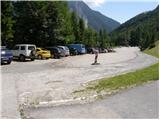
From the highway Ljubljana - Jesenice, we take the Ljubelj exit and follow the road ahead to the border crossing. Only a few meters before the border crossing, signs for Zelenica direct us to the left, and after about ten meters of additional driving, the road brings us to the parking lot below the ski center Zelenica.
Route description:
From the parking lot, we head onto the marked footpath in the direction of Zelenica, Vrtača and Stol. The path first leads along a moderately steep cart track that climbs through the forest, then turns slightly to the right and brings us out of the forest onto a ski slope. We continue the ascent on the ski slope, from which beautiful views open up onto the walls and screes of Begunjščica, and on the right side we see the ridge of Ljubeljšica. The path, which then runs along a rough road, brings us a little higher to the Koča Vrtača hut, where the Zelenica I chairlift ends and the Zelenica II chairlift begins. Here the transport-rescue road turns sharply to the right, but we continue straight ahead towards Zelenica and proceed along a path that is at first still gentle, then steeper, climbing along the ski slope. Higher up, we ascend through a sparse belt of dwarf pines, then return to the road. We continue along the rough road, but when the road turns left, we go right onto a steep footpath that rejoins the road just below the upper station of the single-seater Zelenica II chairlift. From here follows a short descent, and the path brings us to the Dom na Zelenici hut.
Just before the hut, the path to Begunjščica and Roblekov dom branches off to the left, but behind the hut we continue left and begin to ascend beside the children's ski tow Ciciban. Somewhere in the middle of the tow, we reach a small junction, where we continue right across the ski slope (straight to Koča pri izviru Završnice, Srednji vrh and Stol - lower path). On the other side of the Ciciban ski slope, the path enters a narrow belt of forest, beyond which we reach the next ski tow. We also just cross this ski slope, then beside a smaller boulder we find the continuation of the marked path leading towards Vrtača and Stol. Further on, the path leads us across the slopes below the Na Možeh ridge, then descends slightly and brings us to the point where an unmarked path into the Suho ruševje valley and to Palec branches off to the right (there is a small cairn at the junction). After the junction, the path gradually moves onto the slopes of Vrtača, across which it ascends mostly transversely. Higher up, an unmarked path from Koča pri izviru Završnice joins from the left, but we continue straight to the nearby marked junction.
At the junction, the path to Vrtača and towards Stol and Svačica via Vatelce or Sklede branches off slightly to the right, but we continue straight along the lower path, which crosses a belt of dwarf pines and raspberry bushes. After a few minutes of further walking, we reach the next junction, where we can descend left downhill in a few minutes to the Šija saddle, from which the lower path to Stol leads; to the right, a poorer track towards Vrtača branches off (the latter joins the aforementioned marked path a little higher up), but we continue straight again, this time across occasionally steeper grassy slopes interrupted by a few less steep gullies. The crossing of the grassy slopes soon ends, and the path brings us to a steep gully, through which we begin to descend along a path that is locally eroded and slippery in places. When the gully ends, the path moves onto scree, across which it descends transversely below the cliffs to the cirque V Kožnah. Here the path begins to ascend again, and the lower path and the path from Završnica join from the left.
We continue straight, and the path further leads us past several large boulders. A short, somewhat steeper ascent follows, and we reach a junction where the path to Celovška koča and Svačica branches off to the right, or the path via Vatelce or Sklede joins us. Here too we continue straight; the path from the small valley between Srednja peč 1920 m (Srednja peč is a lesser-known peak on the left) and the Orlic ridge (Orlice is a more difficult-to-access ridge between the Belščica saddle and Stol) gradually moves onto larger scree, across which we ascend transversely to the right; then the path gradually enters a steeper valley between Mali Stol on the left and Stol on the right. Here the path climbs steeply, then gradually levels out and brings us to a marked junction, where the path to the nearby Prešernova koča (5 minutes) branches off to the left; we continue right and in 10 minutes of further walking ascend to the highest peak of the Karawanks.
Ljubelj - Zelenica 1:20, Zelenica - Stol 3:30.

Photos:
 1
1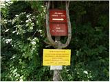 2
2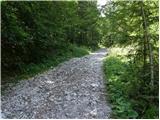 3
3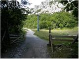 4
4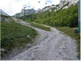 5
5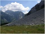 6
6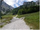 7
7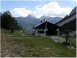 8
8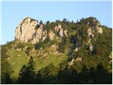 9
9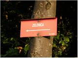 10
10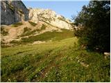 11
11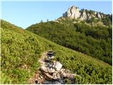 12
12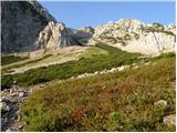 13
13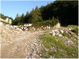 14
14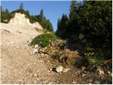 15
15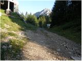 16
16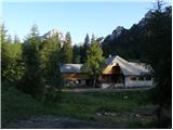 17
17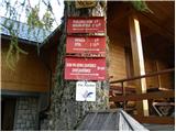 18
18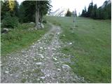 19
19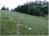 20
20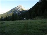 21
21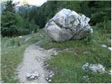 22
22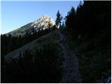 23
23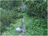 24
24 25
25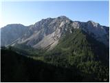 26
26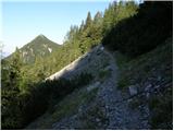 27
27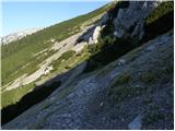 28
28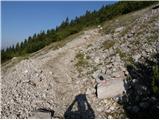 29
29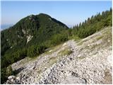 30
30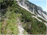 31
31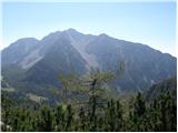 32
32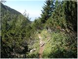 33
33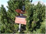 34
34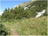 35
35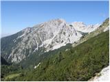 36
36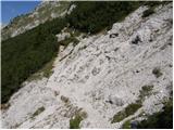 37
37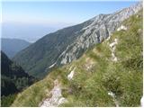 38
38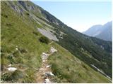 39
39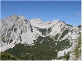 40
40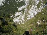 41
41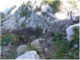 42
42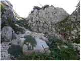 43
43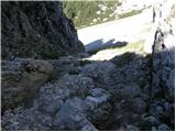 44
44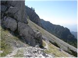 45
45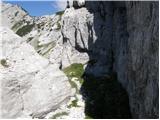 46
46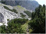 47
47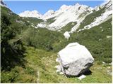 48
48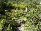 49
49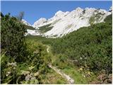 50
50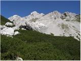 51
51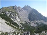 52
52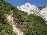 53
53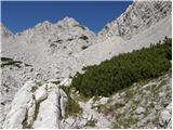 54
54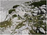 55
55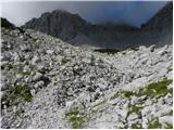 56
56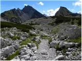 57
57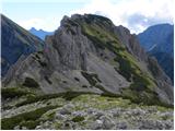 58
58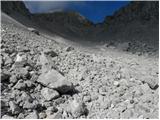 59
59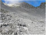 60
60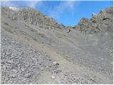 61
61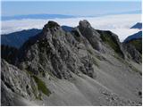 62
62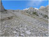 63
63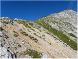 64
64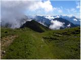 65
65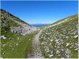 66
66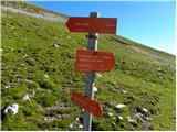 67
67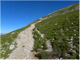 68
68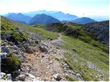 69
69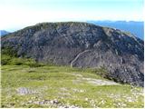 70
70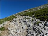 71
71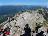 72
72 73
73
Discussion about the trip Ljubelj - Hochstuhl/Stol (upper way)
|
| Gost8. 11. 2006 |
Super trip, the ascent over the last scree is a bit strenuous
|
|
|
|
| BraJan21. 05. 2007 |
On Saturday I went along this path. Indeed, except for the last scree field the path is very easy, a beautiful walk. On the scree there is still snow and you have to be careful not to slip.
|
|
|
|
| Gost25. 06. 2007 |
Yesterday we were at Stol and took this path. Wonderful path that offers us in this season a colorful world of alpine flowers. The summit is also fairy-tale like. The path is not difficult, but quite long.
|
|
|
|
| Gost26. 06. 2007 |
Even nicer is on Vrtača or Palec. And do you know why? Because there are much fewer people and you really rest your soul and heart. Especially the path to Palec is very solitary and if you catch the right time when the gentians are blooming... Nice paths and good luck on these trails!
|
|
|
|
| Gost25. 07. 2007 |
Today I went to Stol from the direction of Ljubelj-Upper path-Stol. The path itself wouldn't be all that demanding, only yesterday's hail made walking a bit harder. On the path along the entire slope of Vrtača there were 4 cm of frozen hail in the morning, a fairly cold wind was blowing, but the return was completely different. There were almost no traces of hail, the sun warm, the wind pleasantly refreshing. I took 3 hours and 40 minutes to Stol, and 3 hours back.
|
|
|
|
| čebelica13. 08. 2007 |
The ascent on the last scree is quite strenuous, otherwise the path is relatively easy and you pass it quickly. Careful in the rain - today it soaked us several times. For descent we chose the lower path, which I don't recommend in the rain because it's completely muddy and hard to pass. Those who want to take the chairlift to Zelenica - in summer it runs only on Saturdays, Sundays and holidays from 7 to 10 am.
|
|
|
|
| mgl8. 07. 2010 |
Does anyone know if there are any cows or mad bulls along the upper path at this time? I have bad experiences!
|
|
|
|
| janav8. 07. 2010 |
Zelenica - Stol, upper path; we walked it on 25.6 and there was neither sight nor sound of cows and bulls...
|
|
|
|
| urbann21. 11. 2010 |
How is this path in winter regarding hazards?
|
|
|
|
| klm21. 11. 2010 |
avalanche upon avalanche...
|
|
|
|
| planinka eva8. 08. 2012 |
Today I was on Stol. Super interesting path the ascent over the last scree is not too strenuous, the descent is excellent the ascent over the last scree is not too strenuous, the descent is excellent
|
|
|
|
| Lalika18. 08. 2012 |
Today we went to Stol via this path. The path is beautiful and picturesque, but quite long. Along the path I was surprised by a rather uncomfortable descent, which by the pictures would be after picture 35. It's a quite narrow gully, the path full of scree. This part was the hardest and most uncomfortable for me (the scree slope is much easier). Judging by the pictures, I even think there may have been a path collapse here. The path descriptions on this site are excellent, so I think the author would have pointed out this uncomfortable section.
|
|
|
|
| otiv18. 08. 2012 |
@Lalika to avoid the gully that caused you problems we choose the lower path, which later joins the upper path.
|
|
|
|
| as778019. 08. 2012 |
Does anyone know about the Zelenica chairlift in summer? Does it run on weekends and until when (also in September)?
|
|
|
|
| serajko19. 08. 2012 |
hi
Yesterday it ran from 7-9:30. I don't have other data. Call the hut at Zelenica, and you'll get exact info
|
|
|
|
| B.Smart18. 07. 2013 |
Yesterday I walked the described trail and find it really nice. At this time lots of flowers and consequently flying insects. Haven't seen so many butterflies for a long time. The trail despite its length is not strenuous, only the last scree can be quite slippery and tiring in places. That descent before joining the lower trail is really very steep, but if you're careful, there shouldn't be a problem. Don't know how it is when wet. From Stol I descended along the scenic trail to Valvasorjev dom, where a colleague picked me up and drove me back to the car at Ljubelj. From Ljubelj to Stol took 3 hours and 30 min. I definitely recommend the trail. Good luck and safe steps in the mountains 
|
|
|
|
| nena3119. 10. 2013 |
Long, but wonderful path, especially in autumn when everything is colorful. On the way back there are even more blueberries, if you find them
And one very steep section uphill
|
|
|
|
| anya.raikkonen18. 07. 2014 |
What is the path like if we descend from Vrtača towards Stol? Or do we have to go back to the starting point and then along this upper path?
|
|
|
|
| klm19. 07. 2014 |
If you are descending from Vrtača and intend to continue towards Stol, it is best to descend only to the small saddle (that is, to the place where the trail turns sharply left), there a small path branches off to the right, which descends across the scree under the Grad (the western ridge of Vrtače) towards the Belščica saddle. From the saddle transversely under Jelenček and Celovška špica and upward across the scree towards Stol. The shortest approach.
|
|
|
|
| sirt119. 07. 2014 |
anya-see the description of the path Ljubelj-Stol (via Vatelca or Skleda)
|
|
|
|
| zalkica123. 08. 2019 |
Is the path suitable for dogs? My dogs are fit, just wondering if there's any climbing section where I'd have to lift them.. can one manage? Thanks
|
|
|
|
| Kompot24. 08. 2019 |
A few years ago my dog walked it without problems, but it's a whippet breed.
|
|
|
|
| zalkica124. 08. 2019 |
Great, many thanks... last time I got stuck, it didn't look that bad from the pictures, then I had to lift them several times over rocks... all three of us were exhausted thanks and have a nice day
|
|
|
|
| biba27. 07. 2020 |
In the steep gully, there is also a steel cable on the right wall when descending.
|
|
|
|
| mikkeni27. 06. 2021 11:47:19 |
Is the path dry from Ljubelj?
|
|
|
To post a comment you must log in:
If you do not yet have a username, you must first
register.