Trate / Johannsenruhe - Hochstuhl/Stol (via Klagenfurter Hütte)
Starting point: Trate / Johannsenruhe (1152 m)
| Latitude/Longitude: | 46,4701°N 14,1562°E |
| |
Route name: via Klagenfurter Hütte
Walking time: 3 h 45 min
Difficulty: partly demanding marked way
Elevation gain: 1084 m
Elevation difference along the route: 1175 m
Map: Karavanke - osrednji del 1:50.000
Recommended equipment (summer):
Recommended equipment (winter): ice axe, crampons
Views: 31.686
 | 2 people like this post |
Access to starting point:
A) Through the Karawanks Tunnel, we drive into Austria, then continue on the motorway towards Beljak, which we leave at the first exit. From the point where we left the motorway, we follow the signs for the village Šentjakob v Rožu / Sankt Jakob im Rosental. When we arrive in the mentioned village, we drive on the main road past Podgorje / Maria Elend and the settlement Sveče / Suetschach to the settlement Bistrica v Rožu / Feistritz im Rosental, where before the stores Billa and Penny we turn right in the direction of the valley Rute / Bärental. About 100 m after we leave the main road, we continue left, then on a somewhat narrower and ascending road we drive to a large parking lot (the parking lot is located near the meadow named Trate / Johannsenruhe). From the Penny store to the starting point there is approximately 9 km of narrower asphalt road, macadam only in the last part. From the entrance to the Karawanks Tunnel to the starting point there is approximately 38 km.
B) Through the Ljubelj border crossing we drive into Austria, where on the main road towards Celovec / Klagenfurt am Wörtersee we drive to the second roundabout, from which we continue driving in the direction of the exit Bistrica v Rožu / Feistritz im Rosental (we leave the main road towards Celovec before we cross the Drava River). In the mentioned settlement, immediately behind the stores Billa and Penny we turn left onto the road in the direction of the valley Rute / Bärental. About 100 m after we leave the main road, we continue left again, then on a somewhat narrower and ascending road we drive to a large parking lot (the parking lot is located near the meadow named Trate / Johannsenruhe). From the Penny store to the starting point there is approximately 9 km of narrower asphalt road, macadam only in the last part. From the entrance to the Ljubelj Tunnel to the starting point there is approximately 32 km.
C) From Dravograd or Slovenj Gradec we drive to Ravne na Koroškem, then continue driving in the direction of the Holmec border crossing. When we enter Austria, we first drive towards Pliberk / Bleiburg, then follow the signs for Globasnica / Globasnitz and further Železna Kapla / Bad Eisenkappel, Borovlje / Ferlach. After Borovlje, at the roundabout we join the road via the Ljubelj border crossing. Here, at the first roundabout we continue in the direction of Celovec / Klagenfurt, at the second in the direction of Bistrica v Rožu / Feistritz im Rosental. In the mentioned settlement, immediately behind the stores Billa and Penny we turn left onto the road in the direction of the valley Rute / Bärental. About 100 m after we leave the main road, we continue left again, then on a somewhat narrower and ascending road we drive to a large parking lot (the parking lot is located near the meadow named Trate / Johannsenruhe). From the Penny store to the starting point there is approximately 9 km of narrower asphalt road, macadam only in the last part. From the Holmec border crossing to the starting point there is approximately 71 km.
Route description:
At the beginning of the parking lot, between the road closed with a barrier and the parking lot, we will notice the beginning of the marked path that leads towards Celovška koča / Klagenfurter Hütte, Stol, Svačica, Ovčji vrh / Geissberg and other destinations. Further ahead, the marked path is joined by an unmarked path that leads from the upper part of the parking lot, and we join the macadam road a few steps further that leads towards the already mentioned mountain hut. The road then leads us through the bed of a torrent and a little further brings us out of the forest onto a meadow (Trate / Johannsenruhe), which is only a few minutes from the starting point. From the meadow a beautiful view opens up, and the road then returns into a belt of forest. When the forest temporarily thins, in a gentle left bend an unmarked "shortcut" continues straight ahead. We continue on the road, where a yellow mountain sign also directs us. Only about a minute further, the "main" road turns right, the "side" one continues straight. From the mentioned junction, we continue on the footpath that runs between both roads and further ascends with the road that leads towards Celovška koča. For some time we ascend transversely across occasionally steeper slopes, then return to the wider macadam road. Further on, the marked path crosses the road a few more times, then at a larger rock or boulder with memorial plaques it splits into two parts.
To the right leads the climbing path to Stol, while we continue straight in the direction of Celovška koča. The path further crosses the road a few more times, higher it brings us from the occasionally sparse forest onto the grazing slopes of Mačenska planina / Matschacher Alm (the huts on the pasture are a few minutes to the left from the marked path). From here follows a slight ascent, and the path or road takes us to Celovška koča in a few minutes.
From the hut we head right in the direction of Stol / Hochstuhl, Svačica / Bielschitza and Prešernova koča, continuing on a gentle cart track that lower down turns into a mountain path, which through a belt of dwarf pines brings us to the screes below Svačica. The path ahead ascends transversely across the first scree, then brings us to a short steep section where a steel cable assists us during the crossing. The short and technically not particularly demanding section of the path ends quickly, and the path continues across the scree via a wide and well-maintained trail. With a view of the surrounding walls, we then ascend without major difficulties to the saddle Belščica, where there is a marked junction.
From the saddle Belščica, from where the path to Svačica branches left, we continue straight ahead towards Vrtača, Prešernova koča and Zelenica. For a few minutes we cross grassy slopes, then arrive at the point where the path to Vrtača branches left, and we continue straight downhill. The path ahead first descends steeply down the gully, then turns right, transitioning to expansive screes across which it ascends transversely. Higher up we leave the scree and descend slightly to the nearby junction, where the upper and lower paths as well as the path from Završnica join us.
Here we continue straight, and the path from the small valley between Srednja peč 1920 m (Srednja peč is a less known peak on the left) and the ridge Orlice (Orlice is a harder-to-access ridge between the saddle Belščica and Stol) gradually transitions onto a larger scree, across which we ascend transversely to the right, then the path gradually enters a steeper valley between Mali Stol on the left and Stol on the right. Here the path ascends steeply, then gradually flattens and brings us to a marked junction, where the path to the nearby Prešernova koča branches left (5 minutes), and we continue right, ascending to the highest peak of the Karawanks in 10 minutes of further walking.
Starting point - Celovška koča 1:30, Celovška koča - Stol 2:15.

Photos:
 1
1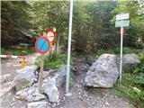 2
2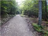 3
3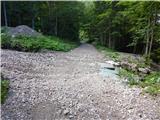 4
4 5
5 6
6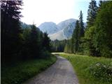 7
7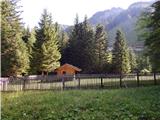 8
8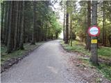 9
9 10
10 11
11 12
12 13
13 14
14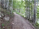 15
15 16
16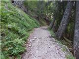 17
17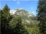 18
18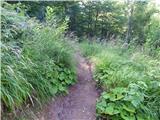 19
19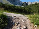 20
20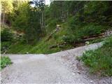 21
21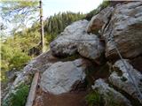 22
22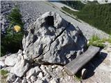 23
23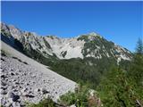 24
24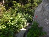 25
25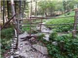 26
26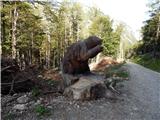 27
27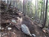 28
28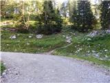 29
29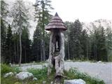 30
30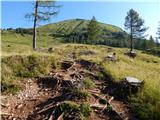 31
31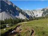 32
32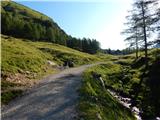 33
33 34
34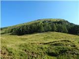 35
35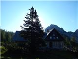 36
36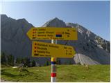 37
37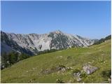 38
38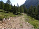 39
39 40
40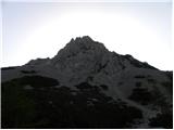 41
41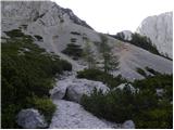 42
42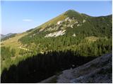 43
43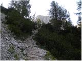 44
44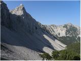 45
45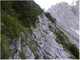 46
46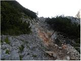 47
47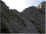 48
48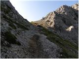 49
49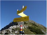 50
50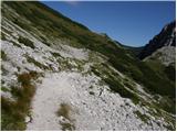 51
51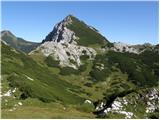 52
52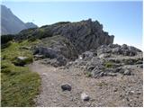 53
53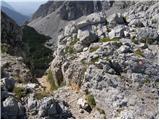 54
54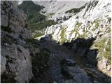 55
55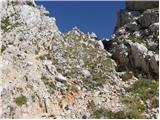 56
56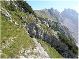 57
57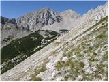 58
58 59
59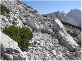 60
60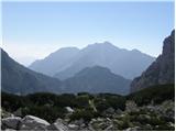 61
61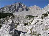 62
62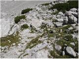 63
63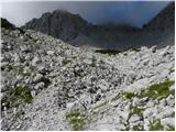 64
64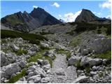 65
65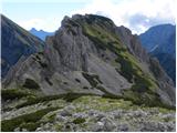 66
66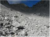 67
67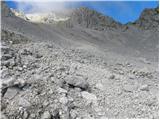 68
68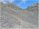 69
69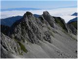 70
70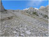 71
71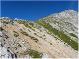 72
72 73
73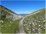 74
74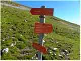 75
75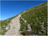 76
76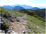 77
77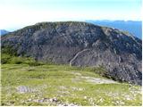 78
78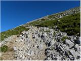 79
79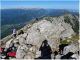 80
80 81
81
Discussion about the trip Trate / Johannsenruhe - Hochstuhl/Stol (via Klagenfurter Hütte)
|
| grahlck1. 12. 2008 |
Nice hike. I'm interested if someone can tell me something about the climbing route to Stol and if they have any pictures. Thanks.
|
|
|
|
| grahlck2. 12. 2008 |
Thank you very much. Grahlck
|
|
|
|
| zlatorog3. 12. 2008 |
We went via the climbing route at the beginning of September and it is one of the better hikes, unfortunately the second half towards the top was in fog.
The most demanding part is right at the beginning, then only locally more exposed. The route is excellently secured; highly recommended (of course with appropriate weather and equipment!!)
Best regards!
|
|
|
|
| klavdipo21. 06. 2010 |
Is the Celovška hut open also during weekdays?
|
|
|
|
| klavdipo21. 06. 2010 |
Ben, thanks!
Best regards
|
|
|
|
| VanSims26. 06. 2010 |
Just a short addition to the description: When we cross Sedlo Belščica to the Slovenian side, we go right. There we see an arrow on the rock and the inscription 'Vrtača'. DO NOT go there! On our right we spot only rocks. Yes, yes, we have to descend those rocks. The markings are a bit sparse. When descending the rocks, we don't go all the way to the bottom but look to the right and when we see the marking we go right too, then along the path that crosses a short scree in about 10 min we reach the path from Zelenica. There then right and continue as per the description.
I would have almost missed it and gone towards Vrtača... 
|
|
|
|
| acjom21. 07. 2010 |
Is the climbing path to Stol still closed?
|
|
|
|
| acjom21. 07. 2010 |
Thanks, but since I don't understand German at all, please still provide a response, thanks
|
|
|
|
| Tadej21. 07. 2010 |
It says the path is open again from today. lp
|
|
|
|
| Fred Derik12. 08. 2025 12:30:37 |
We did this trail on Sunday, August 10, 2025. The description of access to the starting point and the trail itself is correct, but it doesn't really prepare you for what's waiting. It applies to both, the road to the parking lot and the section of the trail from the junction to Vrtača to the top of Stol. The last, three-kilometer gravel section of the road to the parking lot is in quite a desperate condition, at several places you literally have to stop and crawl at snail's pace over deep potholes and transverse ditches. By the way, the asphalt section is also full of insidious potholes, so extreme caution is needed there already if you don't want to completely destroy your undercarriage. As for the trail itself, it is hiker-friendly to Celovška koča, a bit further from the hut, on the ascent to the Belščica saddle, the nasty scree fields begin. Which you curse even more inappropriately during the descent. At the junction before the short descent (left to Vrtača, steeply down to Stol) someone broke the signpost, which confuses the hiker, because the continuation of the trail, the steep descent, is not exactly intuitive. The worst hour of walking awaits you only after the short steep descent, first crossing endless rough scree fields, where sometimes among rocks and stones it's hard to find the right path, at the end of the valley then a steep ascent on the bare slope, which offers little grip neither for hands nor for feet and is a real nightmare on the return. The label 'partly demanding marked trail' is probably quite correct, because there is very little climbing, even fewer technically demanding sections, but as said, it is at the same time also a bit misleading, because the terrain for walking is very demanding.
|
|
|
To post a comment you must log in:
If you do not yet have a username, you must first
register.