Zavrh / Hintergupf - Matzen (via St. Anna)
Starting point: Zavrh / Hintergupf (940 m)
| Latitude/Longitude: | 46,5199°N 14,3938°E |
| |
Route name: via St. Anna
Walking time: 3 h
Difficulty: difficult marked way
Elevation gain: 687 m
Elevation difference along the route: 745 m
Map: Karavanke - osrednji del 1:50.000
Recommended equipment (summer):
Recommended equipment (winter): ice axe, crampons
Views: 2.919
 | 1 person like this post |
Access to starting point:
From the highway Ljubljana - Jesenice, we take the exit Ljubelj (Tržič), then continue driving in the direction of Celovec / Klagenfurt. After the Ljubelj tunnel, the road starts descending, and we follow it to the intersection, where the road slightly to the right and downwards towards the settlement Borovlje / Ferlach branches off. The road, which is still descending, quickly brings us to the mentioned settlement, where we soon cross the railway track. Just a little after the track, we join another road, which we follow to the left; we drive along it only a few 100 m, then turn right in the direction of Železne Kaple / Bad Eisenkapel. At the end of Borovlje, we arrive at a roundabout, from which we again continue in the direction of Železne Kaple. We continue driving through the villages Medborovnica / Unterferlach, Ostrovca / Ostrouza, Trata / Tratten, Glinje / Glainach, Vesca / Dörfl, Ždovlje / Seidolach, Dobrova / Dobrowa to the settlement Kočuha / Gotschuchen, where we turn right in the direction of the hamlet Zavrh / Hintergupf. From the point where we leave the main road, we start ascending more steeply along first still asphalt, higher on a well-maintained macadam road. Just before the hamlet Zavrh, we arrive at a smaller intersection, where we continue right and drive to the hamlet, in the middle of which we notice hiking signposts. From the signposts and nearby houses, we drive along the road a few 10 meters further and then park in a suitable place by the road.
We can also reach the starting point from the direction of Železne Kaple and Koroška.
Route description:
From the place where we parked, we return to the nearby houses, from there we continue on the marked path no. 636. The path first ascends next to the house, then behind it passes onto a grassy cart track, which gently ascends along the edge of a larger meadow. On the other side of the meadow, the path goes into the forest and continues gently ascending for a few more minutes, then turns right and temporarily ascends somewhat more steeply. During the ascent, we cross a few cart tracks, then join a poorer forest road, which we follow to the left. Further on, we walk for some time along the gentle road, along which we eventually arrive at a smaller intersection, where we continue right (also possible straight ahead along the unmarked shortcut - a beaten path that is approximately 5 minutes shorter than along the road). A short descent follows, then the road turns sharply left and gently ascends to the place where we join a wider macadam road. We follow the mentioned road uphill, ascending along it to the saddle Koce / Hansenruhe, where there is a marked junction.
Here, furthest left the road continues towards the Borovniško dammed lake, left paths lead towards Javornik / Jauernig and further towards the summit Setiče / Freiberg, straight ahead the path continues, descending to Bajdiše / Waidisch, while we continue sharply right onto the marked path towards the summit Macna / Matzen.
The path ahead leads past a resting place (table and two benches) and continues along the initially gentle ridge. A little further on, the marked path splits into two parts, and we continue along the right path in the direction of the church of St. Ana / St. Anna and Macna past St. Ana (slightly left Macna - direct path).
From the junction onwards, the path quickly passes onto the northeastern slopes of Macna, across which it begins to ascend transversely. We continue through the forest, only on the section where we pass onto the steeper and unvegetated slope does a beautiful view open towards the Drava River and surrounding mountains. The path quickly returns to the forest, which a few minutes further brings us to the church of St. Ana, from which a beautiful view opens.
Before the church of St. Ana, we continue left and ascend through the forest onto the ridge of Macna. The path ahead continues along the partly vegetated ridge and initially only gently ascends. A short steep ascent follows, where we pass from the right side of the ridge to the left side, then cross the slopes for some time, but soon return to the ridge, which we reach at a sort of notch. Here, a short secured but not overly difficult path branches off to the right to the side subpeak of Macna, from which a beautiful view opens. The marked path continuing towards Macna does not turn onto the mentioned subpeak but continues slightly left, where we first ascend with the aid of a steel cable, then the path levels out and turns left onto steep slopes. Even over the steep section, the steel cable assists us; at the end of the traverse, the path turns right and begins a very steep ascent along the steel cable. The steep section is short, as the path quickly brings us to the cross on the northern subpeak of Macna. Here the path turns left and quickly brings us via the slightly vegetated ridge to the highest and unvegetated summit of Macna.

Photos:
 1
1 2
2 3
3 4
4 5
5 6
6 7
7 8
8 9
9 10
10 11
11 12
12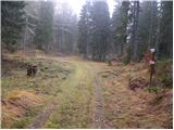 13
13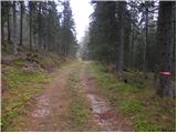 14
14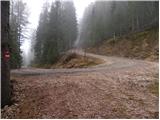 15
15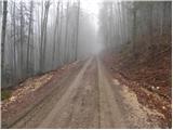 16
16 17
17 18
18 19
19 20
20 21
21 22
22 23
23 24
24 25
25 26
26 27
27 28
28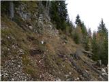 29
29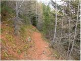 30
30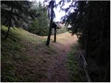 31
31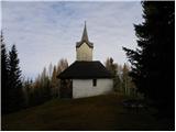 32
32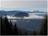 33
33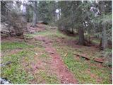 34
34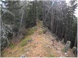 35
35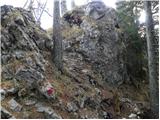 36
36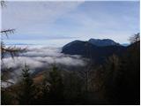 37
37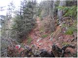 38
38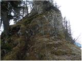 39
39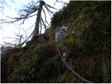 40
40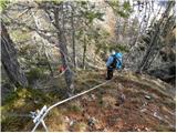 41
41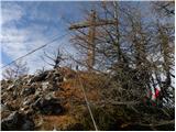 42
42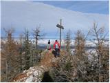 43
43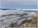 44
44 45
45 46
46 47
47
Discussion about the trip Zavrh / Hintergupf - Matzen (via St. Anna)
To post a comment you must log in:
If you do not yet have a username, you must first
register.