Erjavčeva koča na Vršiču - Slemenova špica
Starting point: Erjavčeva koča na Vršiču (1525 m)
| Latitude/Longitude: | 46,4391°N 13,7483°E |
| |
Walking time: 1 h 25 min
Difficulty: easy marked way
Elevation gain: 386 m
Elevation difference along the route: 430 m
Map: Kranjska Gora 1:30.000
Recommended equipment (summer):
Recommended equipment (winter): ice axe, crampons
Views: 46.828
 | 3 people like this post |
Access to starting point:
From Kranjska Gora on the road which leads over the Vršič pass we drive towards Bovec or vice versa. Between the 22nd and 23rd hairpin turn of the Vršič road we will get to the parking lot below the Erjavčeva koča, where we park.
Route description:
From the mountain hut Erjavčeva koča na Vršiču or from the parking lot at the mountain hut we first carefully cross the main road, then continue on the footpath in the direction of Slemenova špica, Mala Mojstrovka via Hanzova path and Dom v Tamarju. The wide and well-beaten, mostly rocky path then first ascends to the last serpentine on the Kranjska Gora side, where it turns a little to the right and continues relatively steeply ascending. During the ascent the path leads us through belts of dwarf pines and among rare larches. With nice views of the Špik group, Škrlatica, Prisojnik, Vršič... we soon reach the junction, where we join the even more visited path from Vršič pass.
Here we continue right and past the viewpoint a few meters away in a few minutes we ascend to the saddle Vratca (1799 m), where there is the next marked junction.
Left continues the secured climbing path to Mala Mojstrovka and unmarked path towards Sleme, to the right branches off unmarked but well-beaten path towards Prednje Robičje, straight ahead continues the ordinary path towards Sleme and Slemenova špica.
Follows a short part of the path where we cross the slopes below Prednje Robičje, then the path gradually starts to descend towards the slopes above Mala Pišnica valley. When we reach the mentioned slopes the path turns left, then continues with some shorter ascents and descents. In dry conditions the undemanding path brings us a little further to the junction, where from the right joins the marked path from Tamar through Grlo and also unmarked path through Mala Pišnica.
We continue in the direction of Slemenova špica on the path which still crosses slopes high above Mala Pišnica. With nice views which reach all the way to nearby Italy and Austria we soon arrive at the slopes of Slemenova špica, where the slope but not the path flattens. Follows a short ascent, then we arrive at the poorly marked junction, where we continue slightly right (straight leads the path towards Tamar - path past Črnih vod (even if we continue straight it is still possible to reach Slemenova špica)). After a few minutes of further ascent the path completely flattens, and in front of us we see smaller lakes and the view known to all towards Jalovec. We bypass the lakes on the right side, or wherever we wish, then past the stamp box in a few minutes we ascend to the panoramic and precipitous summit of Slemenova špica.

Along the route: Vratca (1799m)
Photos:
 1
1 2
2 3
3 4
4 5
5 6
6 7
7 8
8 9
9 10
10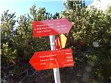 11
11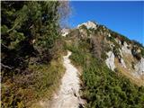 12
12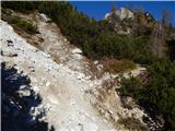 13
13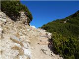 14
14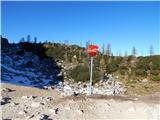 15
15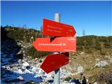 16
16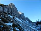 17
17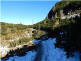 18
18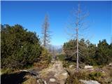 19
19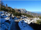 20
20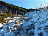 21
21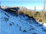 22
22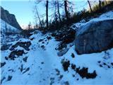 23
23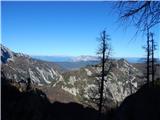 24
24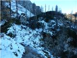 25
25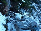 26
26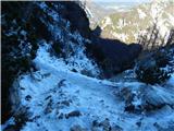 27
27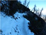 28
28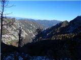 29
29 30
30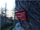 31
31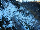 32
32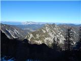 33
33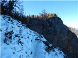 34
34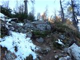 35
35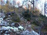 36
36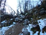 37
37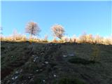 38
38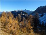 39
39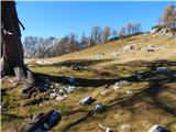 40
40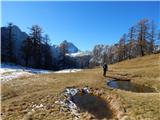 41
41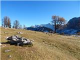 42
42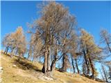 43
43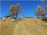 44
44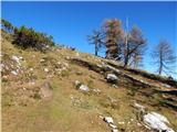 45
45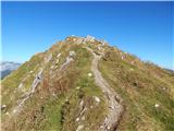 46
46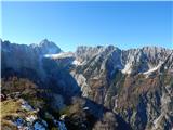 47
47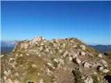 48
48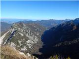 49
49
Discussion about the trip Erjavčeva koča na Vršiču - Slemenova špica
|
| Matjaz_6524. 12. 2016 |
a few more of my photos 
I returned via the path below the north face of Mala Mojstrovka and Šitna glava 
|
|
|
|
| Nordung11. 09. 2018 |
Attention, when approaching the hairpin bend, turn left (towards the road) and there the path continues. This bend is not marked, so you might mistakenly go straight and get stuck in the unpleasant torrent bed. Another warning: the path towards the end is roughly changed. It goes between strange rocks that not everyone can manage. This part is not EASY. Interestingly, this part of the path is not in the photos, even though it's essential!
|
|
|
|
| KatkaV17. 10. 2018 |
Thanks for that note that you need to go to the road, it really looks like the path leads to the torrent.
A bit of caution is really needed in those rocks when the ground is slippery, otherwise, given the number of visitors of all age groups, the path is by no means insurmountable.
And the info could be updated that the summit logbook and stamp are at the very top, which has an altitude of 1909m at least that's what it says on the stamp, not 1911m.
|
|
|
|
| trdi18. 10. 2018 |
That section between the rocks replaces the old section where there used to be a fixed rope that broke into the valley a few years ago. In the wet, you do need to use your hands a bit, but nothing terribly difficult, so that no one gets scared now. Generally speaking, the path is still an easy marked path.
|
|
|
|
| J.P.12. 07. 2020 |
Beautiful corner of nature. Be careful at the bend mentioned by Nordung. LP
|
|
|
|
| orchigu2. 09. 2021 22:38:11 |
Hiked today. Nordung is right, need to watch that shortly after the start we don't stray into the torrent gully, I'd add that somewhere on the path where a path joins from the left (from Vršič probably?) a sign is missing. There we continue right, but I think no one would get lost here. The start is somewhat crumbly and slippery, so at the beginning we struggle a bit and scrape our knees, the path further on is almost like a fairy-tale walk at Erjavčeva koča (at least for now) no need to pay for parking :P at the top in the box there's no summit log, just lots of trash  otherwise a wonderful trip with phenomenal views otherwise a wonderful trip with phenomenal views
|
|
|
To post a comment you must log in:
If you do not yet have a username, you must first
register.