Dule - Grmada on Mala gora
Starting point: Dule (550 m)
| Latitude/Longitude: | 45,8405°N 14,6755°E |
| |
Walking time: 2 h
Difficulty: easy marked way
Elevation gain: 337 m
Elevation difference along the route: 400 m
Map:
Recommended equipment (summer):
Recommended equipment (winter):
Views: 5.427
 | 2 people like this post |
Access to starting point:
A) From Ljubljana, we drive towards Kočevje or vice versa. Only about a kilometer after (from the direction of Kočevje before) Velike Lašče we will get to a crossroad, where we turn left towards the village Zgornje Retje (from the direction of Kočevje right). The road then through a narrow overpass over the railway track brings us to a crossroad, where we continue left (right Zgornje Retje). Only a little further, we come to the next crossroad, where we continue right upwards on a macadam road. We follow this road approximately 3 km to a crossroad, where we notice signs for Kamen vrh. We park on one of the parking lots by the road near the crossroad.
B) From the highway Ljubljana - Novo Mesto we go to the exit Grosuplje (from Ljubljana direction possible also to the exit Cikava), and then we continue driving towards the center of Grosuplje. From Grosuplje we continue driving in the direction of Veliko Mlačevo, Mala and Velika Račna and Videm. From Veliko Mlačevo we continue right (straight Lobček and Luče), and then we continue driving towards Videm, and we drive along it to the settlement Zdenska vas, where we first turn right in the direction of the settlement Videm, and some 10 meters further once again right towards the settlement Rašica. The road then leads us through part of the settlement Cesta and continues by the railway track to the settlement Predstruge, where at the crossroad at the end of the settlement, we continue straight (left Videm, right Rašica) on a road that is at first still asphalt, which later becomes macadam and starts ascending through the forest. When higher we get to a somewhat bigger crossroad, where we notice the sign for Kamen vrh, we park on an appropriate place by the crossroad.
Route description:
From the crossroad, we don't continue on the road in the direction of Kamen vrh, but we return a few meters on the road to a marked mountain path which leads from Ponikve towards Kamen vrh (if we came from Predstruge we continue on the right road). The marked footpath immediately goes into the forest and is at first only gently ascending. The path, which is occasionally a little harder to follow, higher joins the cart track, on which we continue the ascent. The cart track, which gradually starts ascending more steeply, higher changes into a footpath, on which in a few minutes of additional walking we ascend to Kamen vrh, and from there in some 10 strides we descend to the mountain hut.
From the mountain hut, we continue on a worse macadam road which starts slightly descending. The mentioned road we follow only some 10 meters, then a signpost for Grmada points us left on a footpath. After a few steps of additional walking, we get to a poorly marked crossing, where we continue right (slightly left Podgora).
The path, which is still slightly descending, soon brings us to a forest road which we follow to the nearby crossroad. From the crossroad, we continue on the right road and follow it to the spot where a signpost points us left into a dense forest. Further, we ascend on the path which higher brings us to a panoramic grassy slope. A poorly visible and occasionally very badly marked path then turns a little more to the right, where we come to a wide meadow. In the middle of the mentioned meadow, the marked path turns left into the forest (access to Grmada is possible also on a cart track which leads straight), along which in a few minutes of a little steeper walking we ascend to the summit of Grmada.
The entire path, and especially the part of the path from Kamen vrh to Grmada, is orientationally difficult.

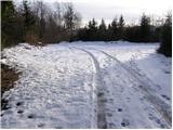
Photos:
 1
1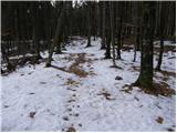 2
2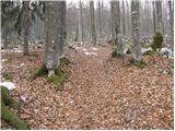 3
3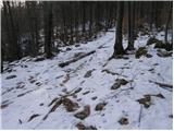 4
4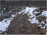 5
5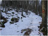 6
6 7
7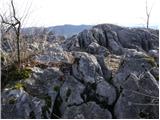 8
8 9
9 10
10 11
11 12
12 13
13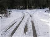 14
14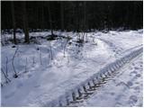 15
15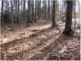 16
16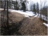 17
17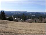 18
18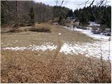 19
19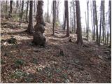 20
20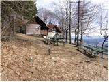 21
21 22
22
Discussion about the trip Dule - Grmada on Mala gora
|
| gustavs18. 04. 2017 |
On 14.4.2017 I ran the above described trail as part of the run Grosuplje - Ponikve - Kamen vrh - Grmada - Stene Sv. Ane - Ribnica.
The fear of getting lost was completely unnecessary, as the trail is very well and visibly marked in most parts. My experience is thus for the direction from Grosuplje towards Ribnica, I cannot confirm the reverse direction.
I had only 3 orientation difficulties:
1. From Ponikve onwards there is a junction of gravel trails on the meadow where it is not entirely clear which is the right one (the right one is the middle one, so simply go straight ahead).
2. On the meadow just before the ascent to Grmada (as described above "poorly visible and occasionally very poorly marked trail") I lost track of the blazes and followed the gravel trail south-east instead of turning to the right trail eastwards. That's why I arrived at the village Vrh pri Poljanah which lies a bit below Grmada.
3. After descending from Grmada I missed the blazes towards Stene Sv. Ane and followed the blazes to Ortnek. Since I saw the mistake on the map (mobile phone) after arriving at the asphalt road I went a little north and then on the gravel trail eastwards.
However, in all cases I attribute the orientation difficulties to myself (due to running, reduced attention to surroundings). At hiking pace I would probably have seen the blazes.
|
|
|
To post a comment you must log in:
If you do not yet have a username, you must first
register.