Drežnica - Batognica (south way)
Starting point: Drežnica (553 m)
| Latitude/Longitude: | 46,2555°N 13,617°E |
| |
Route name: south way
Walking time: 4 h 50 min
Difficulty: easy marked way
Elevation gain: 1611 m
Elevation difference along the route: 1611 m
Map: Julijske Alpe - zahodni del 1:50.000
Recommended equipment (summer):
Recommended equipment (winter): ice axe, crampons
Views: 306
 | 1 person like this post |
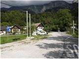
Access to starting point:
From Tolmin or Bovec we drive to Kobarid, from there we follow the road in the direction of Drežnica (the turn-off is from the Kobarid bypass). We continue across the bridge over the Soča River and immediately after the bridge we turn left in the direction of Drežnica. We then follow this mostly ascending road to the center of Drežnica, where we turn right and drive on to the primary school, which is the starting point of our path.
Route description:
From the parking lot, we head past the chapel and primary school onto the marked path to Krn. Further on, the path leads us through the forest and then past the pasture to the Triglav National Park sign. Here, the path along the road (from Drežnica) also joins, but we continue on the marked path, which a little higher crosses the Ročica stream, after which we arrive at the marked junction, where we continue right in the direction of the easier path to Krn (left bivouac and very demanding path to Krn).
The path continues through the forest and is well marked throughout. Higher up, an unmarked path from Podbrdo joins from the right, but we continue left and gradually begin to ascend in zigzags. For some time we ascend relatively steeply, then we reach a small clearing where a hunting hut stands.
From the hunting hut onward, the path begins to ascend below the slopes of Kožljak (1587 m) and soon turns slightly to the left. Higher up, the path takes us out of the forest and beautiful views open up toward Drežnica and Krasji vrh (1773 m). Further on, the path crosses fairly steep slopes for some time, then turns slightly to the right and joins the path from the Kuhinja pasture.
Here we continue left toward Krn and proceed with the ascent along the old military mule track, which at first still runs along the steep western slopes, then gradually climbs onto the Krn plateau, where the slope becomes less steep.
On this section, from the usual path toward Krn we turn onto the path leading toward Krnska škrbina.
Further on, we ascend mostly transversely to the right in a few hairpin turns across the Krnska plošča; as the path approaches Krnska škrbina, the slope becomes quite steep, but the path remains fairly wide. Further on, the slope becomes slightly less steep, but the path becomes steeper and climbs to the junction at Krnska škrbina, from where a beautiful view opens toward the north.
Here we continue on the right path toward Batognica (left Krn, straight down Krnsko jezero), which becomes technically more demanding. The path leads us along an exposed route with the aid of steps along the precipitous southern slopes of Batognica. In wet conditions or snow, there is a great risk of slipping. A few meters below the summit, the path flattens and brings us to the top without major difficulties.
Drežnica - Krnska škrbina 4:30, Krnska škrbina - Batognica 0:20.

Along the route: Krnska škrbina (2058m)
Photos:
 1
1 2
2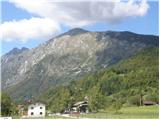 3
3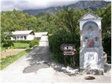 4
4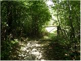 5
5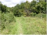 6
6 7
7 8
8 9
9 10
10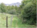 11
11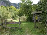 12
12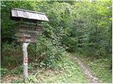 13
13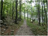 14
14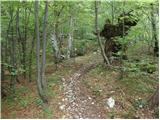 15
15 16
16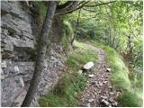 17
17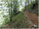 18
18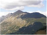 19
19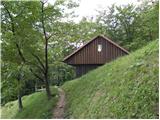 20
20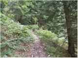 21
21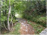 22
22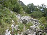 23
23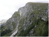 24
24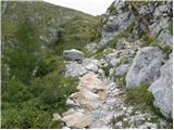 25
25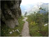 26
26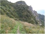 27
27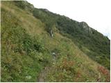 28
28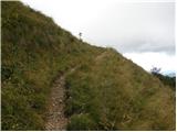 29
29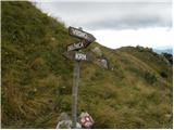 30
30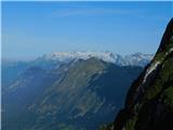 31
31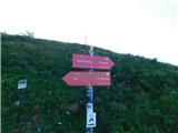 32
32 33
33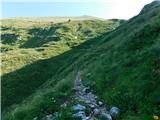 34
34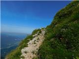 35
35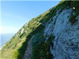 36
36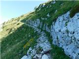 37
37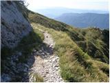 38
38 39
39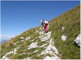 40
40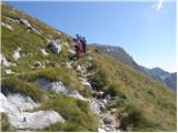 41
41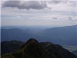 42
42 43
43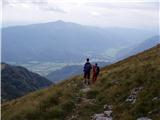 44
44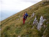 45
45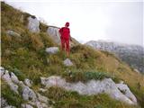 46
46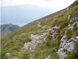 47
47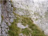 48
48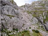 49
49 50
50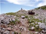 51
51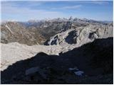 52
52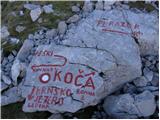 53
53 54
54 55
55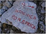 56
56 57
57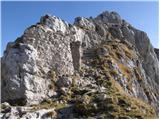 58
58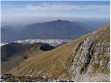 59
59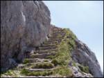 60
60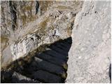 61
61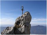 62
62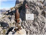 63
63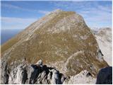 64
64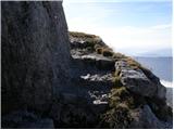 65
65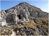 66
66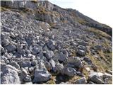 67
67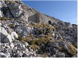 68
68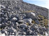 69
69 70
70 71
71
Discussion about the trip Drežnica - Batognica (south way)
To post a comment you must log in:
If you do not yet have a username, you must first
register.