Dom v Iškem Vintgarju - Krim (steep path)
Starting point: Dom v Iškem Vintgarju (360 m)
| Latitude/Longitude: | 45,9118°N 14,4993°E |
| |
Route name: steep path
Walking time: 2 h
Difficulty: partly demanding marked way
Elevation gain: 747 m
Elevation difference along the route: 760 m
Map: Ljubljana - okolica 1:50.000
Recommended equipment (summer):
Recommended equipment (winter): ice axe, crampons
Views: 38.602
 | 2 people like this post |
Access to starting point:
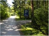
From the southern Ljubljana bypass, we head to the exit for the industrial zone Rudnik, and then continue driving in the direction of Ig. In the main roundabout on Ig, we continue "right" (direction Iški Vintgar and Iška vas), and then we continue on the main road towards Iški Vintgar. When we arrive in Iški Vintgar, we park on the first marked parking lot on the right side.
Route description:
At the end of the first parking lot we will notice a slightly overgrown cart track, which rises barely perceptibly parallel with the nearby road. When after some 10 m we get very close to the other forest road, our cart track turns right uphill. After a short ascent (some 10 m), we need to pay attention to the trees on the right side, because there we will notice the first blaze and a little higher among fallen trees also the second and third.
In the lower part the footpath is harder to follow because of some fallen trees, but if we carefully follow the blazes, they lead us on the slope almost straight upwards, with no major orientation problems. After a few minutes of steep ascent, the path stands even more upright and then ascends very steeply for some time (especially in wet there is a great risk of slipping). Higher the path, which is really quite steep, turns for a few meters right, where it brings us to a small ridgelet. Here the footpath levels out somewhat, but still ascends steeply for some time. After a few minutes we leave the indistinct ridgelet, as relatively frequent blazes on the less beaten path direct us right onto steep slopes, across which we ascend transversely to the right. After a few minutes of traversing we arrive in an indistinct little valley, through which in three minutes we ascend to the edge of a smaller plateau near Gornji Ig. From here follows a descent of a few steps and we join the path from Iška.
When we reach the mentioned marked path we follow it to the left, and then in a few successive junctions we follow it in the direction of Krim.
At the cave Velika Pasica we leave the asphalt and continue to Krim first on a macadam road and higher on cart track. The cart track somewhat higher (at the power line) crosses a wider macadam road, after which it starts to ascend somewhat more steeply. After a few minutes of moderate ascent we arrive at a marked junction, where we continue "straight" in the direction of Krim (left Iški Vintgar - usual path, right Strahomer).
The path ahead starts to ascend quite steeply on a partly rocky cart track, and we walk along it all the way to the road that leads to Krim. Here we cross the road and past a cross and military structures in less than 5 minutes we ascend to the mountain hut on Krim.

Along the route: Gornji Ig (636m)
Photos:
 1
1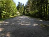 2
2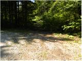 3
3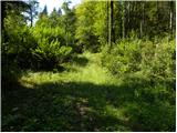 4
4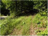 5
5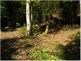 6
6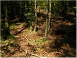 7
7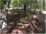 8
8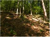 9
9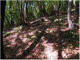 10
10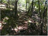 11
11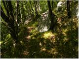 12
12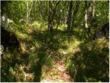 13
13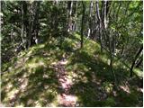 14
14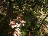 15
15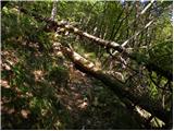 16
16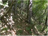 17
17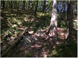 18
18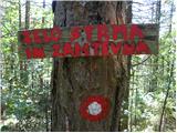 19
19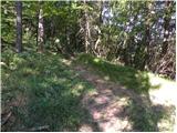 20
20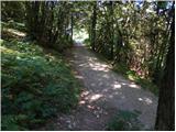 21
21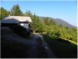 22
22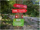 23
23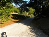 24
24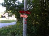 25
25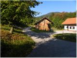 26
26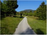 27
27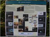 28
28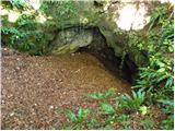 29
29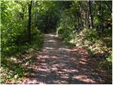 30
30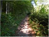 31
31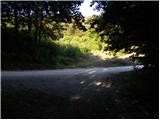 32
32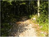 33
33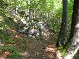 34
34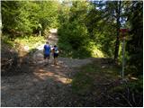 35
35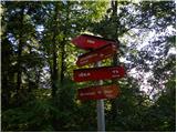 36
36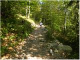 37
37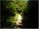 38
38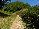 39
39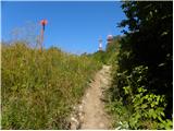 40
40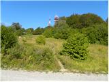 41
41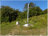 42
42 43
43 44
44 45
45
Discussion about the trip Dom v Iškem Vintgarju - Krim (steep path)
|
| Andrej Potrata21. 12. 2011 |
Yesterday I was at the top and it was fantastic.
Just be careful not to slip, because the path below the summit is icy.
|
|
|
|
| erikaleon31. 10. 2012 |
Today tried to go on this path, but we seem to have missed it and went on the usual one leading to the top.
|
|
|
|
| zokipoki11. 04. 2015 |
very steep and physically demanding path in the lower part... markings are for adventurers  ...you have to look carefully not to get lost...the path is poorly trodden and suitable for loners and adventurers-all the way to the junction of the path from Iška...I liked it. ...you have to look carefully not to get lost...the path is poorly trodden and suitable for loners and adventurers-all the way to the junction of the path from Iška...I liked it.
|
|
|
|
| Mikens23. 06. 2019 |
IMPORTANT!
I ask all hikers to keep their dogs on a leash! (bear area.)
Best hunting regards.
Klement Mal, LD Tomišelj
|
|
|
|
| zwbgr30. 07. 2021 12:17:24 |
Can someone describe the starting point of the trail in Vintgar more precisely? The traffic arrangement has changed and I didn't see the mentioned parking lot.
Then I went along the "usual" path behind the hut and looked for the trail from the top as well, but obviously missed it there too, because I followed a trodden path along the ridgelet, which eventually got lost. Then I descended directly down the slope, twice I came across a tree with a red line (marking or some forestry sign?) and arrived at the bottom on a forest road that took me between two weekend houses to the road near the asphalted bridge over Iška.
|
|
|
|
| jbs30. 07. 2021 21:36:55 |
The trail starts a few meters from the gravel road that branches off to the right towards the houses and water tank before the parking lot in front of the hut. It then joins the trail coming from Iška, when that reaches the Zgornji Ig plateau, a few tens of meters where the path turns to gravel (at the wooden shelter or garage). However, the trail is poorly visible.
|
|
|
|
| NerodniPohodnik28. 11. 2021 22:33:53 |
In Ljubljana, steep slopes on less visible paths are marked as partially difficult?
|
|
|
To post a comment you must log in:
If you do not yet have a username, you must first
register.