Dom v Dragi - Begunjščica (via Roblekov dom)
Starting point: Dom v Dragi (689 m)
| Latitude/Longitude: | 46,395°N 14,2183°E |
| |
Route name: via Roblekov dom
Walking time: 4 h 20 min
Difficulty: easy marked way
Elevation gain: 1371 m
Elevation difference along the route: 1371 m
Map: Karavanke - osrednji del 1:50.000
Recommended equipment (summer):
Recommended equipment (winter): ice axe, crampons
Views: 77.727
 | 4 people like this post |
Access to starting point:
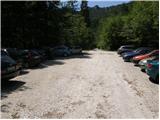
From the highway Ljubljana - Jesenice, we take the exit Brezje, Radovljica or Lesce, and then continue driving in the direction of Begunje na Gorenjskem. When we arrive in Begunje, we drive through the center of the settlement; at the crossroads, we follow the signs for castle Kamen and mountain hut Dom v Dragi. On the other side of the settlement, the main road turns right towards Tržič, and we continue straight on a narrower road, which quickly leads us into Draga valley. For a short time, we still drive on an asphalt road, then the asphalt ends and the road brings us to the parking lot in front of the mountain hut Dom v Dragi. Because only guests are allowed to park in front of the hut, we continue right, and after a good 100 meters of additional driving, we park on one of the two large macadam parking lots.
Route description:
From the parking lot, we continue on the road, which past a bee house brings us to a junction in a few minutes of walking, where we continue left on the road (right Preval-a over Luknja and Begunjščica over Preval-o), which starts to ascend through a scenic gorge. Further on, we ascend on the road for some time, then the markers direct us left onto a footpath, which starts to ascend steeply. Higher up, the steepness eases a little and the marked path crosses a forest road 3 times (2 different roads). The path, which mostly runs through the forest, then brings us higher to the lower part of the mountain pasture Planinca. Here the markers direct us right (ascent straight across the mountain pasture is forbidden) onto a transverse path, which in a few steps of additional walking brings us to the road, which we follow left.
Already after a few 10 steps of walking on the road, we come to a junction, where we continue straight (sharply right mountain pasture Preval-a). Here a short path branches off to the left, which brings us to the hut on mountain pasture Planinca, and we continue straight on the road all the way to Tomčeva koča na Poljški planini, which we reach after 15 minutes of additional walking.
From Tomčeva koča, we continue right following the signs for Roblekov dom and continue the ascent on the path, which passes into the forest. The path through the forest ascends moderately and soon brings us to the spot where several logs intended for heating Roblekov dom are stacked. If we are willing and have enough strength, we can carry a log to the hut (they will be very grateful).
Higher, the forest on the path becomes thinner and thinner, and the path steeper and steeper. From the wide and well-made path, which after rain is quite muddy, we occasionally get nice views. The path then turns a little to the left and brings us to the spot where the path from mountain pasture Preval-a joins from the right.
We continue on the left path, which after another 10 minutes of transverse ascent brings us to the mountain hut.
From the hut, we continue right in the direction of Veliki vrh on Begunjščica on the path which after a few steps goes into the forest. The strip of forest, which is short, quickly changes into shrubbery and higher into dwarf pines. After a good 20 minutes of ascent from Roblekov dom, we come to the next junction, where we again continue in the direction of Veliki vrh, which with 2060 m is the highest peak of Begunjščica (left Dom na Zelenici). The path ahead ascends transversely on locally quite steep southern slopes of Begunjščica. The transverse path, which offers nice views on Gorenjska. The path, which when wet is also dangerous for slipping, then brings us to the panoramic peak, which we reach via a panoramic and steep slope.

Photos:
 1
1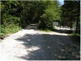 2
2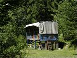 3
3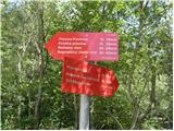 4
4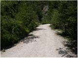 5
5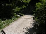 6
6 7
7 8
8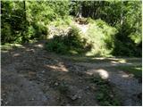 9
9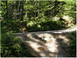 10
10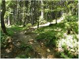 11
11 12
12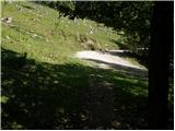 13
13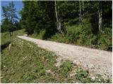 14
14 15
15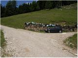 16
16 17
17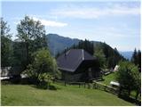 18
18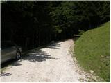 19
19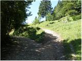 20
20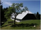 21
21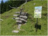 22
22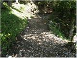 23
23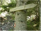 24
24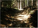 25
25 26
26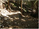 27
27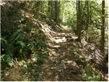 28
28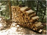 29
29 30
30 31
31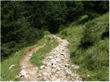 32
32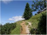 33
33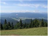 34
34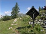 35
35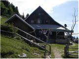 36
36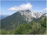 37
37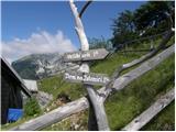 38
38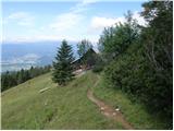 39
39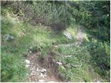 40
40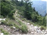 41
41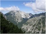 42
42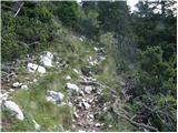 43
43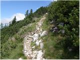 44
44 45
45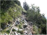 46
46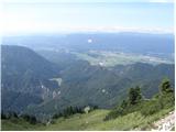 47
47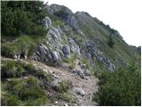 48
48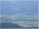 49
49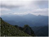 50
50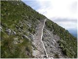 51
51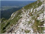 52
52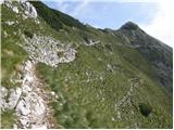 53
53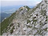 54
54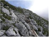 55
55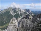 56
56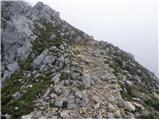 57
57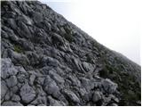 58
58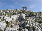 59
59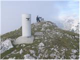 60
60 61
61
Discussion about the trip Dom v Dragi - Begunjščica (via Roblekov dom)
|
| Domch29. 11. 2012 |
on Sunday premier also on Begunjščica. Nice easy tour past Roblek and to Veliki vrh. Easy path with nice views all around. Julijci and KSA like on the palm of your hand, the view reached all the way to Pohorje. Nice sunny and warm weather. But on the top a cold wind was blowing. The marmots were happy about the visit and the snack.
|
|
|
|
| laik23. 06. 2013 |
I plan to walk this path in the near future....but I'm not very experienced..is it suitable? Thanks for the advice
|
|
|
|
| laik23. 06. 2013 |
lidija, thanks
|
|
|
|
| Kokta4. 05. 2015 |
Bravo Zgembo
|
|
|
|
| Farki814. 03. 2019 |
Yesterday hiked this trail, the path through the forest to Planina Planinca (many paths, as it seems everyone goes a bit their own way) is well-trodden and clearly visible due to heavy traffic. If you want to follow the markers to Planina Planinca, some are missing in between, or maybe I don't see well, that's why there's a fairly wide trodden forest strip. From here onwards the path past Poljska planina to Roblekov dom is nicely arranged, the upper half of the path was quite icy. From Roblekov dom onwards all the way to Veliki vrh the path was quite demanding due to wind-packed snow, and dangerous for slipping. The view from the top is worth every drop of sweat
|
|
|
|
| Mirza1528. 10. 2019 |
Yesterday my wife and I were on Begunjščica, excellent trip, weather gorgeous, lots of people took advantage of the last summer day, I recommend it to everyone who wants to enjoy the beautiful views of our beautiful Gorenjska .
|
|
|
|
| Zgembo22. 02. 2020 |
Today I was on this tour, phenomenal weather, frozen path in a few spots but it can be bypassed, no winter gear needed. Nice tour, here are some photos
https://youtu.be/zAVEHdxmtWM
|
|
|
To post a comment you must log in:
If you do not yet have a username, you must first
register.