Dom v Dragi - Begunjščica (via Preval-a)
Starting point: Dom v Dragi (689 m)
| Latitude/Longitude: | 46,395°N 14,2183°E |
| |
Route name: via Preval-a
Walking time: 3 h 30 min
Difficulty: partly demanding marked way
Elevation gain: 1371 m
Elevation difference along the route: 1400 m
Map: Karavanke - osrednji del 1:50.000
Recommended equipment (summer): helmet
Recommended equipment (winter): helmet, ice axe, crampons
Views: 39.234
 | 3 people like this post |
Access to starting point:
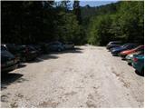
From the Ljubljana–Jesenice highway, take the Brezje, Radovljica, or Lesce exit, then continue driving towards Begunje na Gorenjskem. When we arrive in Begunje, drive through the center of the settlement; at the crossroads, follow the signs for Grad Kamen castle and Dom v Dragi mountain hut. On the other side of the settlement, the main road turns right towards Tržič, and we continue straight on a narrower road, which quickly leads us into the Draga valley. For a short time, we drive on the asphalt road, then the asphalt ends and the road brings us to the parking lot in front of the Dom v Dragi mountain hut. Because only guests are allowed to park in front of the mountain hut, we continue right, and after roughly 100 meters of additional driving, we park on one of the two large macadam parking lots.
Route description:
From the parking lot, we continue along the road, which takes us past a bee house and, in a few minutes of walking, brings us to a junction, where we continue right in the direction of the Preval mountain pasture over Luknja (left Planinca mountain pasture, Poljška planina mountain pasture and Roblekov dom). The path ahead crosses the stream and then ascends gently for some time along the bottom of the valley.
Further on, the valley narrows, and the path brings us in a moderate ascent to a narrow gully, up which we ascend steeply with the help of fixed safety gear.
The short secured section is not particularly demanding technically, but it is exposed to falling stones.
Higher up, the path leads us out of the gully, where it then continues for some time along the stream. This is followed by an ascent up a shorter ladder (undemanding), after which the path enters the forest, where it continues to a poorer road.
We follow the aforementioned road for only a few steps, then the markings direct us right onto a marked footpath, which continues along and beside the cart track. Higher up, the cart track finally turns into a footpath, which heads somewhat more to the right and begins to ascend ever more steeply. We follow this relatively steep path in the final section all the way to the Preval-e mountain pasture, which we reach after a few minutes of further walking.
From the cross on Prevala, we continue north on a marked footpath in the direction of Begunjščica over Kalvarija (left Roblekov dom over Roža, right Ljubelj and Podljubelj). The path ahead first ascends a panoramic grassy slope, then passes into the forest, through which it begins to ascend more steeply. Higher up, the forest starts to thin out, and the path becomes somewhat steeper. This is followed by a fairly steep ascent, which first passes through some bands of brushwood, and higher over steep grassy slopes that are especially dangerous for slipping when wet. We then cross a slightly exposed gully, where there is a small memorial plaque, and the path ascends for a few more minutes along the steep grassy slope. When the slope a little higher flattens somewhat, the marked path turns left and crosses the slopes to the left. Just a few minutes further, we arrive in a small valley, where the slope flattens even more. We merely cross this small valley (slightly to the right of the valley, one can ascend to Begunjska Vrtača on easier pathless terrain in 15 minutes), then in a few minutes we ascend to the main ridge of Begunjščica. When we step onto the ridge, a nice view also opens towards the north, and we continue along the gentle path, which proceeds along a somewhat narrower ridge. This is followed by a short descent to a small saddle, where the "path" over Šentanski plaz joins from the right. Here the ridge of Begunjščica widens, and we follow the increasingly panoramic path to the sub-summit of Veliki vrh. One more very short descent follows, then without major difficulties we ascend in a few minutes to the highest summit of Begunjščica.

Photos:
 1
1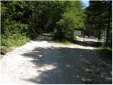 2
2 3
3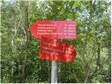 4
4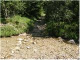 5
5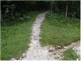 6
6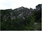 7
7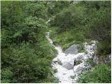 8
8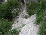 9
9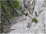 10
10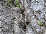 11
11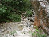 12
12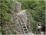 13
13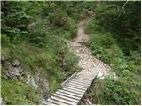 14
14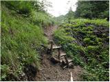 15
15 16
16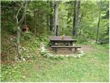 17
17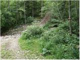 18
18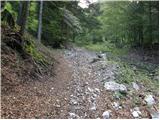 19
19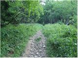 20
20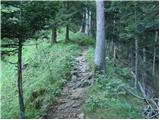 21
21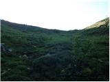 22
22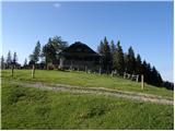 23
23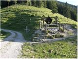 24
24 25
25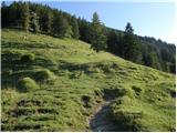 26
26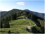 27
27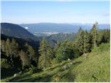 28
28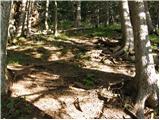 29
29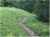 30
30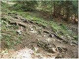 31
31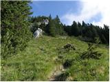 32
32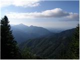 33
33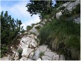 34
34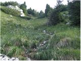 35
35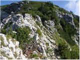 36
36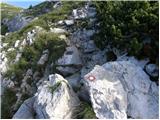 37
37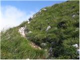 38
38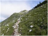 39
39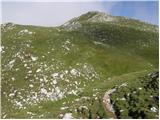 40
40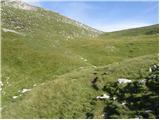 41
41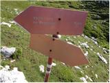 42
42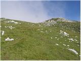 43
43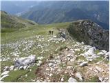 44
44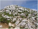 45
45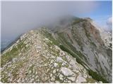 46
46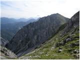 47
47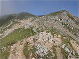 48
48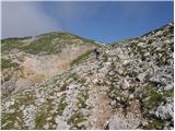 49
49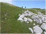 50
50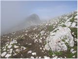 51
51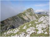 52
52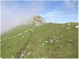 53
53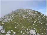 54
54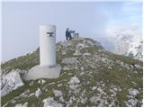 55
55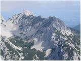 56
56
Discussion about the trip Dom v Dragi - Begunjščica (via Preval-a)
|
| lakkon29. 06. 2013 |
Hello.
If I don't go on a hike/climb somewhere else, I might go on this loop on Sunday:
Dom v Dragi – Preval – Veliki vrh (Begunjščica) - Roblekov dom – Tomševa koča – Dom v Dragi
I've never been there. I assume no winter hiking gear is needed at all? Can you reach the parking (Dom v Dragi) normally with a slightly lower personal car (Seat Leon)? Any other inconveniences on this trail?
Thanks for the help.
|
|
|
|
| LidijaJesih29. 06. 2013 |
As you wrote yourself. Everything checks out. No issues with the car, it's dry too, no other inconveniences (unless you bring them with you :tongue . .
|
|
|
|
| lakkon29. 06. 2013 |
LidijaJesih,
thanks for the reply. I'll do my best to behave as properly as possible.
|
|
|
|
| timotej936. 01. 2014 |
hello. how is the trail now, or in the coming days, is it too dangerous?
best, timotej
|
|
|
|
| malimiha3. 11. 2014 |
Hello.
I'm interested if the path through the Preval-o pasture is dry? How is it then to Roblekov dom?
thanks and best regards,
Miha
|
|
|
|
| marezt3. 11. 2014 |
malimiha the path via Prevalo is dry, likewise to Roblek and also to the top of Begunjščica!
|
|
|
|
| misace10. 11. 2016 |
yesterday View here through Luknja to Kalvarija waded wind-packed ridge (gaiters up to 50 cm) and along well visible "path" to Roblek
View here
View here
|
|
|
|
| Majdag15. 07. 2018 |
Draga valley, Luknja, Prevala, Begunjščica, Roblekov dom, Poljska planina, Planinica, Draga, was my yesterday's path. Past the fallen trees through the calvary from Prevala, the path is already cleared. But yesterday it was wet and slippery all the way. The signpost by the water shows a more realistic ascent time than in the path description. Nice, steep path.
http://jelenkamenmajdag.blogspot.com/2018/07/begunjscica-krozna-pot.html
|
|
|
|
| Kranj9. 06. 2019 |
I would like to get in touch with the woman who was on Begunjščica yesterday, black hair, yellow windbreaker. If you recognize yourself, please get in touch nicely. best regards
|
|
|
|
| MPS22. 06. 2021 07:26:18 |
At the beginning of June I went to see how the sunset looks from the top of Begunjščica. I went up through Luknja (over Prevalo), descended in pitch darkness past Roblek. Both trails are without peculiarities and normally passable. You can watch a short video of the ascent and sunset at the link: Begunjščica, 3.6.2021 - sunset
Safe steps and all the best, Mirko
|
|
|
|
| BostjanZ7117. 06. 2024 18:15:22 |
The trail from Draga to Preval is still damaged and closed, the warning is right after crossing the stream. Checked today, I went to the fixed cable, but it's torn below.
|
|
|
|
| mjk31. 05. 2025 18:06:18 |
Today I went along the path, the path is repaired, newly marked and secured.
|
|
|
To post a comment you must log in:
If you do not yet have a username, you must first
register.