Dom Trilobit - Hochstuhl/Stol (via Rida (Medji dol))
Starting point: Dom Trilobit (939 m)
| Latitude/Longitude: | 46,4579°N 14,1031°E |
| |
Route name: via Rida (Medji dol)
Walking time: 4 h 30 min
Difficulty: easy marked way
Elevation gain: 1297 m
Elevation difference along the route: 1400 m
Map: Karavanke - osrednji del 1:50.000
Recommended equipment (summer): helmet
Recommended equipment (winter): helmet, ice axe, crampons
Views: 16.504
 | 3 people like this post |
Access to starting point:
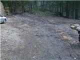
From the Ljubljana-Jesenice highway, take the Lipce exit, then turn right towards Jesenice. In the settlement Javornik, at the first traffic-light intersection, turn right (direction Lj.) towards Koroška Bela. At the next intersection with traffic lights, turn left, and soon again left towards Javorniški Rovt. After a few kilometers of uphill driving (when we have already arrived in the mentioned village), in a sharp left turn, the macadam road branches off straight ahead towards the Dom Trilobit mountain hut (sign). After a few hundred meters, we arrive at the lake, along which the road runs; on the left, we notice Dom Trilobit. When we drive past this structure, the road ends in the forest; here is our starting point.
Route description:
On the left side from the starting point, a somewhat damaged cart track leads uphill, which we follow and at the same time encounter the first blaze. After a few minutes, we notice a branch-off of the cart track to the right towards the mountain pasture Stamare, but we continue straight to the spot where the path approaches the stream bed. Here the cart track turns left and ends at the upper spring of the Javornik stream or flows into a forest path. This begins to climb more steeply, first straight, then zigzagging through the forest. On the left, we can notice a monument with a fence, and after only 45 minutes of walking, we arrive at the second monument (to the hunter) by the path, where on the right there is a completely destroyed bench. The steepness eases a bit, and the path heads left towards the north, running for a while through a mixed woodland. Here, on the right, we can first observe the screes of Srednica, and later a view gradually opens eastward towards the Rida amphitheater. We can observe this fully once the forest transitions into a belt of dwarf pines. A few more zigzags and we are near the Seče mountain pasture, where we encounter directional signs on a tree. Head right towards Vajnež and Stol. The path first ascends moderately, then soon descends quite steeply towards the screes of the amphitheater, where it proceeds almost flat for a while in a right-circular direction. Before it brings us out of Rida, it ascends briefly again; at the top, it turns left towards SE. With moderate ascending amid dwarf pines, the path now brings us to the grassy slope of Belščica, where it first ascends slightly, then almost levels out. This is followed by about half an hour of walking with a fine view towards the Ljubljana Basin, up to the branch-off for Vajnež, which ascends last on the left.
At the sign reading Vajnež, continue straight and follow the blazes and marked directions on the rocks. These lead us slightly right, past Vajneževo sedlo on the left, towards Potoški Stol, which we reach after a few minutes of walking. Near the highest point of Potoški Stol, the path heads right (straight ahead goes to the marker - cross), towards the southern edge, where it turns left towards the somewhat exposed ridge separating Potoški and Veliki Stol. Once on the ridge, we can observe the landscapes on the Austrian and Slovenian sides simultaneously, but we step carefully. After some time, we move to the slope of Veliki Stol, where the path ascends moderately. When we encounter the steep left branch-off, continue straight or right over the rough scree, where in the little valley between Mali and Veliki Stol we soon join the left branch of the path coming from the Valvazor direction. Here turn left towards the saddle between both Stols, then once again left, and after 10 more minutes of walking reach the summit.

Photos:
 1
1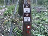 2
2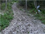 3
3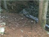 4
4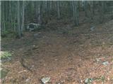 5
5 6
6 7
7 8
8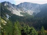 9
9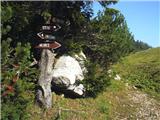 10
10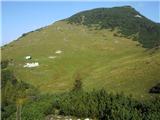 11
11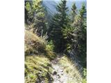 12
12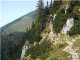 13
13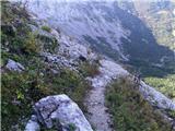 14
14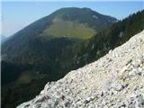 15
15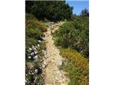 16
16 17
17 18
18 19
19 20
20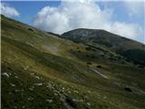 21
21 22
22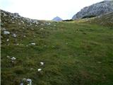 23
23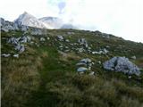 24
24 25
25 26
26 27
27 28
28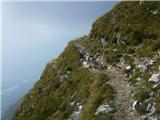 29
29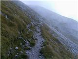 30
30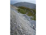 31
31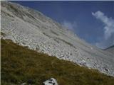 32
32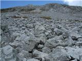 33
33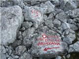 34
34 35
35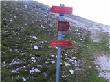 36
36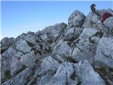 37
37
Discussion about the trip Dom Trilobit - Hochstuhl/Stol (via Rida (Medji dol))
|
| ninooos27. 05. 2012 |
The path is defined as "easy marked path", I know exactly what that means, but I'm interested in how dangerous it actually is - many of the above photos put me in a dilemma: take the child on this path to Stol or not? Any tip from locals? Please  , thanks, best regards , thanks, best regards
|
|
|
|
| Irina28. 05. 2012 |
@ninooos,
I agree that some photos give the impression that part of the path is very exposed.
I would be concerned about how children would manage 5 hours of walking on a path that is mostly "clearing" and the sun shines mercilessly. Of course you can start very, very early. But I wonder if it's still fun for the "kids" or more the parents' wish.
|
|
|
|
| heinz28. 05. 2012 |
Irina correctly wrote about children. Walking in the sun is at least 3 hours in each direction. Otherwise, the path is only somewhat "exposed" on the ridge between Potoški Stol and the approach to Stol (pictures 25-29), which lasts about 1/2 hour. This part is the most beautiful. Regarding walking on such terrain, there will certainly be no problems if you've already been to 2000m with children (Begunjščica, Viševnik etc.).
|
|
|
|
| ninooos28. 05. 2012 |
Thanks for the opinions. To be honest, I myself didn't think about possible boredom and scorching sun  ... I was only looking at an alternative approach to Stol, as repeating tours is most boring for the kids (last 2 years up 4x, always from Valvazorja). They love mountains, but don't like long drives to the starting point, so we explore Upper Gorenjska from all sides ... I was only looking at an alternative approach to Stol, as repeating tours is most boring for the kids (last 2 years up 4x, always from Valvazorja). They love mountains, but don't like long drives to the starting point, so we explore Upper Gorenjska from all sides
|
|
|
|
| ninooos28. 05. 2012 |
Pardon, 3x up... Trip from this starting point offers many shortcut options ... main thing is there's a summit logbook and stamp at the "top"  
|
|
|
|
| heinz28. 05. 2012 |
Otherwise you can also start from Potoška planina (Urbas spring) via Vajnež. This one is a bit shorter. Find the description and combine with this.
|
|
|
|
| Irina28. 05. 2012 |
@ ninooos 28.5.2012
What about Škofjeloško or Cerkljansko hribovje and Jelovica..... there are also interesting hikes there.
|
|
|
To post a comment you must log in:
If you do not yet have a username, you must first
register.