Dolina Kot - Dom Valentina Staniča
Starting point: Dolina Kot (950 m)
| Latitude/Longitude: | 46,4157°N 13,8977°E |
| |
Walking time: 4 h 10 min
Difficulty: difficult marked way
Elevation gain: 1382 m
Elevation difference along the route: 1385 m
Map: Triglav 1:25.000
Recommended equipment (summer): helmet
Recommended equipment (winter): helmet, ice axe, crampons
Views: 47.984
 | 3 people like this post |
Access to starting point:
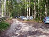
We drive to Mojstrana, then follow the signs for the Kot and Krma valleys. At Kosmačev preval we leave the road leading further towards Krma, Radovna and Bled and continue driving right onto the side road in the direction of the Kot valley. This is followed by driving on a gravel road, which we follow to the mountain direction signs at the end of the drivable road in Lengarjev rovt.
Route description:
From the end of the road we continue along the wider marked path towards Stanič's hut and Kredarica, which gently ascends through the forest. After a few minutes we reach the Kotarica scree field, across which we traverse to the other side where the trail reappears.
This is followed by some easy walking through the forest, but after about half an hour the path quickly becomes quite steep and due to the often slippery ground also dangerous for slipping, especially on descent, so considerable extra caution is required on this section. On this part, a few pegs assist at the more difficult spots. Higher up the steepness eases and the path leads us to the spring Pri studenčku, which dries up in dry weather.
Here an unmarked path branches off to the left towards Macesnovec, but we continue straight across the torrent gully, after the gully we cross a short secured but not particularly demanding section. This is followed by ascent through the dwarf pine belt, higher up we enter increasingly rocky terrain where we can already clearly see a larger boulder ahead. Here our path is crossed quite unobtrusively by the PP trail (Planica - Pokljuka path), but we ascend with ever better views to the aforementioned boulder named Debeli kamen.
At Debeli kamen the dwarf pines occasionally end completely and we proceed through increasingly alpine terrain where we mostly ascend on scree. On this section a nice view back opens to Ladja (Ladja is a distinct sheer promontory or peak covered in dwarf pines rising above the Kot valley), then we ascend to the marked junction where the climbing path to Vrbanove špice, or Lojze Rekar's path, branches right.
We continue on the left path towards Triglav, Rjavina and Dom Valentina Staniča pod Triglavom, where the gradient eases and the path leads along the left side of the Pekel cirque.
Here first a marked very difficult secured path to Rjavina branches left, but we ascend transversely above the cirque along the northwestern slopes of Rjavina. As we approach Dovška vrata slightly further on, a passage opens to the left to the Rjavina ridge, or rather the passage leads us directly to the mentioned gates, from which a marked ridge path leads to Rjavina, but we continue straight towards the marked path to Dom Valentina Staniča.
Further on we mostly ascend moderately through alpine terrain, following this path all the way to Dom Valentina Staniča pod Triglavom, from where a fine view opens to Triglav and the surrounding peaks.
Starting point - Pri studencu 1:25, Pri studencu - Debeli kamen 1:20, Debeli kamen - Pekel 0:45, Pekel - Dom Valentina Staniča 0:40.

Along the route: Pri studencu (1330m), Debeli kamen (1810m), Pekel (2089m)
Photos:
 1
1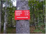 2
2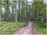 3
3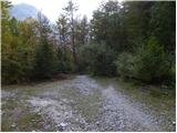 4
4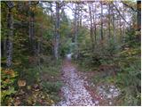 5
5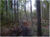 6
6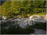 7
7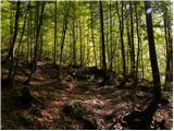 8
8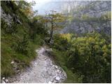 9
9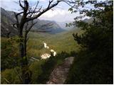 10
10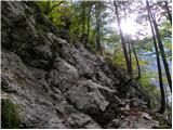 11
11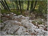 12
12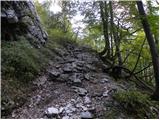 13
13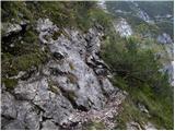 14
14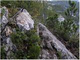 15
15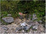 16
16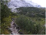 17
17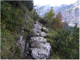 18
18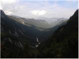 19
19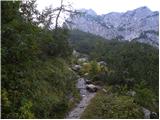 20
20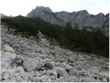 21
21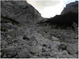 22
22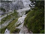 23
23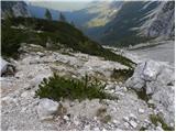 24
24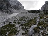 25
25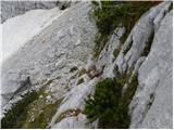 26
26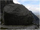 27
27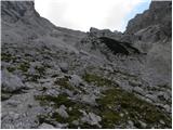 28
28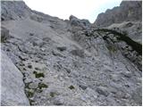 29
29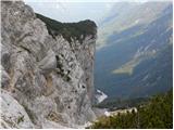 30
30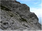 31
31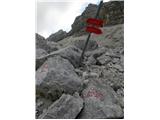 32
32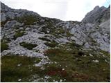 33
33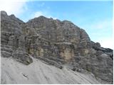 34
34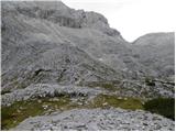 35
35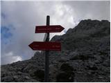 36
36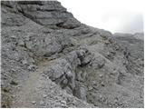 37
37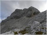 38
38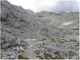 39
39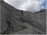 40
40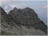 41
41 42
42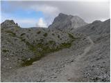 43
43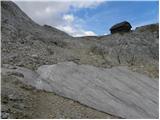 44
44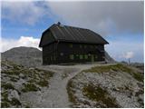 45
45
Discussion about the trip Dolina Kot - Dom Valentina Staniča
|
| andrej jerina25. 06. 2008 |
From Visoka Vrbanova špica, Peter and I descended to Stanič's hut and continued the path towards Kot. On the path, especially in Peklo, it is still covered with some snow patches. In the afternoon the snow was soft, so it didn't pose problems, but in the morning it might be different. Careful, especially on descent, on two snow patches it is quite steep and dangerous for slipping. Best regards Andrej
|
|
|
|
| velkavrh1. 08. 2009 |
Repeated the same path as my predecessor. It is nice to go to Staničev a bit winding from Kot. That detour over Vrbanova špica and Vrbanov vrh is especially wonderful. However, I recommend it only to lovers of cables, because there are plenty of them on the entire path to Staničev.
|
|
|
|
| valerija11220. 08. 2013 |
Velkavrh, please tell me if you can reach the parking lot in Kot with a regular car (punto, clio). Thanks and best regards.
|
|
|
|
| neph20. 08. 2013 |
The road is passable with careful and slow driving, occasionally you need to avoid some bump or hole.
|
|
|
|
| JusAvgustin20. 08. 2013 |
Thanks, I was just about to ask.
|
|
|
|
| Julijec30. 07. 2018 |
On the way to Stanič there are still some snow patches, but except for the first one where you need to be careful, they are nothing special. Interestingly, Stanič hut has so little visitors given the proximity of Triglav, Rjavina and Vrata.
|
|
|
|
| Ajgor200114. 09. 2018 |
Is this path possible with a dog? Thanks.
|
|
|
|
| simon7914. 09. 2018 |
If he is used to high mountains, then it is suitable.
You might need to carry him at some spots (pics 14-15).
If he hasn't been in similar terrain yet, hard to say, depends on the dog.
|
|
|
|
| Ajgor200115. 09. 2018 |
They are used to it but still I wouldn't want to endanger them. They mean too much to me. Anyway if it's only this difficulty we'll go. Thanks.
|
|
|
|
| babim15. 09. 2018 |
In my opinion, this path is still too strenuous for a dog. Personally, I don't approve of such endeavors.
|
|
|
|
| nina427. 07. 2024 16:50:39 |
Today I parked less than a kilometer from Lengarjev rovt, because everything there was full and I got a friendly warning from the ranger service that next time it would cost me 100 EUR.
|
|
|
|
| Tajka6719. 06. 2025 16:51:51 |
Hello, is the path to Stanič's hut dry? Grateful for answers.
|
|
|
|
| Vrhovka5. 09. 2025 12:44:52 |
On 4.9.2025 the road is nicely drivable to Kot, even with a low car. Path bp, except to Debeleg kamen the path is quite wet and slippery at this time, so it requires extra caution, especially for descent, because the rocks don't dry.
|
|
|
To post a comment you must log in:
If you do not yet have a username, you must first
register.