Starting point: Črnivec (902 m)
| Latitude/Longitude: | 46,2608°N 14,7024°E |
| |
Walking time: 1 h 30 min
Difficulty: easy marked way
Elevation gain: 533 m
Elevation difference along the route: 550 m
Map: Kamniške in Savinjske Alpe 1:50.000
Recommended equipment (summer):
Recommended equipment (winter): crampons
Views: 36.807
 | 1 person like this post |
Access to starting point:
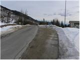
From Kamnik we drive towards Gornji Grad or vice versa. When we reach the mountain pass Črnivec, we park on the parking lot by the information boards. Parking in front of the nearby inn is only for guests.
Route description:
On the mountain pass, we look for mountain signposts for Vrh Kašne planine, which point us towards the north on a macadam road. After some 10 steps of walking on the road, we will notice the sign for the water catchment area and right next to it the beginning of the footpath. The path at first leads over a panoramic slope, as there is no forest here anymore since the strong wind on 13th July 2008 (in the area of Črnivec more than 50,000 seedlings were planted in the year 2009, approximately one third deciduous trees) on the newly made path (the old one was completely destroyed) along which we notice numerous blazes.
Higher, we cross the forest road and then continue the ascent on a relatively steep cart track. The path ahead for some time leads on slopes ruined by strong wind, and then, when we again cross the forest road, it gradually passes into old mostly conifer forest. Further, we moderately ascend on a cart track, cross some smaller springs and again step on the forest road. Higher, the path for a short time entirely flattens, and then gradually starts to ascend steeper and steeper. After a good hour of walking from the starting point, we step out of the forest on grassy slopes of Kranjska reber. The path, which is in the lower part of the grassy slope surrounded by fern, higher ascends even a little steeper and brings us to the main ridge of Kranjska reber, where it flattens. From the spot when we stepped on the ridge, only some 10 strides of easy walking separate us to the top.

Along the route: Na križu (1238m)
Photos:
 1
1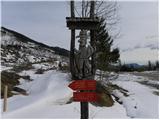 2
2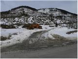 3
3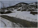 4
4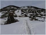 5
5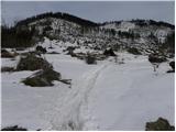 6
6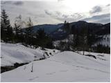 7
7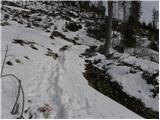 8
8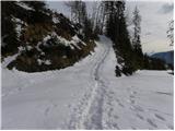 9
9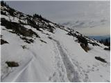 10
10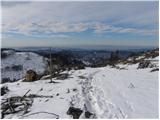 11
11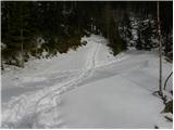 12
12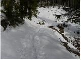 13
13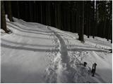 14
14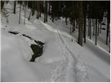 15
15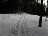 16
16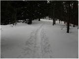 17
17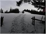 18
18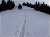 19
19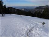 20
20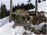 21
21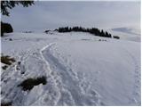 22
22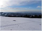 23
23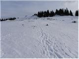 24
24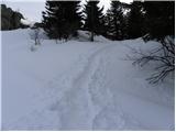 25
25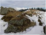 26
26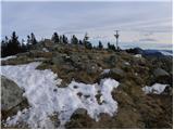 27
27 28
28
Discussion about the trip Črnivec - Kranjska reber
|
| U&Q3. 10. 2011 |
Hello!
I'm interested if the trip can be extended to Lepenatka and what the walking time frame to there is, if it's possible.
Thank you
|
|
|
|
| trilko22. 01. 2012 |
A little before the end of the windthrow, before the marked path leads into the forest, there are a couple of fallen spruces on the road that need to be climbed over if we want to stay on the marked path. Instead, I turned left on the road a bit before these spruces and after a few serpentines, the end of the road and uphill walking (unplanned) ended up at the top of nearby Plešivec.
So, you need to climb over those spruces 
Otherwise, a nice trip, fine views, warm sun, only a little windy.
|
|
|
|
| Sherlock16. 11. 2015 |
Super tour! The only thing is the destroyed zigzag, which should be replaced 
|
|
|
|
| zivljenje je lepo30. 12. 2015 |
The path from Črnivec is very simple, suitable for all children. However, due to the large clearcut in winter the path in the lower part is boring, you have the feeling as if walking in a desert. At the same time I fear that in summer, when the shrubbery grows, the lower part of the path is much harder to pass. From the top the path can be extended to Lepenatka. We didn't go there, but in my opinion it's another hour and a half of walking.
|
|
|
|
| grega_p1. 02. 2021 |
Excellent viewpoint, at least in today's conditions. From Kum, Menine, Golt, Uršlja gora, Smrekovec, Komna, Travnik, Raduha, parts of Olševa, across KS Alps (near Velika planina, Lepenatka, Rogatec), then Ratitovec, Blegoš, Trnovski Gozd, Javornik, Nanos, Javorniki, Snežnik...
Below 900m there was low cloud cover, so I could only see the higher peaks, massifs. And I could watch all that all day.
Otherwise, the lower path doesn't seem (quite) time-consuming to me, the spruces have already grown quite a bit. The snow is firm, the path is well-trodden and doesn't sink, but it's slightly icy in places.
|
|
|
To post a comment you must log in:
If you do not yet have a username, you must first
register.