Cave del Mole - Viš/Jof Fuart
Starting point: Cave del Mole (1035 m)
| Latitude/Longitude: | 46,4023°N 13,5105°E |
| |
Walking time: 4 h 30 min
Difficulty: difficult marked way
Elevation gain: 1631 m
Elevation difference along the route: 1640 m
Map: Julijske Alpe - zahodni del 1:50.000
Recommended equipment (summer): helmet, self belay set
Recommended equipment (winter): helmet, self belay set, ice axe, crampons
Views: 49.893
 | 2 people like this post |
Access to starting point:
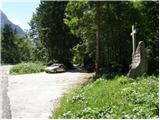
From Kranjska Gora over the border crossing Rateče we drive to Trbiž/Tarvisio. In Trbiž we continue left in the direction of Bovec and we follow the road to the crossroads near Rabeljsko jezero. Here we continue right in the direction of Nevejski preval/Sella Nevea. This road, which is mostly ascending, we follow to the spot where a macadam road branches off to the right. At the turn-off there is a monument with a cross and on a tree a signpost with the caption “Corsi”. We then follow the macadam road for a few turns, after that a little before the gate we park on the parking lot by the road.
From Bovec we drive to the border crossing Predel, from which we descend to the Italian side. Only a little after Rabeljsko jezero we come to a crossroads, where we continue left in the direction of Nevejski preval/Sella Nevea. Further, follow the upper description.
Route description:
From the parking lot, we continue on a macadam road which in zig-zags starts ascending. The road runs through the forest, so there is not much of a view. Only occasionally a view opens up towards the south and southeast. The road then turns to the left and starts ascending even a little steeper towards the north. A steep concreted road then brings us out of the forest on the mountain pasture Viška planina (1530m). Near the bottom station of a cargo cableway we will notice signposts, which point us to the right into the forest on the “German path” (sentiero dei tedeschi). At first, the path descends a little, turns to the right and crosses a few torrents. The path then starts ascending through the forest and later through dwarf pines. More frequently also beautiful views are opening up mainly towards the mountain pasture Viška planina below us and in the direction towards Rombon and Črnelska špca. On the path, there are also some steel cables, but the path isn't too hard on any part. More caution is needed mainly in the time when there are snow fields on the path. We soon notice in front of us the mountain hut Corsi and when we come out of the dwarf pines, to the hut follows only a few meters on a grassy slope.
From the mountain hut, we continue towards the north, where we start ascending on partly grassy and partly rocky terrain. The path then brings us to a junction, where we go left on path 627, and to the right leads path 625 towards Krniška škrbina (Ital. Forcella del Vallone) and further towards bivouac Gorizia. After a short ascent, we come again to a junction, where we go again left (direction Jof Fuart), and to the right leads path 627 towards Trbiška škrbinica (Forcella di Riofreddo). The path then turns slightly to the left and brings us to the entrance of a somewhat more demanding part of the path. Here the path turns right upward and some easy climbing on the rock is also needed. The path then turns slightly to the right and brings us to another somewhat harder part of the path. Here the path turns left upward and starts ascending along the steel cable. Next follows a somewhat low passage through a window and then again ascent along the steel cable. The path then brings us to a junction, where from the right from precipitous ledges joins path Anita Goitan. After a short ascent, we come again to a junction where we go right, left branches off path Anita Goitan. Next follows a moderately steep ascent on rocky and somewhat gravelly terrain. A little below the summit from the right also joins the northeastern path Gola Nordest. From here follows only a shorter ascent towards a very panoramic summit.

Photos:
 1
1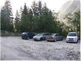 2
2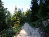 3
3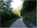 4
4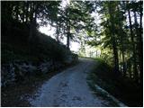 5
5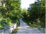 6
6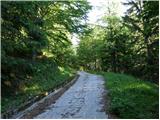 7
7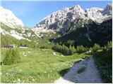 8
8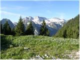 9
9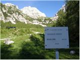 10
10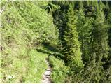 11
11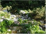 12
12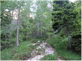 13
13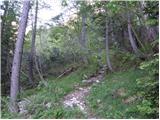 14
14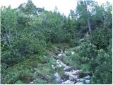 15
15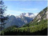 16
16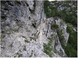 17
17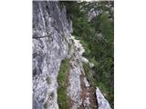 18
18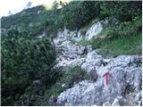 19
19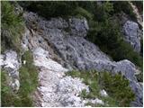 20
20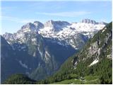 21
21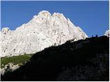 22
22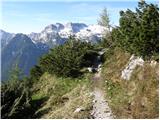 23
23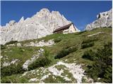 24
24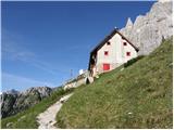 25
25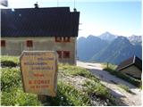 26
26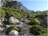 27
27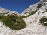 28
28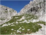 29
29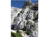 30
30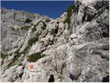 31
31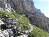 32
32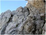 33
33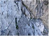 34
34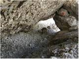 35
35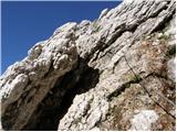 36
36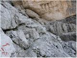 37
37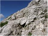 38
38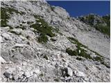 39
39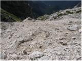 40
40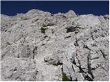 41
41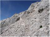 42
42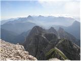 43
43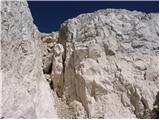 44
44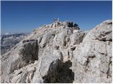 45
45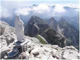 46
46 47
47
Discussion about the trip Cave del Mole - Viš/Jof Fuart
|
| benjamin76. 08. 2010 |
Could I ask for help? How long is the approximate walk from Planina Pecol to Viš? Thanks.
|
|
|
|
| jedriličar6. 08. 2010 |
Last year at the end of September I was on Viš, we slept in Rif. Corsi. As far as I remember, from the parking lot to Rif. Corsi it takes about 2.5 hours of easy walking, nothing strenuous or difficult. From the rifugio to Viš say 3 hours of easy walking, with one section secured by a cable, but again nothing difficult or demanding to climb. All in all, ascent and descent can be done in one day without any problems. The trail is not demanding, neither technically nor in terms of fitness. Best regards
|
|
|
|
| lukapet29. 07. 2013 |
I'm interested in the condition of the path. Is there still any snowfield on the path. What is the condition of the pegs and is the path normally marked?
|
|
|
|
| mirank29. 07. 2013 |
I was up there about three weeks ago. On the approach and on A Goitan, one unproblematic snow patch each, which can also be bypassed (after the last few days I don't think there's much left). On the descent via the usual path there were no issues, but it's true that shortly below the window I crossed fully to the right to the path from Škrbina zadnje Špranje, where a nicer descent on the snow patch in the gully to the Corsie water reservoir beckoned. The fixed protections that exist are all fine, there are enough markers and more. Good luck
|
|
|
|
| VanSims6. 08. 2013 |
Despite what @jedriličar wrote, I still warn that an average hiker should not underestimate the path even though it is 'only' difficult. The difficulty I would compare somewhere to the Planika - Mali Triglav path or e.g. Turska gora from Kamniško sedlo via Kotličev.
|
|
|
|
| resar227. 09. 2013 |
I'm curious about the barrier?
is it open after the grazing season, or can you drive by car to planina Viš?
resar
|
|
|
|
| mirank27. 09. 2013 |
I have never driven past even if it was open. Otherwise you can expect an unpleasant surprise on the way back, which I have seen. Once I even watched a bull with a large ring in its nose licking dew off the hood of a luxury jeep with IT plates It's not that bad to walk that hour to Viška planina even though the path is quite uninteresting. It's not that bad to walk that hour to Viška planina even though the path is quite uninteresting.
|
|
|
|
| irska28. 09. 2014 |
Very nice path, just enough secured to allow some scrambling  . Yesterday's beautiful early autumn day was perfect for this sunlit path . . Yesterday's beautiful early autumn day was perfect for this sunlit path .
|
|
|
|
| damijanp17. 08. 2015 |
Some glimpses from this path are at the link:
Viš
|
|
|
|
| Marko Torelli26. 08. 2016 |
24.8.2016 we were up there. Since the markings in Italy are somewhat Italian (where you need it, it's not there), one tip if we want the easiest route to Viš. When we start ascending northwards and according to instructions mostly keep left, many people (like us) get too close to Mojzes on Škrbina Zadnje Špranje, then realize it's not the right path. If we still want the easiest route to Viš, we can cross pathless to the gully between Viš and Gamsova matra where we see the path or continue to Mojzes and then via Anita right to the summit. Don't carry water, there's plenty up to Corsija. Regards
|
|
|
|
| LoniB15. 08. 2017 |
Today on Viš. Path excellently marked but directions/junctions poorly. hribi.net guide useless here. To Corsi hut no issue, then most paths marked Anita. Described path (Mojzes at notch) barely from hut (left to Sello Neveo) to saddle. Right fork to two: hard Anita Gotan, easier with cables. Initially joint then direct left Anita right, marked later at cross. Hope helps first-timers to Viš. Mass path-hunting promoted socializing today.
|
|
|
|
| LoniB15. 08. 2017 |
Pardon lapsus: described path is the one left of Anita not Mojzes.
|
|
|
|
| darinka424. 07. 2019 |
Yesterday we walked this path. From the parking lot to the summit of Viš it took us from 7:25 a.m. when we started walking. We were at the summit at 12:45 p.m. We didn't stop except at Corsiju for maybe 10 minutes, where we ate some fruit. Also on the descent past Mojzesova škrbina we walked from 13:45 to 17:55. With the caveat that it was necessary to be careful going down. So the stated times are approximate, depending on how fast you hike.
|
|
|
|
| Ksandi18. 10. 2019 |
Yesterday 17.10. from Corsi hut to Mojzesova škrbina and first to Koštrunove špice, then back to Mojzesova škrbina and on to Viš. Descent via normal route. Nice experience. 
|
|
|
|
| Planinka7430. 06. 2021 07:23:31 |
I'd like just one piece of information, is Viš normally passable from this path or is winter gear also needed? We planned to go on Sunday. Thank you.
|
|
|
To post a comment you must log in:
If you do not yet have a username, you must first
register.