Veliki Travnik (Turnovka)
|
| geppo24. 03. 2008 15:18:14 |
After a few days of lounging around, I drove towards Logarska today. When I arrived from Ljubno, I turned right uphill at the signpost (Travnik, Komen). After a couple of kilometers of nice road, snow started accumulating on the road surface and even winter tires didn't help anymore (it was snowing heavily). I parked the car and continued on foot. The goal of the trip was Travnik. At the farm, I noticed the sign for Travnik (left into the forest - 2 hours). It was still snowing heavily and there was more and more snow (up to 50cm in the forest, significantly more on clearings). In the last part of the path, heavy fog also descended (visibility approx. 5m) and snowdrifts appeared. So, I turned back about half an hour before the summit. Heavy snowfall accompanied me back too (rain in the valley). I have the path reconnoitered and ready for next time when conditions are better (if it doesn't get messed up again).
Regards
|
|
|
|
| geppo29. 03. 2008 17:32:41 |
Today, I repeated the hike to Travnik again. Morning had plenty of sun. Good protective glasses are a must, snow in abundance. Snow was extremely wet, snow cover height up to 1m in the upper part. Very strenuous for walking and lots of wetness. But the view....
Regards
|
|
|
|
| Stolar2. 04. 2008 15:28:12 |
In autumn we with the family walked the path from Smrekovec over Komen to Travnik. Nice path, without long ascents. For this year we decided to continue from Travnik to Raduha. Maybe someone knows this path?
|
|
|
|
| geppo2. 04. 2008 19:03:10 |
I haven't walked that path yet. We last time came to Mali Travnik. A bit further towards Veliki Travnik the path meets the one coming from Smrekovec over Veliki Travnik. No fear of missing the path to Koča na Loki. Height difference is negligible so no big ascents await you here either.
Regards
|
|
|
|
| Stolar3. 04. 2008 08:57:09 |
geppo, thanks for the info. In summer happy trails under your feet.
|
|
|
|
| zamet8. 12. 2008 19:32:55 |
Sunday hike to Travnik. Regards
| (+1) |  | |
|
|
|
|
| Zalas8. 12. 2008 19:37:12 |
And what did you want with that.
|
|
|
|
| zamet8. 12. 2008 19:58:15 |
To see what the snow conditions are like.
| (+1) | | |
|
|
|
|
| fpetel18. 12. 2008 20:24:27 |
Great pictures - fairy tale landscape of white chocolate
|
|
|
|
| skorny8. 12. 2008 22:01:45 |
WHERE DID YOU FORGET ME!!!!
GREETINGS FROM BOŠTJAN FROM LJUBLJANA, WHO KNOWS THAT TRAVNIK IS THE BEST, BEST, ESPECIALLY IF "LUMPI" IS ON DUTY
|
|
|
|
| Zalas9. 12. 2008 10:28:24 |
Now I know what you meant. Sorry but yesterday I didn't see the pictures, now I see them and it took my breath away.
|
|
|
|
| skiman9. 12. 2008 10:32:05 |
Hi,
I'm interested whether this Travnik is above Ljubno in the Savinja Valley.
LP
|
|
|
|
| fpetel19. 12. 2008 12:12:04 |
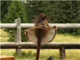
skorny - the last four pictures aren't quite up to date especially - the last one with Ojstrica, Veliki vrh and horse in the foreground.
|
|
|
|
| klema9. 12. 2008 12:34:36 |
Hi,
If going up via Rastke and past the hospital there was more than 1 meter of snow, so you need to choose the path via Robnikova planina.
We tried past the hospital, but there was too much snow.
 1 1
|
|
|
|
| fpetel19. 12. 2008 14:09:42 |
Apparently it's frozen now and holds a person, but these conditions change so quickly and in the next days a lot of snow will fall and it will be completely different again.
Best regards.
|
|
|
|
| skorny9. 12. 2008 17:49:41 |
Yes Skiman, that's Travnik above Ljubno. Guessing from your nickname this is the right hill for turno variants. From Smrekovec you can go to Komen, then paradise for your variants opens up - not demanding for hiking - if you have snowshoes, not avalanche prone, and nice wide tracks too, so you won't get stuck with your ice axe - and a drop of schnaps instead of saba, to warm you up a bit. For "fpetel1" I'll say these are pictures from August 2008, I was with family for a couple days at Travnik at Lumpi, so they are pretty old pictures - and he didn't even have such a light hat.
 1 1
|
|
|
|
| triglavski9. 12. 2008 17:55:58 |
Yeah we also know small letters bro.
|
|
|
|
| geppo9. 12. 2008 18:11:18 |
skorny
pictures - old / we usually post if someone needs info on a hiked path. Otherwise, it's more for current conditions. And next time really make the letters smaller!
Regards
 1 1
|
|
|
|
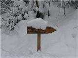
| skorny9. 03. 2009 11:38:44 |
On Saturday, 07.03.2009 I set off from Rast - Grunti direction to Travnik. Snow starts at about 1000 meters and doesn't stick, so I got pretty soaked to the Travnik hut. Snow at the top about 150 cm and recommend snowshoes or lots of will power, I didn't have snowshoes myself. And a few pics.
|
|
|
|
| Tadej22. 04. 2009 17:36:18 |
Today I climbed to Travnik from the Žep stream valley, via Robnikova planina (also Počka planina on the map). Snow starts just before the Travnik hut, then more and more, and on top in shady spots about 1m.
Descended past the hospital and then back to start via unmarked path.
LP Tadej
|
|
|
|
| skorny22. 04. 2009 20:36:44 |
Yeah, I kinda "screwed" you a bit, cuz it was such a nice day
|
|
|
You must log in to post a comment:
If you do not yet have a username, you must first
register.