Sveti Lenart - Rogatec (via Zg. Špeh)
Starting point: Sveti Lenart (910 m)
| Latitude/Longitude: | 46,3124°N 14,756°E |
| |
Route name: via Zg. Špeh
Walking time: 1 h 50 min
Difficulty: partly demanding marked way
Elevation gain: 647 m
Elevation difference along the route: 647 m
Map: Kamniške in Savinjske Alpe 1:50.000
Recommended equipment (summer):
Recommended equipment (winter): ice axe, crampons
Views: 38.358
 | 2 people like this post |
Access to starting point:
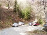
From Kamnik we drive towards Gornji grad. At the chapel just a few dozen meters before Gornji grad we turn left (direction Sveti Lenart). Further, we drive on the road which goes along the stream upwards. The road then leaves the stream and brings us to a decaying wooden shack, where we continue ahead on the road towards the church. At the crossing below the church we park.
From the Štajerska side we first drive to Gornji Grad and follow the road ahead in the direction of Kamnik. Immediately after Gornji Grad we turn right (direction Sveti Lenart). Further, follow the above description.
Route description:
From the parking lot, we go right on a cart track which in a few minutes brings us to the church of St. Lenart. At the church, we follow the signs V. Rogac and continue on the road which is a few meters above the church. We then soon leave the road and start ascending through the forest and past a few streams. The path then crosses a road and starts ascending on a narrow cart track which brings us to the mountain pasture Zg. Špeh. On the mountain pasture, we follow the signs V. Rogac and the path again brings us into the forest. At first, we ascend alongside barbed wire, which protects the livestock grazing on the mountain pasture, then the path turns to the left and ascends all the time towards the west. On this part of the path there is no view as it runs through the forest all the time. In the last part, the path becomes quite steep and a few dozen meters below the summit we come out of the forest again. Only a short ascent on the steep grassy slope to the panoramic summit follows.

Photos:
 1
1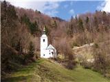 2
2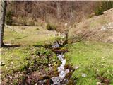 3
34424411.th.jpg) 4
4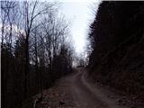 5
5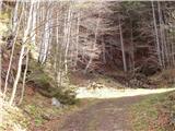 6
6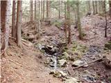 7
7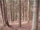 8
8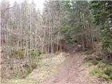 9
9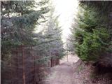 10
10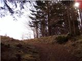 11
114424411.th.jpg) 12
12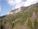 13
134424409.th.jpg) 14
14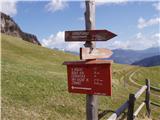 15
15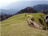 16
16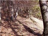 17
17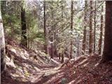 18
18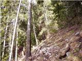 19
19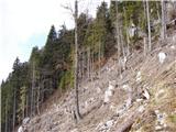 20
20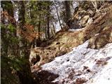 21
21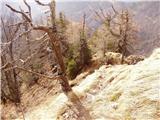 22
22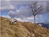 23
234424408.th.jpg) 24
24
Discussion about the trip Sveti Lenart - Rogatec (via Zg. Špeh)
|
| fpetel122. 04. 2008 |
Towards the summit (45') very steep path. Caution is advised in wet weather and in winter (crampons mandatory), when the climbing path to Kal is sometimes more recommended.
|
|
|
|
| pika12. 08. 2010 |
The road to Lenart is quite damaged in places from this year's rain, so drive slowly.
|
|
|
|
| bostjan8512. 07. 2012 |
I'm curious about the road to the starting point, is it still destroyed?
|
|
|
|
| kr neki13. 07. 2012 |
The road is normally drivable  . .
|
|
|
|
| Darxta4. 08. 2013 |
The road to the starting point is normally passable.
A little below Zg. Špeh there is a stream where you can refill drinking water supplies, and at the church there is a very cold spring - ideal for refreshment upon return!
The path between Zg. Špeh and the summit is somewhat overgrown in places, but nettles can also sting legs.
The view from the summit is phenomenal!
|
|
|
|
| petruša13. 04. 2015 |
Hello, how is the snow situation on this trail? Is the trail already dry? We would go on Saturday.... cheers
|
|
|
|
| rossoner13. 04. 2015 |
On Saturday we went along this path to sedlo Kal and further to Lepenatka. The trail is dry, and the road to the church is normally passable.
|
|
|
|
| xerian13. 04. 2015 |
Today at Lepenatka and Rogatec. Trail is dry, views are awesome 
|
|
|
|
| golica15. 04. 2016 |
Tomorrow I'd like to head to Rogatec, is the path from Zgh. Špeh non-precipitous/non-exposed? (category, easy) I know it's steep otherwise, but I'm more interested in exposure. Is it possible to make a loop to Kal and Lepenatka, then back to Sv. Lenart?
thanks
|
|
|
|
| garmont15. 04. 2016 |
The path described above is not problematic. Need to be careful just below the summit due to steepness and slippery terrain.
As for the loop path to Kal, it won't be entirely straightforward. The path in fact continues along the ridge of Rogatec, which is precipitous on both sides and not really suitable for vertigo sufferers.
|
|
|
|
| golica15. 04. 2016 |
Garmont, thanks for the detailed reply, it's clear, just one more thing, this path I'm asking about isn't a ridge path, just normally steep?? regards
|
|
|
|
| garmont15. 04. 2016 |
That's right. Go boldly.
|
|
|
|
| nommi29. 05. 2016 |
This weekend we hiked the mentioned trail to Rogatec with the family.
The upper part is very steep and especially on the descent from the top section of the trail great caution is needed—even when dry.
I'm wondering if anyone knows the criteria by which trails are rated "easy", "partly demanding" etc.
In my opinion this one would also deserve to be called "partly demanding". On many other mountains I've encountered cables and pegs where, in my opinion, they were less necessary than on this trail. On the last section of the trail to Rogatec via Špeh a peg would be quite welcome.
|
|
|
|
| Tadej29. 05. 2016 |
Thanks for the warning. The upper part is indeed quite steep and I have updated it to partly demanding trail.
|
|
|
|
| Blake14. 04. 2018 |
Today I did this path. The current condition is such that the path from Zgornji Špeh is very, very poorly passable as it is full of fallen trees requiring quite a few detours. The path from Z. Špeh is extended by about an hour. Otherwise, a very well marked path. At the summit, it all pays off with a magnificent view
|
|
|
|
| homoAlpinus30. 04. 2018 |
29.4. I hiked this trail and it's mostly nicely passable. From Zg. Špeh, on some sections you need to find a slight detour but no problems finding it. The trail doesn't get longer because of that. The descent to the saddle towards Lepenatka is excellently cleared. Good luck.
|
|
|
|
| tonisteb24. 06. 2018 |
Hello.
On June 20th I was at the summit and forgot a fishing rod 60 cm long (folded of course).
I'm not a fisherman, just to avoid confusion, I use it as an antenna holder for a radio station. If someone finds it by chance, I recommend myself.
Tel. 051 412 525.
Thanks and happy hiking.
|
|
|
|
| ovi4. 06. 2023 20:06:38 |
Hello!
My wife, our dog and I returned from Rogatec today (start below Sv. Lenart) - the original plan was ascent past the Sv. Lenart chapel via Zg. Špeh - but beware!
You need to follow the markers (at the parking lot below the chapel) - immediately right (Rogatec 1h56min - then right along the road!!! and NOT uphill - uphill markers will lead you to the start of the road "in the end") or - before that - to the junction for Lepenatko - so we (due to the extremely poorly marked trail from the church onwards) were forced to visit Lepenatko and then "around the ass in the pocket" - to avoid the demanding trail - UNSUITABLE FOR DOGS!!! circular return along the unmarked forest road and then (left) join the trail from Zg. Špeh.
Luckily we avoided (by a minute) a heavy thunderstorm and were back at the start at 14:00...
Put up some more signs - direction Zg. Špeh on the road above the deer or something similar - the slope is (everywhere) extremely slippery and locally dangerous - despite "partly demanding trail" unsuitable for children under 10 years - especially on descent.
otherwise a nice hard training for high mountains...
|
|
|
|
| ovi12. 06. 2023 16:00:23 |
..because most SVO special forces aren't there anymore...
|
|
|
|
| Dvatisočakar28. 03. 2025 13:38:11 |
Hello.
I would kindly ask if someone could write when the primroses will bloom in the walls of Rogac........supposedly the view is wonderful - all in yellow. I was told at the beginning of May, but I don't know how long they bloom.
Thank you in advance for any information on this.
|
|
|
|
| Dvatisočakar30. 04. 2025 23:26:27 |
Here, I was there today.....they're blooming like crazy....priceless....the most beautiful mountain flower for me.
|
|
|
To post a comment you must log in:
If you do not yet have a username, you must first
register.