Starting point: Strane (656 m)
Walking time: 1 h 20 min
Difficulty: partly demanding unmarked way
Elevation gain: 486 m
Elevation difference along the route: 486 m
Map: Nanos, 1:50 000
Recommended equipment (summer):
Recommended equipment (winter): ice axe, crampons
Views: 6.457
 | 1 person like this post |
Access to starting point:
From the Ljubljana-Koper highway we exit at the Razdrto exit and go right back towards Postojna on the old road, at the first crossroad we turn left towards Veliko Ubeljsko and Strane. We drive to the village Strane and at the end of the village at the retaining wall we turn left on an asphalt path. At the path fork we leave the car and go to the left on a cart track.
Route description:
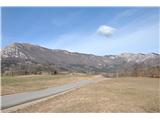
On the cart track we continue upwards, sticking to the left direction to a meadow, where we look for cairns and turn right into the forest. We follow the well-visible footpath and slowly ascend across a small scree. A steep ascent awaits us. When we come to the vantage point, we follow the left footpath, we feel a little bit of wilderness, but the footpath is followable. The path ascends among rocks on the edge of a panoramic ridge. After an hour and twenty minutes we reach the peak of Maj.
We are rewarded with a view of Pleša (Nanos), Snežnik, Postojna basin and also a view of the "window of Nanos".
Photos:
 1
1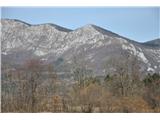 2
2 3
3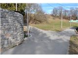 4
4 5
5 6
6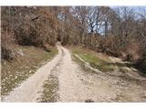 7
7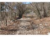 8
8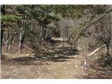 9
9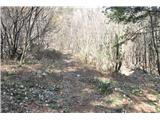 10
10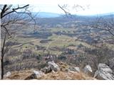 11
11 12
12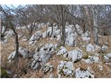 13
13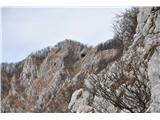 14
14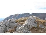 15
15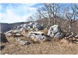 16
16
Discussion about the trip Strane - Maj
|
| darinka418. 03. 2020 |
Has anyone walked here, I'm interested where the hollow wall is. Today we went along the path from Suh vrh. Along the entire ridge to Strane. I walked here for the first time. By the path, which is otherwise poorly visible, there was an interesting window. I'm wondering if that window is natural?
|
|
|
|
| darinka418. 03. 2020 |
It motivates me, because we met a hiker who was going from Strane to the bench on this Maj ridge by name. And she said that's the window, I photographed it artificially made. But to me it looked natural. Otherwise we had the path from Suh vrh entered on the phone, because no markings and hard to follow at all. Also to Nanos we went from V. Ubeljskega on the new path. Steep all the way, past Pekova skala.
|
|
|
|
| tavzentroza18. 03. 2020 |
Hollow wall, as I look at the map, is that entire rocky area (see path description image no. 2) I think the window is natural, at least when I was there I didn't have the impression that someone made it...
|
|
|
|
| darinka421. 03. 2020 |
It will hold. Thanks. Definitely interesting.
|
|
|
|
| franca1. 05. 2023 12:44:23 |
On maps Maj is the 1020 m contour, a panoramic clearing on the ridge. Locals call this point Vrh gore, while Maj is the summit at 1142 m.
|
|
|
To post a comment you must log in:
If you do not yet have a username, you must first
register.