Spodnja Dobrava - Stovc (Stolec)
Starting point: Spodnja Dobrava (486 m)
| Latitude/Longitude: | 46,30239°N 14,22825°E |
| |
Walking time: 20 min
Difficulty: easy unmarked way
Elevation gain: -12 m
Elevation difference along the route: 5 m
Map:
Recommended equipment (summer):
Recommended equipment (winter):
Views: 416
 | 2 people like this post |
Access to starting point:
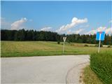
We leave the Gorenjska highway at the Brezje exit, then follow the signs for Kropa and Podnart, along the main road we drive to the settlement Posavec, where we go right towards Otoče and Mišače. In Otoče after crossing the railway track we continue straight (left Zaloše) towards Mišače, in Mišače we go left towards Srednja Dobrava and Kropa. Further we drive through Zgornja and Srednja Dobrava, then we already arrive in Spodnja Dobrava, where a good 100 meters further from the chapel the road turns right, straight ahead a dead-end street continues. At the mentioned junction the described path begins, suitable places for parking are not available nearby. We can park on the large parking lot by the parish church in Srednja Dobrava, which lengthens the path by less than 10 minutes.
Route description:
From the starting point, we head into the dead-end street, which on the left side bypasses some houses, the road then gradually changes into a cart track. At the junction by the edge of the forest we continue straight, a few minutes ahead we go left. The path ahead narrows somewhat, at the smaller junction we go right, a gentle and in places somewhat overgrown path brings us to a junction near Stovc, we continue straight towards Stovc, guided by a direction sign on a tree. Some ten steps further we already arrive at the viewpoint, the log box is located just a little further to the right.
Description and pictures refer to the condition in August 2020.
Photos:
 1
1 2
2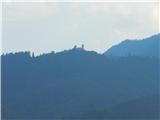 3
3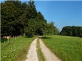 4
4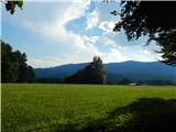 5
5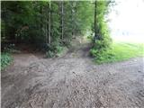 6
6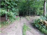 7
7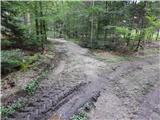 8
8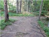 9
9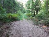 10
10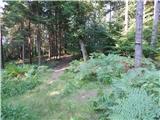 11
11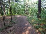 12
12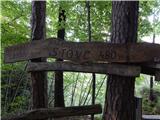 13
13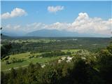 14
14
Discussion about the trip Spodnja Dobrava - Stovc (Stolec)
To post a comment you must log in:
If you do not yet have a username, you must first
register.