Starting point: Rudno polje (1347 m)
| Latitude/Longitude: | 46,3458°N 13,9236°E |
| |
Walking time: 1 h 20 min
Difficulty: easy marked way, easy unmarked way
Elevation gain: 443 m
Elevation difference along the route: 443 m
Map: TNP 1:50.000
Recommended equipment (summer):
Recommended equipment (winter): ice axe, crampons
Views: 13.442
 | 3 people like this post |
Access to starting point:
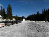
From the Ljubljana - Jesenice highway, take the Lesce exit and follow the road towards Bled. In Bled, at the traffic light, signs for Pokljuka direct us to the right. Continue through Gorje and past the abandoned Zatrnik ski resort to Rudno polje on Pokljuka (large parking lot, barracks, and shooting range).
Route description:
At the end of the parking lot, a gravel road branches off to the right, with signposts for Triglav. We head onto this road, which gently ascends and brings us to the ski resort after ten minutes.
On the other side of the ski resort, next to the ski lift, we will notice a marked footpath that continues to the right from the road. We take this path, which leads us in a moderate ascent through a strip of forest to a gravel road (up to here also possible by road), which we follow to the right, but only a few steps. Just before the road crosses the ski slope, a marked footpath branches off to the left, which first crosses a pasture fence, then ascends along the edge of the ski slope. At the top of the first ski lift, the marked path turns left and then begins to ascend more steeply along the edge of the second steeper ski slope. The second ski lift also ends soon, and we continue on the path, which transitions into a small relatively steep valley. Towards the top of said valley, the path ascends relatively steeply, then suddenly flattens and leads us past an abandoned hunting observation post to a crossroads.
We continue straight in the direction of Viševnik (right Lipanca and Viševnik over Kačji rob) on again a steeper path, which after a few minutes of further walking brings us to a small saddle, from which a beautiful view opens up to the Bohinjsko - Tolminske gore, sometimes called Spodnje Bohinjske gore.
At the saddle, we leave the marked path that leads to Viševnik and continue the ascent to the left on a gentle and less visible trail, which ascends through a strip of dense dwarf pines. We follow this trail, which first brings us to the pre-summit of Plesišče, all the way to the mentioned summit, which we reach in less than five minutes of walking from the place where we left the marked path.
Rudno polje - Planinski taborni prostor 0:10, Planinski taborni prostor - Planina Krasca 0:05, Planina Krasca - Zlata voda 0:50, Zlata voda - sedlo pod Plesiščem 0:10, sedlo pod Plesiščem - Plesišče 0:05.

Along the route: Planinski taborni prostor (1369m), Planina Krasca (1402m), Zlata voda (1717m), Sedlo pod Plesiščem (1780m)
Photos:
 1
1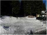 2
2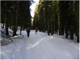 3
3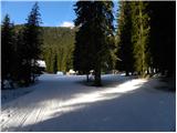 4
4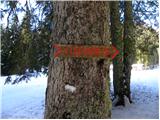 5
5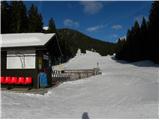 6
6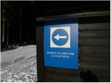 7
7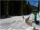 8
8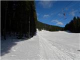 9
9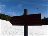 10
10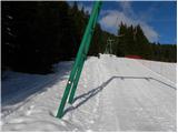 11
11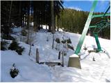 12
12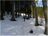 13
13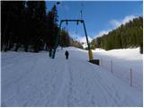 14
14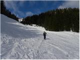 15
15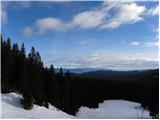 16
16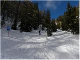 17
17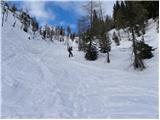 18
18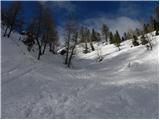 19
19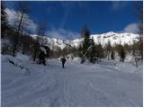 20
20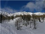 21
21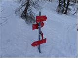 22
22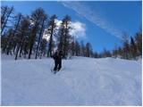 23
23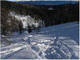 24
24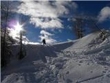 25
25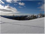 26
26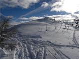 27
27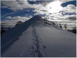 28
28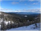 29
29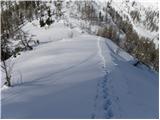 30
30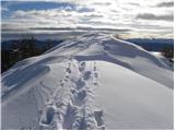 31
31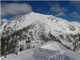 32
32
Discussion about the trip Rudno polje - Plesišče
|
| skiro12313. 08. 2020 |
I couldn't find the less visible paths. The trail from the saddle is completely overgrown with brushwood, so the summit is only reachable when the brushwood is covered with snow.
|
|
|
To post a comment you must log in:
If you do not yet have a username, you must first
register.